Ág

Ág | |
|---|---|
Village | |
| Coordinates: 46°17′45″N 18°12′09″E / 46.29587°N 18.20241°E | |
| Country | |
| County | Baranya |
| District | Hegyhát |
| Area | |
| • Total | 12.03 km2 (4.64 sq mi) |
| Population (2019)[1] | |
| • Total | 178 |
| • Density | 15/km2 (38/sq mi) |
| Time zone | UTC+1 (CET) |
| • Summer (DST) | UTC+2 (CEST) |
| Postal code | 7381 |
| Area code | 72 |
| NUTS 3 | HU231 |
| HCSO | 25812 |
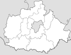
Ág ([ˈɒɡ], German: Neuda) is a village (Hungarian: község) in northern Baranya County, Hegyhát District, in southern Hungary. Its population at the 2011 Census was 177.[2] Until the end of World War II, the inhabitants' majority was Protestant Danube Swabians. Most of the former German settlers were expelled to Allied-occupied Germany and Allied-occupied Austria in 1945–1948, following the Potsdam Agreement.[3] Only a few Germans of Hungary live there, the majority today are the descendants of Hungarians from the Czechoslovak–Hungarian population exchange. They got the houses of the former Danube Swabian inhabitants.
Etymology
[edit]The village's name comes from the word ág, meaning 'stream'. It was recorded as Naghagh in 1487.[4]
Local government
[edit]The village is governed by a mayor with a four-person council. The local government of the village operates a joint council office with the nearby localities of Gerényes, Kisvaszar, Tarrós, Tékes and Vásárosdombó. Ág maintains a branch office, but the seat of the joint council is in Vásárosdombó.[1][5]
As of the election of 2019, the village also has a local minority self-government for its Roma community, with three elected representatives.[6]
Transportation
[edit]The village is a cul-de-sac community, with only one access road connecting it to Road 6546 via nearby village Gerényes.
Railway
[edit]- Vásárosdombó train station, 5.6 km (3.5 mi) to the west of the village off Road 6546. The station is on the Pusztaszabolcs–Pécs railway line and is operated by MÁV.
Road
[edit]- Road 6546 connects the village to Vásárosdombó to the west and Komló to the south.
- Main road 611, a north–south road accessible in Vásárosdombó, connects the village to its district seat Sásd and the town of Dombóvár.
External links
[edit]- Street map (in Hungarian)
- OpenStreetMap
References
[edit]- ^ a b c "Gazetteer of Hungary, 1 January 2019" (PDF). Hungarian Central Statistical Office. Retrieved 23 October 2021.
- ^ "Population Census 2011: Regional Data - Baranya County". Hungarian Central Statistical Office. 1 October 2011. Retrieved 23 October 2021.
- ^ "Die Vertreibung – Landsmannschaft der Deutschen aus Ungarn".
- ^ Kiss, Lajos (1980). Földrajzi nevek etimológiai szótára. Budapest: Akadémiai Kiadó. ISBN 963-05-2277-2.
- ^ "Local government elections 2019 - Ág (Baranya County)". Hungarian National Election Office (in Hungarian). Archived from the original on 2021-10-23. Retrieved 23 October 2021.
- ^ "Nationality local government elections 2019 - Ág (Baranya County)". Hungarian National Election Office (in Hungarian). Archived from the original on 2021-10-23. Retrieved 23 October 2021.


