Accokeek Creek

| Accokeek Creek Tributary to Potomac Creek | |
|---|---|
| Location | |
| Country | United States |
| State | Virginia |
| County | Stafford |
| Physical characteristics | |
| Source | Aquia Creek divide |
| • location | about 0.25 miles northeast of Moores Corners, Virginia |
| • coordinates | 38°27′31″N 077°28′26″W / 38.45861°N 77.47389°W[1] |
| • elevation | 285 ft (87 m)[2] |
| Mouth | Potomac Creek |
• location | Crows Nest Point, Virginia |
• coordinates | 38°21′00″N 077°18′18″W / 38.35000°N 77.30500°W[1] |
• elevation | 0 ft (0 m)[2] |
| Length | 14.60 mi (23.50 km)[3] |
| Basin size | 22.81 square miles (59.1 km2)[4] |
| Discharge | |
| • location | Potomac Creek |
| • average | 23.72 cu ft/s (0.672 m3/s) at mouth with Potomac Creek[4] |
| Basin features | |
| Progression | southeast |
| River system | Potomac River |
| Tributaries | |
| • left | unnamed tributaries |
| • right | unnamed tributaries |
| Bridges | Shelton Shop Road, Monument Drive (x2), Ramoth Church Road, I-95, US 1, VA 608, Raven Road |
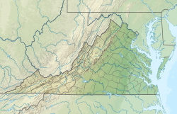
Accokeek Creek is a tidal tributary of Potomac Creek, itself a tributary of the Potomac River, in Stafford County, Virginia, United States.[5] From it headwaters to its mouth, Accokeek Creek is 15.4 miles (24.8 km) in total length.[6]
Nomenclature
[edit]The United States Board on Geographic Names officially decided upon the creek's name in 1940.[5] Before the official naming decision, Accokeek Creek was also alternatively known as Accakeek Creek.[5]
Course
[edit]Accokeek Creek rises on the Aquia Creek divide about 0.25 miles northeast of Moores Corner, Virginia. Accokeek Creek then flows southeast to meet Potomac Creek at Crows Nest Point just upstream of the Potomac River.[2]
Watershed
[edit]Accokeek Creek drains 22.81 square miles (59.1 km2) of area, receives about 43.0 in/year of precipitation, has a topographic wetness index of 390.53 and is about 60.1% forested.[4]
Maps
[edit]

See also
[edit]- Accokeek (plantation), homestead of George Mason I
- List of rivers of Virginia
References
[edit]- ^ a b "GNIS Detail - Accokeek Creek". geonames.usgs.gov. US Geological Survey. Retrieved 11 March 2020.
- ^ a b c "Accokeek Creek Topo Map, Stafford County VA (Passapatanzy Area)". TopoZone. Locality, LLC. Retrieved 11 March 2020.
- ^ "ArcGIS Web Application". epa.maps.arcgis.com. US EPA. Retrieved 11 March 2020.
- ^ a b c "Accokeek Creek Watershed Report". Waters Geoviewer. US EPA. Retrieved 11 March 2020.
- ^ a b c United States Board on Geographic Names (28 Sep 1979). "United States Board on Geographic Names". United States Board on Geographic Names. Archived from the original on 20 March 2009. Retrieved 2009-03-22.
- ^ U.S. Geological Survey. National Hydrography Dataset high-resolution flowline data. The National Map Archived 2012-03-29 at the Wayback Machine, accessed August 15, 2011

