Khilkhet Thana

Khilkhet Thana খিলক্ষেত থানা | |
|---|---|
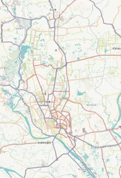
 Expandable map of vicinity of Khilkhet Thana | |
| Coordinates: 23°49′52″N 90°25′28″E / 23.83113°N 90.42431°E | |
| Country | |
| Division | Dhaka Division |
| District | Dhaka District |
| Established | 2005 |
| Area | |
| • Total | 15.88 km2 (6.13 sq mi) |
| Elevation | 23 m (75 ft) |
| Population | |
| • Total | 176,427 |
| • Density | 8,190/km2 (21,200/sq mi) |
| Time zone | UTC+6 (BST) |
| Postal code | 1229[3] |
| Area code | 02[4] |
Khilkhet Thana (Bengali: খিলক্ষেত থানা) is a thana (sub-district) of Dhaka, Bangladesh. It was created in 2005.[5]
Geography
[edit]Khilkhet Thana has a total area of 15.88 square kilometres (6.13 sq mi).[6] It is bounded on the east by the Turag River (across which lies Rupganj Upazila of Narayanganj District). It borders Dhakshinkhan and Uttar Khan thanas to the north, Badda Thana to the south, Cantonment Thana to the west, and Bimanbandar Thana to the northwest.[5] Nearest residential area of Khilkhet thana building is Nikunja-1 and Nikunja-2.
History
[edit]Administration of Khilkhet Thana was established on 27 June in 2005 [7] that consists of south parts of Badda thana. Before, this area was under the administration of Badda thana.
Demographics
[edit]According to the 2011 Census of Bangladesh, Khilkhet Thana had 31,141 households and a population of 130,053, all of whom lived in urban areas. 8.6% of the population was under the age of 5. The literacy rate (age 7 and over) was 73.8%, compared to the national average of 51.8%.[6][9]
Administration
[edit]Khilkhet Thana consists of part of Dhaka North City Corporation Ward No. 17, part of Dakshinkhan Union, and [Dumni Union].[5]
Education
[edit]American International University-Bangladesh is located in this thana. There are two colleges in this thana. They are: Amirjan College located at Dumni,[10] and Kurmitola High School and College, located at Khilkhet.
Kurmitola High School and College, popularly known as Khilkhet High School is the epicenter of modern education in these entire area which was established in 1948, while Amirjan College was established in 2012.
There are a number of schools in this thana. According to Dhaka Education Board institute website[11] this thana has six high schools: Amirjan High School, Jan-E-Alam Sarker High School, Barua Alauddin Dewan High School, Dumni High School,Talna Ruhul Amin Khan High School And Jahid ikbal High School.
Religious Institutions
[edit]According to the information of Banglapedia, there are 67 mosques and 3 temples.[5] Notable ones are: Dumni Nama Para Jame Masjid, Dumni Bazar Jame Masjid, Dumni Kali Mondir, Barua Shah Jame Masjid, Nikunja-2 central Jame Masjid.
See also
[edit]- Badda Thana
- Cantonment Thana
- Bimanbandar
- Dhakshinkhan
- Uttarkhan
- Upazilas of Bangladesh
- Districts of Bangladesh
- Divisions of Bangladesh
References
[edit]- ^ "Geographic coordinates of Dhaka, Bangladesh". DATEANDTIME.INFO. Retrieved 7 July 2016.
- ^ National Report (PDF). Population and Housing Census 2022. Vol. 1. Dhaka: Bangladesh Bureau of Statistics. November 2023. p. 386. ISBN 978-9844752016.
- ^ "Bangladesh Postal Code". Dhaka: Bangladesh Postal Department under the Department of Posts and Telecommunications of the Ministry of Posts, Telecommunications and Information Technology of the People's Republic of Bangladesh. 19 October 2024.
- ^ "Bangladesh Area Code". China: Chahaoba.com. 18 October 2024.
- ^ a b c d Akhter, Shamima (2012). "Khilkhet Thana". In Islam, Sirajul; Jamal, Ahmed A. (eds.). Banglapedia: National Encyclopedia of Bangladesh (Second ed.). Asiatic Society of Bangladesh.
- ^ a b "Community Report:Dhaka" (PDF). Population & Housing Census 2011. Bangladesh Bureau of Statistics. May 2015. pp. 232, 508, 692. Retrieved June 18, 2017.
- ^ Khilkhet thana on BanglaPedia
- ^ "Bangladesh Population and Housing Census 2011 Zila Report – Dhaka" (PDF). bbs.gov.bd. Bangladesh Bureau of Statistics.
- ^ "Population and Housing Census 2011: Bangladesh at a Glance" (PDF). Bangladesh Bureau of Statistics. p. 508. Archived from the original (PDF) on July 28, 2014. Retrieved July 21, 2014.
- ^ Eboard Result Board Tree
- ^ Dhaka Education Board,


