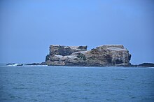
Lawrence Rocks

 Lawrence Rocks rocky islets in Western Victoria | |
| Etymology | Captain Effingham Lawrence[1][2] |
|---|---|
| Geography | |
| Location | Bass Strait |
| Coordinates | 38°24′30″S 141°40′10″E / 38.40833°S 141.66944°E |
| Area | 7 ha (17 acres)[3] |
| Length | 800 m (2600 ft)[3] |
| Width | 50 m (160 ft)[3] |
| Highest elevation | 90 m (300 ft)[3] |
| Administration | |
Australia | |
| State | Victoria |
The Lawrence Rocks are a group of two rocky islets, 6.8 ha and 1.5 ha in area, with an associated reef, 2.4 km south-east of Point Danger in western Victoria, Australia, and about 6 km south-east of the city of Portland.[3] Geologically, the group is formed from the remnants of an extinct volcano, with the islets composed of basalt and tuff.[4]
The islets were sighted by Lieutenant James Grant on 5 December 1800 from the survey brig HMS Lady Nelson and named[1] for Captain Effingham Lawrence,[2] one of the Elder Brethren of Trinity House.

Fauna
[edit]
The rocks are protected as a nature reserve and are the site of a breeding colony of Australasian gannets, the overspill from which led to the establishment of a sister colony at Point Danger.[5] The group has been identified by BirdLife International as an Important Bird Area (IBA), because it supports over 10% of the world population of Australasian gannets, being used by over 6000 birds.[6] [7] Other birds recorded on the rocks, and likely to breed there, include little penguins, black-faced cormorants, crested terns, silver gulls, sooty oystercatchers and small numbers of Cape gannets. The rocks are also used as a haul-out site by Australian fur seals.[4] Seal hunting was conducted on the island in the 19th century.[8]
Recreational dive sites
[edit]There are several named sites:[9]
- The Nursery, at the eastern side, where there are four caves, one known as the Cockpit with a small chamber at the top, at 38° 24.280′ S, 141° 40.260′ E
- North Point, a boulder ridge off the northern end of Lawrence Rocks, at 38° 24.225′ S, 141° 40.004′ E
- The Saddle, a gully that cuts through the centre of the rocks, at 38° 24.331′ S, 141° 40.082′ E
- The Harbour, an area of gutters, ledges and swim-throughs, at 38° 24.514′ S, 141° 40.136′ E
- The wreck of the Emily S, a short distance northeast from Lawrence Rocks.
References
[edit]- ^ a b Grant, James (1803). The narrative of a voyage of discovery, performed in His Majesty's vessel the Lady Nelson, of sixty tons burthen: with sliding keels, in the years 1800, 1801, and 1802, to New South Wales. Printed by C. Roworth for T. Egerton. pp. 71–72. ISBN 978-0-7243-0036-5. Retrieved 25 January 2012.
- ^ a b Wall, Bruce (1967). "Lawrence, William Effingham (1781–1841)". Australian Dictionary of Biography. Canberra: National Centre of Biography, Australian National University. ISBN 978-0-522-84459-7. ISSN 1833-7538. OCLC 70677943. Retrieved 25 January 2012.
- ^ a b c d e Pescott, T. W. (November 1980). "Seabird islands No 100, Lawrence Rocks, Victoria" (PDF). Corella. 4 (4): 107–109.
- ^ a b BirdLife International. (2011). Important Bird Areas factsheet: Lawrence Rocks. Downloaded from http://www.birdlife.org on 04/08/2011.
- ^ "Point Danger Australasian Gannet Breeding Colony". Portland Holidays. Archived from the original on 19 August 2006. Retrieved 28 February 2011.
- ^ "IBA: Lawrence Rocks". Birdata. Birds Australia. Archived from the original on 6 July 2011. Retrieved 4 August 2011.
- ^ "Victoria: State of the Islands". 15 January 2014.
- ^ Karen Townrow, An archaeological survey of sealing & whaling sites in Victoria, Heritage Victoria & Australian Heritage Commission, Melbourne, 1997, p.14.
- ^ "Diving Lawrence Rocks". scubadoctor.com.au. Retrieved 21 August 2024.
