| Name | Image | County | Size | Estab-
lished[1] | Lake / river | Remarks |
| acres | ha |
| Ackley Lake State Park | | Judith Basin | 290 | 120 | 1940 | Ackley Lake | |
| Anaconda Smelter Stack State Park |  | Deer Lodge | 12 | 4.9 | 1986 | none | The park cannot actually be accessed, but only viewed from a distance. |
| Bannack State Park | 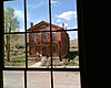 | Beaverhead | 1,529 | 619 | 1954 | Grasshopper Creek | The well-preserved ghost town of a one-time territorial capital. |
| Beaverhead Rock State Park | 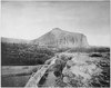 | Madison | 71 | 29 | 1975 | Beaverhead River | |
| Beavertail Hill State Park |  | Missoula | 65 | 26 | 1968 | Clark Fork | |
| Big Arm State Park | | Lake | 217 | 88 | 1966 | Flathead Lake | Unit of Flathead Lake State Park |
| Black Sandy State Park | | Lewis and Clark | 43 | 17 | 1980 | Hauser Reservoir | |
| Brush Lake State Park | | Sheridan | 450 | 180 | 2004 | Brush Lake | There are no fish in this lake due to the mineral makeup of the water. |
| Chief Plenty Coups State Park | 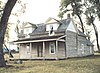 | Big Horn | 195 | 79 | 1961 | Pryor Creek | |
| Clark's Lookout State Park | | Beaverhead | 7 | 2.8 | 1985 | Beaverhead River | |
| Cooney State Park | | Carbon | 309 | 125 | 1970 | Cooney Reservoir | |
| Council Grove State Park | | Missoula | 187 | 76 | 1978 | Clark Fork River | |
| Elkhorn State Park |  | Jefferson | 1 | 0.40 | 1980 | none | |
| Finley Point State Park |  | Lake | 28 | 11 | 1965 | Flathead Lake | Unit of Flathead Lake State Park |
| First Peoples Buffalo Jump State Park |  | Cascade | 1,481 | 599 | 1972 | none | Formerly Ulm Pishkun State Park |
| Fish Creek State Park | | Mineral | 6,200 | 2,500 | 2010 | Fish Creek | |
| Fort Owen State Park |  | Ravalli | 2 | 0.81 | 1956 | Mill Creek | |
| Frenchtown Pond State Park | | Missoula | 41 | 17 | 1972 | Frenchtown Pond | |
| Giant Springs State Park |  | Cascade | 675 | 273 | 1972 | Missouri River and Roe River | |
| Granite Ghost Town State Park |  | Granite | 1 | 0.40 | 1975 | none | Abandoned 1890s silver boomtown. |
| Greycliff Prairie Dog Town State Park |  | Sweet Grass | 98 | 40 | 1974 | none | |
| Hell Creek State Park |  | Garfield | 337 | 136 | 1966 | Fort Peck Lake | |
| Lake Elmo State Park |  | Yellowstone | 183 | 74 | 1983 | Lake Elmo | |
| Lake Mary Ronan State Park |  | Lake | 120 | 49 | 1967 | Flathead Lake | |
| Les Mason State Park | | Flathead | 8 | 3.2 | 1983 | Whitefish Lake | |
| Lewis and Clark Caverns State Park |  | Jefferson | 2,920 | 1,180 | 1935 | none | |
| Logan State Park | | Lincoln | 18 | 7.3 | 1967 | Middle Thompson Lake | |
| Lone Pine State Park | | Flathead | 251 | 102 | 1941 | none | |
| Lost Creek State Park |  | Deer Lodge | 502 | 203 | 1957 | Lost Creek | |
| Milltown State Park | | Missoula | 635 | 257 | 2012 | Clark Fork and Blackfoot rivers | |
| Madison Buffalo Jump State Park |  | Gallatin | 638 | 258 | 1966 | none | |
| Makoshika State Park | 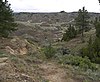 | Dawson | 11,634 | 4,708 | 1953 | none | |
| Marias River State Park | | Toole | 2,011 | 814 | 2009[2] | Marias River | |
| Medicine Rocks State Park | 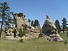 | Carter | 330 | 130 | 1957 | none | |
| Missouri Headwaters State Park |  | Gallatin | 532 | 215 | 1947 | Jefferson, Madison, and Gallatin rivers | |
| North Shore State Park | | Flathead | 160 | 65 | n/a | Flathead Lake | |
| Painted Rocks State Park | | Ravalli | 23 | 9.3 | 1963 | Painted Rocks Reservoir, Bitterroot River | |
| Pictograph Cave State Park |  | Yellowstone | 93 | 38 | 1969 | none | |
| Pirogue Island State Park | | Custer | 210 | 85 | 1982 | Yellowstone River | |
| Placid Lake State Park |  | Powell | 31 | 13 | 1977 | Placid Lake | |
| Rosebud Battlefield State Park |  | Big Horn | 3,052 | 1,235 | 1978 | none | |
| Salmon Lake State Park | | Missoula | 42 | 17 | 1977 | Salmon Lake, Clearwater River | |
| Sluice Boxes State Park |  | Cascade | 1,451 | 587 | 1974 | Belt Creek | |
| Smith River State Park |  | Meagher | 1 | 0.40 | 1960 | Smith River | 59-mile (95 km) segment of the river with only one public put-in and one public take-out for the entire stretch. |
| Somers Beach State Park | | Flathead | 106 | 43 | 2021 | Flathead Lake | |
| Spring Meadow Lake State Park | | Lewis and Clark | 61 | 25 | 1981 | Spring Meadow Lake | |
| Thompson Falls State Park | 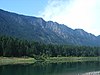 | Sanders | 36 | 15 | 1960 | Clark Fork, Noxon Rapids Reservoir | |
| Tongue River Reservoir State Park |  | Big Horn | 642 | 260 | 1983 | Tongue River Reservoir | |
| Tower Rock State Park |  | Cascade | 140 | 57 | 2004 | Near Missouri River | |
| Travelers' Rest State Park | 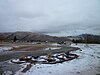 | Missoula | 41 | 17 | 2001 | Lolo Creek | |
| Wayfarers State Park | | Lake | 67 | 27 | 1969 | Flathead Lake | Unit of Flathead Lake State Park |
| West Shore State Park | | Lake | 129 | 52 | 1955 | Flathead Lake | Unit of Flathead Lake State Park |
| Whitefish Lake State Park |  | Flathead | 10 | 4.0 | 1960 | Whitefish Lake | |
| Wild Horse Island State Park | | Lake | 2,164 | 876 | 1977 | Flathead Lake | Unit of Flathead Lake State Park |
| Yellow Bay State Park |  | Lake | 15 | 6.1 | 1941 | Flathead Lake, Yellow Bay Creek | Unit of Flathead Lake State Park |


.jpg)

.jpg)

.jpg)


.jpg)


.jpg)


