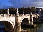
Pont Julien

Pont Julien | |
|---|---|
 Pont Julien | |
| Coordinates | 43°51′45″N 5°18′28″E / 43.86250°N 5.30778°E |
| Carries | Via Domitia |
| Crosses | Calavon |
| Locale | Near Bonnieux, Vaucluse, France |
| Characteristics | |
| Design | Arch bridge |
| Material | Limestone |
| Total length | 85 m |
| Width | 5.50 m |
| Longest span | 16.3 m |
| No. of spans | 3 |
| Clearance below | 9 m |
| History | |
| Construction end | 3 BC |
| Location | |
 | |
The Pont Julien (French pronunciation: [pɔ̃ ʒyljɛ̃], Julian Bridge) is a Roman stone arch bridge over the Calavon river, in the south-east of France, dating from 3 BC. The supporting columns are notable for openings to allow floodwater to pass through. It is located in the territory of the commune of Bonnieux, north of the village of the same name, and 8 km west of Apt. Originally, it was built on the Via Domitia, an important Roman road which connected Italy to the Roman territories in France. It was used for car traffic until 2005, when a replacement bridge was built to preserve it from wear and tear. It is still used as bike- and footpath. This amounts to approximately 2000 years of uninterrupted use.
Gallery
[edit]- View of the Pont Julien
- View of the underside of one of the arches
- The modern bridge crossing the Cavalon upriver of the bridge
- View of the bridge on an old postcard
- The dry riverbed of the Calavon and the main arch of the bridge
- Pont Julien in March
See also
[edit]References
[edit]- Murati, Philippe (1994). Ponts de Provence. Nice. pp. 19–20.
{{cite book}}: CS1 maint: location missing publisher (link) - O’Connor, Colin (1993), Roman Bridges, Cambridge University Press, pp. 96f. (G5), ISBN 0-521-39326-4
External links
[edit] Media related to Pont Julien at Wikimedia Commons
- Pont Julien at Structurae
- Traianus – Technical investigation of Roman public works


