Baturité
 From Wikipedia the free encyclopedia
Baturité | |
|---|---|
 | |
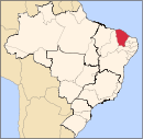
 Location in Ceará state | |
| Coordinates: 04°19′44″S 38°53′06″W / 4.32889°S 38.88500°W | |
| Country | Brazil |
| Region | Northeast |
| State | Ceará |
| Government | |
| • Mayor | Francisco de Assis Germano Arruda (PDT) |
| Area | |
| • Total | 308,780 km2 (119,220 sq mi) |
| Population (2020 [2]) | |
| • Total | 35,941 |
| • Density | 0.12/km2 (0.30/sq mi) |
| Time zone | UTC−3 (BRT) |
| HDI (2010) | 0.619 – medium[3] |
Baturité is a city of Ceará State, Brazil 80 km (50 mi) from the state capital Fortaleza. It is located in the microregion of Baturité. The population estimate in 2020 was 35,941 inhabitants.
Economy[edit]

The economy of Baturité is mainly agricultural and based on the cultivation of cotton, sugar cane, rice, maize and beans.
History[edit]
Baturité received the first railway in the state of Ceará. It started to operate in 1873. Today, this train station is a museum.
Notable people[edit]
- Nilto Maciel (1945–2014), writer
References[edit]
- ^ IBGE (10 October 2002). "Área territorial oficial". Resolução da Presidência do IBGE de n° 5 (R.PR-5/02). Retrieved 5 December 2010.
- ^ IBGE 2020
- ^ "Archived copy" (PDF). United Nations Development Programme (UNDP). Archived from the original (PDF) on 8 July 2014. Retrieved 13 March 2022.
{{cite web}}: CS1 maint: archived copy as title (link) - ^ "Baturité -- Estações Ferroviárias do Estado do Ceará".


