Te Henga / Bethells Beach
 From Wikipedia the free encyclopedia
Te Henga / Bethells Beach | |
|---|---|
 Sunset at Bethells Beach | |
 | |
| Coordinates: 36°53′25″S 174°27′05″E / 36.89028°S 174.45139°E | |
| Country | New Zealand |
| Region | Auckland |
| Ward | Waitākere ward |
| Local board | Waitākere Ranges Local Board |
| Electorates | |
| Government | |
| • Territorial Authority | Auckland Council |
| Area | |
| • Total | 5.37 km2 (2.07 sq mi) |
| Population (June 2023)[2] | |
| • Total | 280 |
| • Density | 52/km2 (140/sq mi) |
Te Henga, or Bethells Beach, is a coastal community in West Auckland, New Zealand. The Māori name for the area, "Te Henga", is in reference to the long foredunes which run along the beach and look like the Henga or gunwale of an upturned waka hull.[3] This name originally applied to a wide area of the lower Waitakere River valley, but during the early 1900s the area became popular with visiting European immigrants who began to refer to the area as "Bethells Beach" after the Bethell Family who live there and still own much of the area. In 1976 the New Zealand Geographic Board officially named the area "Te Henga (Bethells Beach)".[4]
The beach is approximately 37 km (23 mi) west of Auckland City, at the mouth of the Waitakere River where it flows into the Tasman Sea. One of several popular resorts in the area (others include Muriwai, Piha and Karekare), it is rated the 4th most dangerous beach in New Zealand to swim at due to its strong rips and currents. There have been many fatalities including in 2009, Rugby League star Sonny Fai, who was never located. It experiences a population explosion over summer with thousands of visitors. This has put a lot of pressure on the local infrastructure and environment with an increase in rubbish and parking issues.[citation needed]
History and culture[edit]

The Te Henga Valley shows evidence of human settlement dating back many centuries. Carbon dating of midden shells at Kauwahaia Island date settlement back to at least the year 1600.[5] The cultural history of the area is of archaeologically significant sites, including food gathering areas, pā (fortifications), walkways, canoe landings and sacred places.[4] Te Henga and the Waitākere River have traditionally been major settled areas for the iwi Te Kawerau ā Maki,[6] with many pā found around the islands, headland and inland areas close to Te Henga.[6] A rock in the beach to the north-west of Ihumoana Island is the namesake of Wai-tākere ("cascading water"),[7][8] which was later applied to the Waitākere River, Ranges, and West Auckland in general.[9]
In the mid 1800s, much of the area (1,180 hectares (2,900 acres)) was designated as the Waitakere and Puketotara Native Reserve. These native reserves were to be ‘inalienable’ for Kawerau people to live on in perpetuity. The provision of the native reserves was largely undermined by the Native Land Court, created in 1865, which was based on the settlers' legal system, and converted customary title to land into individual title. Over the following decades much of the land was sold to European immigrants.[3] The arrival of Europeans in the 19th century led to major changes in the character and shape of Te Henga (Bethells Beach). The most significant of these changes was the clearing of the land for timber and pastoral farming which began in 1854 and continued until the 1920s. In addition, a dam was constructed on the Waitakere River in the 1920s, drastically altering the level of the riverbed and reducing the outflow of water to the sea.[4] Prior to the dam being constructed, the Waitākere River catchment at Te Henga was a site where New Zealand flax was harvested.[10]
In excerpts from a letter of 23 September 1853, Henry Waterhouse of Waiti described the wreck of the barque Helena, near the mouth of the Waitakere River at Te Henga. Heavy seas and the incoming tide had caused the barque to break in two, resulting in the loss of seven lives including the captain. Four survivors were rescued by two Kawerau Māori men returning from pig hunting, who cared for them for several days before escorting them to Auckland.[11]
John Bethell negotiated with the Waitakere County Council to sell the land that is now known as Te Henga Park. The Council considered the beach and park area would provide excellent recreation facilities for residents of Auckland. Te Henga was recognised as a place of regional significance.[4]
Te Henga / Bethells Beach was the location where feminist artist Juliet Batten performed 100 Women Performance.[12]
Demographics[edit]
Statistics New Zealand describes Bethells Beach as a rural settlement, which covers 5.37 km2 (2.07 sq mi)[1] and had an estimated population of 280 as of June 2023,[2] with a population density of 52 people per km2. The settlement is part of the larger Muriwai Valley-Bethells Beach statistical area.
| Year | Pop. | ±% p.a. |
|---|---|---|
| 2006 | 261 | — |
| 2013 | 255 | −0.33% |
| 2018 | 264 | +0.70% |
| Source: [13] | ||
Bethells Beach had a population of 264 at the 2018 New Zealand census, an increase of 9 people (3.5%) since the 2013 census, and an increase of 3 people (1.1%) since the 2006 census. There were 117 households, comprising 132 males and 138 females, giving a sex ratio of 0.96 males per female, with 39 people (14.8%) aged under 15 years, 42 (15.9%) aged 15 to 29, 159 (60.2%) aged 30 to 64, and 21 (8.0%) aged 65 or older.
Ethnicities were 96.6% European/Pākehā, 10.2% Māori, 4.5% Pacific peoples, and 3.4% Asian. People may identify with more than one ethnicity.
Although some people chose not to answer the census's question about religious affiliation, 67.0% had no religion, 17.0% were Christian, 1.1% had Māori religious beliefs, 2.3% were Buddhist and 3.4% had other religions.
Of those at least 15 years old, 78 (34.7%) people had a bachelor's or higher degree, and 21 (9.3%) people had no formal qualifications. 48 people (21.3%) earned over $70,000 compared to 17.2% nationally. The employment status of those at least 15 was that 120 (53.3%) people were employed full-time, 39 (17.3%) were part-time, and 9 (4.0%) were unemployed.[13]
Muriwai Valley-Bethells Beach statistical area[edit]
Muriwai Valley-Bethells Beach statistical area, which does not include Muriwai settlement, covers 35.36 km2 (13.65 sq mi)[1] and had an estimated population of 1,240 as of June 2023,[14] with a population density of 35 people per km2.
| Year | Pop. | ±% p.a. |
|---|---|---|
| 2006 | 825 | — |
| 2013 | 945 | +1.96% |
| 2018 | 1,104 | +3.16% |
| Source: [15] | ||
Muriwai Valley-Bethells Beach had a population of 1,104 at the 2018 New Zealand census, an increase of 159 people (16.8%) since the 2013 census, and an increase of 279 people (33.8%) since the 2006 census. There were 372 households, comprising 564 males and 540 females, giving a sex ratio of 1.04 males per female. The median age was 39.2 years (compared with 37.4 years nationally), with 237 people (21.5%) aged under 15 years, 177 (16.0%) aged 15 to 29, 570 (51.6%) aged 30 to 64, and 120 (10.9%) aged 65 or older.
Ethnicities were 96.5% European/Pākehā, 10.1% Māori, 3.0% Pacific peoples, 1.6% Asian, and 1.4% other ethnicities. People may identify with more than one ethnicity.
The percentage of people born overseas was 20.4, compared with 27.1% nationally.
Although some people chose not to answer the census's question about religious affiliation, 67.1% had no religion, 23.4% were Christian, 0.5% had Māori religious beliefs, 0.5% were Buddhist and 1.9% had other religions.
Of those at least 15 years old, 246 (28.4%) people had a bachelor's or higher degree, and 90 (10.4%) people had no formal qualifications. The median income was $38,600, compared with $31,800 nationally. 228 people (26.3%) earned over $70,000 compared to 17.2% nationally. The employment status of those at least 15 was that 489 (56.4%) people were employed full-time, 168 (19.4%) were part-time, and 27 (3.1%) were unemployed.[15]
Marae[edit]
Te Henga is a tribal meeting ground for the local iwi of Te Kawerau a Maki.[16][17] Historically there were several marae spread around the Te Henga (Bethells Beach) area, however these sites are now all in private ownership and housing. Currently the iwi are in negotiations with Auckland Council to set up a new marae at Te Henga so they can return to their ancestral heartland.
Geology[edit]
7,000 years ago, when sea-levels rose after the Last Glacial Maximum, Te Henga / Bethells Beach and the surrounding area including Lake Wainamu formed a part of the Waitākere River tidal estuary. Over time, Tasman Sea sand accumulated at Te Henga, forming sand dunes and freshwater lakes.[18] The sand dunes have accumulated in several phases over the last 4,500 years. These sands contain quantities of black titanomagnetite derived from the volcanic rocks of Taranaki and carried north by coastal currents. The dunes continually move in a dynamic coastal process. There are three dune-impounded lakes: Lake Wainamu, Lake Kawaupaku and Lake Waiataru.
The Te Henga wetlands originally formed as a freshwater lake during the same time period as the three remaining lakes. The lake was destroyed in 1910 with the construction of the Waitākere Dam and Reservoir, which made water-levels rise and the water to become more silty. The wetlands began forming in the mid-1920s.[10]
Ecology of the Waitakere River catchment[edit]

The Waitākere River catchment consists of roughly 70 km2 of the bush-clad Waitākere Ranges. Located on the west coast of the Auckland Region approximately 75% of the catchment consists of native vegetation in spite of extensive milling, farming and settlement.
The major features of the catchment are:
- the abundance of native vegetation
- the steep and rugged terrain
- the Te Henga wetland
- the sand dunes
- Lake Wainamu
- The Waitākere Reservoir
The Waitakere River has two main tributaries, the Mokoroa and Waiti streams. The headwaters of the river are in the vast and steep Waitākere Ranges and drain out at the Bethell's Beach river mouth.
In comparison with other North Island beaches, and to some extent even the west coast beaches of Muriwai and Piha, settlement at Bethells has been minor with most development revolving around horticulture and agriculture.
With the exception of the Waitākere Reservoir the catchments resources have largely escaped development.

In 1990 the Auckland Regional Water Board developed and prepared a Waitakere River Catchment Water and Soil Plan. This pre-Resource Management Act document aimed to deal with the competing water and soil resource demands within the catchment in terms of "conservation, allocation, use and quality of natural water and in terms of soil conservation and preventing damage from flooding." Although this document reached its quarter-century in 2015, many of its principles still apply.
Activity[edit]
- Surfing is the main pastime. Other pastimes include parasailing and hang gliding, for which the prevailing westerly wind often provides favourable conditions.
- Fishing is also popular, although dangerous in many places and many deaths have taken place from this.
- Bush walking is encouraged, with boardwalks in place.
- Sunbathing, swimming, picnics, running etc.
- Skimboarding is also becoming quite popular with young people.
Filming location[edit]
The beach has been used as a filming location for several projects, one of the earliest being a four-month shoot for award-winning drama series Children of Fire Mountain (1979). Other shoots include the music video for Shania Twain's single "Forever and for Always"(2003), "Out of the Woods" for Taylor Swift, TV series The New Adventures of Black Beauty and The Wilds[19], Brit/New Zealand TV movie The Man Who Lost His Head, and episodes of Xena: Warrior Princess, Young Hercules, and Hercules: The Legendary Journeys. Battle scenes for New Disney Channel Original movie Avalon High were also filmed there. In addition, K-pop singer Taeyeon's first solo music video I, and the end scenes of Crouching Tiger, Hidden Dragon: Sword of Destiny were also filmed here.
Gallery[edit]
-
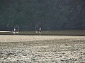 Fun in the lagoon
 -
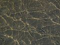 Bethell patterns
 -
 Cave
Cave -
 Shag
Shag -
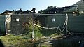 Burnt ablutions block
 -
 Surf lifesaving lookout


References[edit]
- ^ a b c "ArcGIS Web Application". statsnz.maps.arcgis.com. Retrieved 6 June 2022.
- ^ a b "Subnational population estimates (RC, SA2), by age and sex, at 30 June 1996-2023 (2023 boundaries)". Statistics New Zealand. Retrieved 25 October 2023. (regional councils); "Subnational population estimates (TA, SA2), by age and sex, at 30 June 1996-2023 (2023 boundaries)". Statistics New Zealand. Retrieved 25 October 2023. (territorial authorities); "Subnational population estimates (urban rural), by age and sex, at 30 June 1996-2023 (2023 boundaries)". Statistics New Zealand. Retrieved 25 October 2023. (urban areas)
- ^ a b TKITA-2013-0062 Cultural Values Assessment for Te Henga Local Area Plan, prepared by Te Kawerau Iwi Tribal Authority
- ^ a b c d "Te Henga Park Reserve Management Plan: Description of Te Henga Park" (PDF). Waitakere City Council. June 2002. Archived from the original (PDF) on 24 July 2011.
- ^ Diamond, John T.; Hayward, Bruce W. (1990). "Prehistoric Sites in West Auckland". In Northcote-Bade, James (ed.). West Auckland Remembers, Volume 1. West Auckland Historical Society. pp. 34–36. ISBN 0-473-00983-8.
- ^ a b Murdoch, Graeme (1990). "Nga Tohu o Waitakere: the Maori Place Names of the Waitakere River Valley and its Environs; their Background History and an Explanation of their Meaning". In Northcote-Bade, James (ed.). West Auckland Remembers, Volume 1. West Auckland Historical Society. p. 27. ISBN 0-473-00983-8.
- ^ Taua, Te Warena (2009). "He Kohikohinga Kōrero mō Hikurangi". In Macdonald, Finlay; Kerr, Ruth (eds.). West: The History of Waitakere. Random House. p. 23. ISBN 9781869790080.
- ^ "Te Kawerau ā Maki Deed of Settlement Schedule" (PDF). New Zealand Government. 22 February 2014. Retrieved 29 January 2021.
- ^ Murdoch, Graeme (1990). "Nga Tohu o Waitakere: the Maori Place Names of the Waitakere River Valley and its Environs; their Background History and an Explanation of their Meaning". In Northcote-Bade, James (ed.). West Auckland Remembers, Volume 1. West Auckland Historical Society. p. 18. ISBN 0-473-00983-8.
- ^ a b Cameron, Ewen; Hayward, Bruce; Murdoch, Graeme (2008). A Field Guide to Auckland: Exploring the Region's Natural and Historical Heritage (Revised ed.). Random House New Zealand. p. 160. ISBN 978-1-86962-1513.
- ^ Woodward, Mary (May 2021). Waitakere's West Coasters. Paradigm Associates. ISBN 978-0-473-57178-8.
- ^ Dunn, Michael (2008). New Zealand Sculpture: A History (Updated ed.). Auckland: Auckland University Press. p. 123. ISBN 978-1-86940-425-3.
- ^ a b "Statistical area 1 dataset for 2018 Census". Statistics New Zealand. March 2020. 7002138 and 7002140.
- ^ "Population estimate tables - NZ.Stat". Statistics New Zealand. Retrieved 25 October 2023.
- ^ a b "Statistical area 1 dataset for 2018 Census". Statistics New Zealand. March 2020. Muriwai Valley-Bethells Beach (115300). 2018 Census place summary: Muriwai Valley-Bethells Beach
- ^ "Te Kāhui Māngai directory". tkm.govt.nz. Te Puni Kōkiri.
- ^ "Māori Maps". maorimaps.com. Te Potiki National Trust.
- ^ Hayward, Bruce (2009). "Land, Sea and Sky". In Macdonald, Finlay; Kerr, Ruth (eds.). West: The History of Waitakere. Random House. pp. 13–14, 21. ISBN 9781869790080.
- ^ "'The Wilds': Stunt Coordinator Min Windle Emboldened the Actors to Test Their Limits". 23 December 2020.
External links[edit]
- Bethells Beach Surf Life Saving Patrol
- Photographs of Te Henga held in Auckland Libraries' heritage collections.