Leer, Lower Saxony
 From Wikipedia the free encyclopedia
This article needs additional citations for verification. (January 2013) |
Leer | |
|---|---|
 View of the town hall and harbor | |
.svg) Flag _COA.svg) Coat of arms | |
Location of Leer within Leer district  | |
 Leer  Leer | |
| Coordinates: 53°13′51″N 7°27′10″E / 53.23083°N 7.45278°E | |
| Country | Germany |
| State | Lower Saxony |
| District | Leer |
| Subdivisions | 9 Subdivisions |
| Government | |
| • Mayor (2021–26) | Claus-Peter Horst[1] (Ind.) |
| Area | |
| • Total | 70.30 km2 (27.14 sq mi) |
| Elevation | 3 m (10 ft) |
| Population (2021-12-31)[2] | |
| • Total | 35,078 |
| • Density | 500/km2 (1,300/sq mi) |
| Time zone | UTC+01:00 (CET) |
| • Summer (DST) | UTC+02:00 (CEST) |
| Postal codes | 26789 |
| Dialling codes | 0491 |
| Vehicle registration | LER |
| Website | www.leer.de |
.jpg)
Leer (German pronunciation: [leːɐ̯] ⓘ) is a town in the district of Leer, in the northwestern part of Lower Saxony, Germany. It is situated on the river Leda,[3] a tributary of the river Ems, near the border with the Netherlands. With 34,958 inhabitants (2021), it is the third-largest city in East Frisia after Emden and Aurich.
It has a railway and autobahn connection to Groningen, Netherlands, Emden, Bremen and the South (Rheine and the Ruhr industrial region).
Geography[edit]
Leer had been a settlement long before it was first mentioned in written documents. Originally, the city was situated at a meander near the mouth of the river Leda into the Ems, which is still the center of the town today. Even though Leer is some 30 km (19 mi) away from the coast, it can be reached by large ships via the Ems. Leer lies close to the Dutch border; the district of Leer shares a border with the Dutch province of Groningen. The island and nature reserve of Bingumer Sand lies within the district.
History[edit]
County of East Frisia 1464–1744
Kingdom of Prussia 1744–1806
Kingdom of Holland 1806–1810
First French Empire 1810–1813
Kingdom of Prussia 1813–1815
Kingdom of Hanover 1815–1866
German Empire 1871–1918
Weimar Republic 1918–1933
Nazi Germany 1933–1945
Allied-occupied Germany 1945–1949
West Germany 1949–1990

There are many traces of early settlements in the area, including crude flint tools that are dated back to roughly 3200 BC.
In 791 AD Saint Ludger built the first chapel in East Frisia at the western edge of the settlement Leer, then still named Hleri after feetlot, willow. This chapel is mentioned for the first time in a written document from 850 AD.
During the 14th and 15th centuries, Leer was hometown of the Ukena family, which was one most influential East-Frisian chieftain families of that time. The town profited from the trade with the Hanse, and a fortress Leerort was built.
In 1508, Count Edzard obtained the official right to host a market, which started the tradition of the "Gallimarkt," which is now an annual fair. In 1744 East Frisia fell to Prussia, then ruled by Frederick the Great. Town privileges were awarded in 1823[3] by George IV, King of Hanover.
In 1854 Leer became connected to the "Hannoversche Westbahn" railway, which at that time connected Emden and Rheine in the Ruhr area. In 1856, the Westbahn was connected to the central German railway network.
Unlike Emden, Leer only suffered little damage by Allied bombing in World War II. The city was occupied by Canadian troops on 28 April 1945.
On 1 October 1955, Leer received the status of an independent city.
Politics[edit]
Since 1964 the city's government has been led by the Social-Democratic Party SPD. The major opposition parties are the Christian Democratic Union Party CDU, the Green Party and the Allgemeine Wählergemeinschaft (AWG), an independent local party. The mayor of Leer is Claus-Peter Horst, elected in 2021.[1]
The town council consists of (elections of 2016):[4]
- SPD: 36.7% / 14 seats
- CDU: 27.9% / 11 seats
- AWG: 10.2% / 4 seats
- Grüne: 13.9% / 5 seats
- FDP: 3.0% / 1 seat
- The Left: 3.1% / 1 seat
- CDL: 3.5% / 1 seat
- BfL 1.3%: / 1 seat
- Haase 0.5%: / 0 seat
Mayors[edit]
| Term of office | Mayor |
|---|---|
| 1812–1814 | Maire Willem Cramer von Baumgarten |
| 1814–1842 | Abraham Erlenholtz (till 1823 temporary) |
| 1843–1852 | Adolf Wilhelm Hillingh |
| 1852–1857 | Georg Heinrich Leonhard Schow |
| 1857–1888 | Julius Pustau |
| 1888–1913 | August Dieckmann |
| 1914–1917 | City counsel Gerhard Tschackert (temporary) |
| 1917–1920 | Emil Helms |
| 1920–1933 | Erich vom Bruch |
| 1933–1945 | Erich Drescher |
| 1945–1946 | Albrecht Graf von Wedel |
| 1946 | Johann Epkes |
| 1946 | Hermann Uebel |
| 1946–1948 | Louis Thelemann |
| 1948–1950 | Ernst Stendel |
| 1950–1964 | Hermann Uebel |
| 1964–1968 | Friedrich Geerdes |
| 1968 | Heinrich Klasen |
| 1968–1973 | Horst Milde |
| 1973–2001 | Günther Boekhoff |
| 2001–2014 | Wolfgang Kellner (independent) |
| 2014–2021 | Beatrix Kuhl (CDU) |
| 2021–incumbent | Claus-Peter Horst (independent) |

Notable buildings[edit]
- Harderwykenburg
- Haneburg
- Evenburg
- Philippsburg (Castle)
- Telecommunication tower "Leer-Nüttermoor" (Height:160 meters)
-
 City Hall in Leer
 -
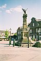 City Centre in Leer


Religion[edit]
Leer is a traditional Protestant city and home to both the Lutheran and Reformed churches. The German Reformed Church has its head office in Leer. Furthermore, Leer offers an unusually large variety of smaller religious communities, especially Baptists, Mennonites, Methodists, Adventists and Mormons. Even though Eastern Frisia is a mainly a Protestant region, there is a small Roman Catholic community in Leer.
Economics and infrastructure[edit]
Two autobahns (freeways) cross north of Leer, the A 28 (Leer – Bremen) and the A 31 (Emden – Oberhausen, Ruhr Area). The city itself has three junctions to the autobahns. Leer railway station is a relay station between Groningen and Bremen in the west–east direction and the South and Emden harbour (with a large VW factory and shipping facilities) in the north. The airfield Leer-Papenburg north of the city offers limited passenger flights to nearby airfields, most notably the East Frisian Islands. The closest international airport is Bremen International Airport.
Leer is home to many German shipping companies – about 20 per cent of the German merchant fleet are registered in Leer. The Bünting group Home is based in Leer and is one of the city's main employers. Although Bünting owns several German supermarket chains, the company is best known for their tea, which is available all over Germany.
Each year in autumn the Gallimarkt is held. Traditionally a cattle-market, the Gallimarkt is now one of the largest fairs in Northwest Germany.
Education[edit]
In Leer there are seven primary schools and numerous secondary schools. The two gymnasiums, Telletta-Gross-Gymnasium and Ubbo-Emmius-Gymnasium, educate more than 1,500 pupils each and are two of the largest grammar schools in Lower Saxony. The Navigation School is now a faculty of the Hochschule Emden – Leer (University of applied science). The town also offers education at two vocational schools.
Twin towns – sister cities[edit]
 Elbląg, Poland
 Trowbridge, United Kingdom
Notable people[edit]


- Focko Ukena (1370–1436), East Frisian chieftain
- Ubbo Emmius (1547–1625), theologian, geographer and historian from the University of Groningen
- Gustaaf Willem van Imhoff (1705–1750), governor-general of Dutch East India
- Petrus Hofstede de Groot (1802-1886), Dutch theologian.[6]
- Johann Ludwig Hinrichs (1818–1901), co-founder of the German Baptists
- Onno Klopp (1822–1903), publicist and historian.[7]
- Wilhelmine Siefkes (1890–1984), writer of Low German
- Bernhard Bavink (1879–1947), Natural philosopher and scientist
- Ernst Reuter (1889–1953), politician and municipal scientist, mayor of West-Berlin 1948–1953, brought up locally
- Hermann Lange (1912–1943), blessed priest and Nazi victim
- Marron Curtis Fort (1938–2019), linguist and curator of Low German and Frisian languages, lived locally
- Karl Dall (1941–2020), presenter, singer and comedian; gained his apprenticeship locally
- Friedel Grützmacher (born 1942), politician of Alliance 90/The Greens
- H.P. Baxxter (born 1964), singer of the band Scooter
- Garrelt Duin (born 1968), former local and national politician (SPD)
- Ilka Groenewold (born 1985), TV presenter, singer and amateur athlete.
Sport[edit]
- Okka Rau (born 1977), beach volleyball player
- Christina Hennings (born 1984), rower
- Tobias Steffen (born 1992), footballer who has played over 250 games
References[edit]
- ^ a b "Direktwahlen in Niedersachsen vom 12. September 2021" (PDF). Landesamt für Statistik Niedersachsen. 13 October 2021.
- ^ "LSN-Online Regionaldatenbank, Tabelle A100001G: Fortschreibung des Bevölkerungsstandes, Stand 31. Dezember 2021" (in German). Landesamt für Statistik Niedersachsen.
- ^ a b Chisholm, Hugh, ed. (1911). . Encyclopædia Britannica. Vol. 16 (11th ed.). Cambridge University Press. p. 370.
- ^ "Stadtratswahl 2016". wahlen.leer.de. Retrieved 31 May 2019.
- ^ "Städtepartnerschaften". leer.de (in German). Leer. Retrieved 21 January 2021.
- ^ . Encyclopædia Britannica. Vol. 13 (11th ed.). 1911. p. 566.
- ^ . Encyclopædia Britannica. Vol. 15 (11th ed.). 1911. p. 847.
External links[edit]
 Leer travel guide from Wikivoyage
- Official website
 (in German)
 - Photo collections about Leer (in German)
Towns and municipalities in Leer (district) | ||
|---|---|---|
 | ||
| International | |
|---|---|
| National | |
| Geographic | |
| Other | |