Файл:Submarine cables.png


Размер этого предпросмотра: 641 × 600 пкс. Другие разрешения: 257 × 240 пкс | 513 × 480 пкс | 1021 × 955 пкс.
Исходный файл (1021 × 955 пкс, размер файла: 81 КБ, MIME-тип: image/png)
Этот файл находится на Викискладе. Сведения о нём показаны ниже. Викисклад — централизованное хранилище для свободных файлов, используемых в проектах Викимедиа. |
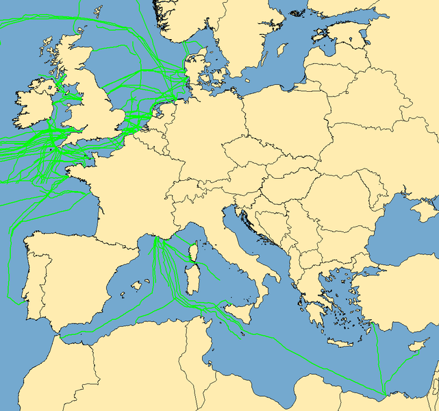
| Описание | Map with examples of submarine communications cables. Some of the cables represented were incomplete in the mapping stage; they do not go to "nowhere", they are merely incomplete when this image was captured. | ||
| Дата | (UTC) | ||
| Источник | Data taken from public sources. Created using MapInfo Professional v8.5 and various mapping resources. | ||
| Автор | Rarelibra | ||
| Права (Повторное использование этого файла) |
|
История файла
Нажмите на дату/время, чтобы посмотреть файл, который был загружен в тот момент.
| Дата/время | Миниатюра | Размеры | Участник | Примечание | |
|---|---|---|---|---|---|
| текущий | 10:53, 7 октября 2019 | | 1021 × 955 (81 КБ) | Bjh21 | Reverted to version as of 19:07, 13 August 2007 (UTC): Waldyrious and User:Μυρμηγκάκι have already reverted this version, which is an objection under COM:OVERWRITE. Also the world map is already available at File:World map of submarine cables.png. |
| 03:27, 7 октября 2019 |  | 1601 × 1025 (74 КБ) | Rarelibra | Reverted to version as of 07:57, 2 October 2008 (UTC) | |
| 13:09, 21 декабря 2008 |  | 1021 × 955 (81 КБ) | Waldyrious | Reverted to original version. Other versions will be uploaded separately. | |
| 12:55, 2 октября 2008 |  | 1025 × 614 (16 КБ) | Rarelibra | Reverted to version as of 22:13, 1 February 2008 | |
| 07:57, 2 октября 2008 |  | 1601 × 1025 (74 КБ) | Μυρμηγκάκι | Reverted to version as of 23:22, 22 August 2007 | |
| 22:13, 1 февраля 2008 |  | 1025 × 614 (16 КБ) | Rarelibra | Updated example of a submarine cable in the North Sea. The blue line depicts the ACTUAL location of the submarine cable, taken from GPS coordinates of the cable. The red line depicts the REPRESENTATIVE location of the submarine cable. | |
| 23:22, 22 августа 2007 |  | 1601 × 1025 (74 КБ) | Rarelibra | Updated map with cables around the world. | |
| 19:07, 13 августа 2007 |  | 1021 × 955 (81 КБ) | Rarelibra | Map with examples of submarine communications cables in Europe (Mediterranean Sea, English Channel, and North Sea). Data taken from public sources for fishermen and is therefore not restricted in any sense. Created by ~~~~ for public domain use, using Map |
Использование файла
Нет страниц, использующих этот файл.
Глобальное использование файла
Данный файл используется в следующих вики:
- Использование в da.wikipedia.org
- Использование в de.wikipedia.org
- Использование в en.wikipedia.org