حارة النصارى هي واحد من الأحياء الأربع الكبرى في مدينة القدس الشرقية، وتقع داخل أسوار مدينة القدس؛ الأحياء الأربع الأخرى هي الحي اليهودي، الحي الإسلاميوحارة الأرمن.[1] ويقع في الحي المسيحي في الركن الشمالي الغربي من المدينة القديمة، ويمتد من الباب الجديد في الشمال، على طول الجدار الغربي من المدينة القديمة وصولًا إلى باب الخليل. حارة النصارى تحتوي على نحو 40 من الأماكن المقدسة المسيحية. من بينها كنيسة القيامة، واحدة من أقدس الأماكن في المعتقد المسيحي، هذا الحي معظم سكانه من المسيحيين العرب وهو إلى جانب حارة الأرمن الذي يقطنه الارمنالمسيحيين من التجمعات المسيحية الكبرى في القدس القديمة.[2]
تم بناء الحي المسيحي حول كنيسة القيامة والتي هي قلب هذا الحي. حول الكنيسة تم بناء عدد كبير من الكنائس والأديرة. بشكل عام يحتوي الحي على من المنازل التي يملكها مسيحيين، والتي تتركز في معظمها في الجزء الجنوبي الشرقي من الحارة بالقرب من بوابة أريحا. يحتوي الحارة على عدد من المدارس والمباني التعليمية، مثل المدرسة اللوثرية ومدرسة سانت بيير، بالإضافة إلى تواجد مستشفيات تملكها ارساليات ورهبانيات مسيحية.
المباني المسيحية التي تتواجد في الحارة أهمها كنيسة القيامة، والتي تحتل معظم الأراضي، إلى جانب بطريركية كنيسة الروم الأرثوذكس في القدس ودير الفرنسيسكان، وسان سالفاتور والبطريركية اللاتينية في القدس.الحارة تحتوي أيضًا على محلات بيع التذكارات والمقاهي والمطاعم والفنادق ومحلات الصاغة والساعات والحمامات. وتتركز في معظم المحلات التجارية في شارع السوق، وشارع داوود، وعلى طول الطريق المسيحي. وقد تم بناء بعض الفنادق (مثل فندق كازا نوفا، وفندق الروم الكاثوليك) من قبل الكنائس من أجل اقامة أماكن راحة للزوار والحجاج. هناك عدد من الفنادق الخاصة. الحارة تحتوي أيضًا على بعض المتاحف الصغيرة مثل متحف البطريركية الأرثوذكسية. في الجزء الجنوبي الغربي من الحارة هناك بركة سباحة وتدعى ببركة حزقيا والتي كانت تستخدم لتخزين مياه الأمطار للمنطقة.[3]
في القرن التاسع عشر هدفت الدول الأوروبية توسيع نفوذها في القدس، وبدأ ازدهار المباني والعمارة في الحي المسيحي. حاولت السلطات العثمانية وقف النفوذ الأوروبي وقواعد المنشأت وشراء الأراضي في المنطقة. لكنها أدت تدخلات شخصية من رؤساء تلك الدول (مثل ويلهلم الثاني من ألمانيا فرانز جوزيف من النمسا) لبناء بعض مباني الدينية لتلك الدول.
في نهاية القرن 19 لم يكن هناك مزيد من الأراضي في الحي المسيحي. في الفترة نفسها، بعد فتح قناة السويس حج وسافر العديد من المسيحيين إلى الأراضي المقدسة. هذا أدى إلى اشتداد المنافسة بين القوى الأوروبية من أجل زيادة نفوذها في القدس. بنت فرنسا المستشفيات، وأديرة، وبيوت الشباب للزوار من خارج المدينة القديمة في منطقة متاخمة للحي النصارى وهي المنطقة التي أصبحت تعرف باسم المنطقة الفرنسية. ومن قبلهم، بنى الروس مجمعات سكانية وعلمية مكان قريب.[4]
تطور حي النصارى مع زيادة النفوذ الغربي الأوروبي فبتنيت مدارس الارساليات والمشافي والمعاهد العلمية، فازدهر حي النصارى مقارنة بالاحياء الأخرى التي عانت من فقدان هذه الخدمات، كما نشط حارة النصارى اقتصاديًا خاصًة مع ازدهار أحول سكانه الذين عملوا بالتجارة ومع هجرة مسيحيي القدس أرسل اثرياء المهجر أموال لدعم أهالي الحي. في عام 1898 وافقت الدولة العثمانية على طلب من الدول الأوروبية وفتحت بوابة جديدة في أسوار البلدة القديمة، في منطقة جديدة للتنمية. كانت تسمى بوابة «باب جديد».[5]
المورستان: شارع يقع فيه مشفى المورستان الذي بناه فرسان القديس يوحنا خلال العصر الصليبي، يقع في الشارع عدد من المحال التجارية والسوق المركزي في حارة النصارى.
^Arnon، Adar (1992). "The Quarters of Jerusalem in the Ottoman Period". Middle Eastern Studies. Taylor & Francis, Ltd. ج. 28 ع. 1: 12. ISSN:0026-3206. JSTOR:4283477. مؤرشف من الأصل في 2023-10-16. اطلع عليه بتاريخ 2023-05-31. The continuous Moslem area of the city occupied its entire east half penetrating its west half at the north, near Damascus Gate. Excluding its south part and the north-west bulge, this region will be defined in the nineteenth century as the 'Moslem Quarter'. In the west part of the city lay Haret en-Nasara in the middle of the area which will be named in modern times the 'Christian Quarter'. Two minorities dwelt in the south outskirts of the city: Jews in Haret el-Yahud, in the south-west part of the future Jewish Quarter and Armenians around their monastery in the south part of the modern Armenian Quarter. The layout of ethno-religious groups in sixteenth-century Jerusalem agreed then with the guidelines of their dispersal in the city in the thirteenth century described above.
^Teller، Matthew (2022). Nine Quarters of Jerusalem: A New Biography of the Old City. Profile Books. ص. Chapter 1. ISBN:978-1-78283-904-0. مؤرشف من الأصل في 2023-06-09. اطلع عليه بتاريخ 2023-05-30. But it may not have been Aldrich and Symonds. Below the frame of their map, printed in italic script, a single line notes that 'The Writing' had been added by 'the Revd. G. Williams[لغات أخرى]' and 'the Revd. Robert Willis'… Some sources suggest [Williams] arrived before [Michael] Alexander, in 1841. If so, did he meet Aldrich and Symonds? We don't know. But Williams became their champion, defending them when the Haram inaccuracy came up and then publishing their work. The survey the two Royal Engineers did was not intended for commercial release (Aldrich had originally been sent to سوريا under 'secret service'), and it was several years before their military plan of Jerusalem came to public attention, published first in 1845 by their senior officer Alderson in plain form, without most of the detail and labelling, and then in full in 1849, in the second edition of Williams's book The Holy City. Did Aldrich and/or Symonds invent the idea of four quarters in Jerusalem? It's possible, but they were military surveyors, not scholars. It seems more likely they spent their very short stay producing a usable street-plan for their superior officers, without necessarily getting wrapped up in details of names and places. The 1845 publication, shorn of street names, quarter labels and other detail, suggests that… Compounding his anachronisms, and perhaps with an urge to reproduce Roman urban design in this new context, Williams writes how two main streets, north-south and east-west, 'divide Jerusalem into four quarters.' Then the crucial line: 'The subdivisions of the streets and quarters are numerous, but unimportant.' Historians will, I hope, be able to delve more deeply into Williams's work, but for me, this is evidence enough. For almost two hundred years, virtually the entire world has accepted the ill-informed, dismissive judgementalism of a jejune Old Etonian missionary as representing enduring fact about the social make-up of Jerusalem. It's shameful… With Britain's increased standing in Palestine after 1840, and the growth of interest in biblical archaeology that was to become an obsession a few decades later, it was vital for the Protestant missionaries to establish boundaries in Jerusalem… Williams spread his ideas around. Ernst Gustav Schultz, who came to Jerusalem in 1842 as Prussian vice-consul, writes in his 1845 book Jerusalem: Eine Vorlesung ('A Lecture'): 'It is with sincere gratitude I must mention that, on my arrival in Jerusalem, Mr Williams ... willingly alerted me to the important information that he [and] another young Anglican clergyman, Mr Rolands, had discovered about the topography of [Jerusalem].' Later come the lines: 'Let us now divide the city into quarters,' and, after mentioning Jews and Christians, 'All the rest of the city is the Mohammedan Quarter.' Included was خرائط كيبرت لفلسطين والقدس, drawn by Heinrich Kiepert, that labelled the four quarters, mirroring Williams's treatment in The Holy City.
^Arnon، Adar (1992). "The Quarters of Jerusalem in the Ottoman Period". Middle Eastern Studies. Taylor & Francis, Ltd. ج. 28 ع. 1: 5–7. ISSN:0026-3206. JSTOR:4283477. مؤرشف من الأصل في 2023-10-16. اطلع عليه بتاريخ 2023-05-31. The origin of this ethno-religious partition lies in the nineteenth-century modern survey maps of Jerusalem drawn by Europeans - travellers, army officers, architects - who explored the city. The following verbal geographical definitions of the quarters will refer to this contemporarily prevailing division of the Old City. The ethno-religious partition of the Old City on the nineteenth-century maps reflected a situation rooted in history. Crusader Jerusalem of the twelfth and thirteenth centuries, the capital of the Latin Kingdom of Jerusalem, was partitioned among the residential territories of people from different European countries, Oriental Christian communities and knights orders. In 1244 Jerusalem returned to Moslem hands when it became part of the Ayyubid Sultanate of Egypt. The change of government coincided with a devastation of the city by the Central Asian tribe of Khawarizm which all but annihilated the city's population. In 1250 the Mamluks rose to power in Egypt. Under their rule Jerusalem became a magnet to pilgrims from all parts of the Islamic world. People from various regions, towns and tribes settled in it. The parts of the city preferred by the Moslems were those adjoining the north and west sides of the Temple Mount (the other two sides lay outside the city) on which stood their two revered mosques, the Dome of the Rock and al-Agsa Mosque. Christians from different denominations resettled in the north-west of the city, at the vicinity of the Church of the Holy Sepulchre. Armenians settled in its south-west, near their Cathedral of St James which had been destroyd by the Khawarizms. Jews settled in Jerusalem, beginning with the second half of the thirteenth century, near the south wall of the city, because the territory there was not settled by any other community and separated from their venerated place, the West (Wailing) Wall, only by a small quarter of North-African Moslems. When the city changed hands again at the beginning of the sixteenth century, falling to the Ottoman Turks, no change in the city's population, and hence in its quarters occurred.


 منظر عام لحارة النصارى.
 دير القديس أنطونيوس القبطي.
 مدخل المورستان ليلًا.
 زقاق في حارة النصارى.
 كنيسة يسوع الكاثوليكية.
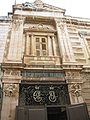 الكنيسة الروسية.
 داخل منزل لاحد أثرياء الروس في حارة النصارى.
 صورة قديمة لحارة النصارى، تظهر فيها بركة حزقيال تعود إلى عام 1862.
 كنيسة المخلص اللاتينية.
 ساعة جرسية كنيسة المخلص.
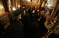 رجال دين أرثوذكس مع الرئيس الأمريكي السابق جورج بوش داخل كنيسة بطريركية الروم الأرثوذكس.
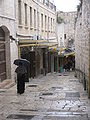 شارع النبي داوود.
 قصر بترا.
 فندق امبريال.
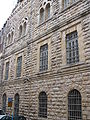 أحد مباني الحارة.
 شرفات في حارة النصارى.
 داخل حارة النصارى.
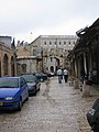 مدخل بوابة الجديد.
 بيوت حارة النصارى.
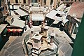 نافورة المارستان.


.jpg)


.jpg)


.jpg)

.jpg)


