ملف:IsraelCVFRchart-BorderNorth copy.jpg


حجم هذه المعاينة: 442 × 599 بكسل. الأبعاد الأخرى: 177 × 240 بكسل | 354 × 480 بكسل | 567 × 768 بكسل | 756 × 1٬024 بكسل | 1٬308 × 1٬772 بكسل.
الملف الأصلي (1٬308 × 1٬772 بكسل حجم الملف: 2٫01 ميجابايت، نوع MIME: image/jpeg)
| هذا ملف من ويكيميديا كومنز. معلومات من صفحة وصفه مبينة في الأسفل. كومنز مستودع ملفات ميديا ذو رخصة حرة. |
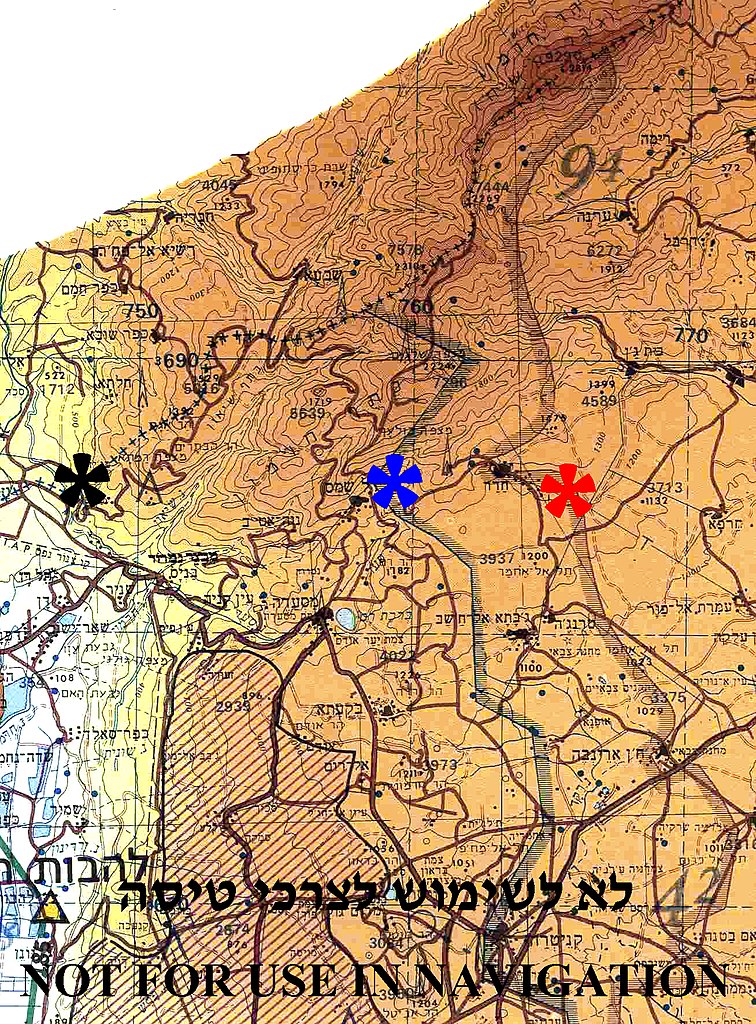
| الوصف | English: Borders between Israel, Syria and Lebanon in Mount Hermon region The (+++) line between Israel and Lebanon – marked by black asterisk Disengagement Israeli front line with Syria (1974) - marked by blue asterisk Disengagement Syrian front line with Israel (1974) - marked by red asterisk. | ||
| التاريخ | |||
| المصدر | Aeronautical Information Publication - Domestic (AIP) of the Israel Civil Aviation Administration – presently Civil Aviation Authority (CAA) | ||
| المؤلف | Etan Tal | ||
| الترخيص (إعادة استخدام هذا الملف) |
|
Image to be used for illustration of aviation articles. Not for actual navigation. Original image is public domain (State Regulations) - uploader added the disclaimers prohibiting navigation use in compliance with normal aviation practice. Modified image released to the public domain as well.
تاريخ الملف
اضغط على زمن/تاريخ لرؤية الملف كما بدا في هذا الزمن.
| زمن/تاريخ | صورة مصغرة | الأبعاد | مستخدم | تعليق | |
|---|---|---|---|---|---|
| حالي | 01:08، 12 أكتوبر 2009 | | 1٬308 × 1٬772 (2٫01 ميجابايت) | Etan J. Tal | {{Information |Description={{en|1=Borders between Israel, Syria and Lebanon in Mount Hermon region The Blue Line between Israel and Lebanon – marked by black asterisk Disengagement Israeli front line with Syria (1974) - marked by blue asterisk Disen |
استخدام الملف
الصفحة التالية تستخدم هذا الملف:
الاستخدام العالمي للملف
الويكيات الأخرى التالية تستخدم هذا الملف:
- الاستخدام في arz.wikipedia.org
- الاستخدام في ca.wikipedia.org
- الاستخدام في en.wikipedia.org
- الاستخدام في he.wikipedia.org
- الاستخدام في tt.wikipedia.org