Muddy Branch
 From Wikipedia the free encyclopedia
| Muddy Branch | |
|---|---|
 Muddy Branch Stream near Esworthy Rd | |
 | |
| Location | |
| Country | United States |
| State | Maryland |
| Counties | Montgomery |
| Physical characteristics | |
| Source | |
| • location | Gaithersburg, MD |
| Mouth | Potomac River |
• location | North of Pennyfield Lock, Potomac, MD |
• coordinates | 39°03′16″N 77°17′37″W / 39.05444°N 77.29361°W |
| Length | 11.9 miles (19.2 km) |
Muddy Branch is a tributary stream of the Potomac River in Montgomery County, Maryland, United States, located about 14 miles (23 km) northwest of Washington, D.C.
Course
[edit]The headwaters of the stream originate in Gaithersburg, and the stream flows southwest for 11.9 miles (19.2 km),[1] through Muddy Branch Park and Blockhouse Point Conservation Park, under the Chesapeake and Ohio Canal near Pennyfield Lock, to the Potomac River.
Tributaries
[edit]- Decoverly Tributary
- Dufief Tributary
- Lakes Tributary
- Pennyfield Lock Tributary
- Potomac Grove Tributary
- Query Mill Tributary
- Quince Orchard Knolls Tributary
- Rich Branch
- Route 28 Tributary
Recreation
[edit]Parts of Muddy Branch flow through Blockhouse Point Conservation Park and the Muddy Branch Stream Valley Park. The Muddy Branch Greenway Trail is a 9 miles (14 km) long natural surface trail that runs from the Potomac River to Darnestown Road.[2] along Muddy Branch. There is a boat ramp on Muddy Branch just before it goes under the C & O canal that can be used by small boats (such as canoes and kayaks) to access the Potomac River.[3]
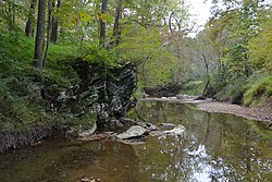
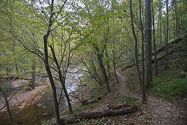
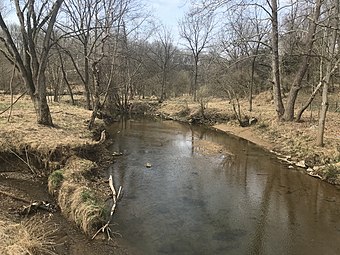
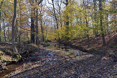
- Different parts of Muddy Branch
- Muddy Branch, crossing under the Chesapeake and Ohio Canal, just before emptying into the Potomac River
- Muddy Branch Stream and the Muddy Branch Greenway Trail
- Muddy Branch near Quince Orchard Road in North Potomac, Maryland
- Muddy Branch Stream behind Morris Park, Gaithersburg, Maryland
See also
[edit]References
[edit]- ^ U.S. Geological Survey. National Hydrography Dataset high-resolution flowline data. The National Map, accessed August 15, 2011
- ^ "Muddy Branch Greenway Trail". Montgomery County Department of Parks. 2019-10-22. Retrieved 2020-10-08.
- ^ "Pennyfield Lock Neighborhood Conservation Area". Montgomery County Department of Parks. 2020-01-02. Retrieved 2020-10-21.
External links
[edit]- Muddy Branch and Watts Branch Subwatersheds Implementation Plan (2012) - Montgomery County Department of Environmental Protection
- Muddy Branch Alliance - Community watershed group
39°04′58″N 77°16′06″W / 39.082689°N 77.268208°W


