Oregon's congressional districts
 From Wikipedia the free encyclopedia

The U.S. state of Oregon has had six United States congressional districts since 2023, when the 6th district was created as a result of the 2020 census.[1] The 5th district was added as a result of the 1980 census, and boundaries were redrawn following the population changes to each district as determined by the 1990, 2000, 2010, and 2020 censuses.
Current districts and representatives
[edit]List of members of the United States House delegation from Oregon, their terms, their district boundaries, and the district political ratings according to the CPVI. The delegation has a total of six members, including four Democrats, and two Republicans.
| Current U.S. representatives from Oregon | |||||
|---|---|---|---|---|---|
| District | Member (Residence)[2] | Party | Incumbent since | CPVI (2022)[3] | District map |
| 1st |  Suzanne Bonamici (Beaverton) | Democratic | January 31, 2012 | D+18 |  |
| 2nd | 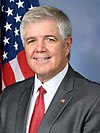 Cliff Bentz (Ontario) | Republican | January 3, 2021 | R+15 |  |
| 3rd |  Earl Blumenauer (Portland) | Democratic | May 21, 1996 | D+22 | 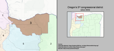 |
| 4th |  Val Hoyle (Springfield) | Democratic | January 3, 2023 | D+4 |  |
| 5th |  Lori Chavez-DeRemer (Happy Valley) | Republican | January 3, 2023 | D+2 | 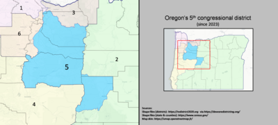 |
| 6th |  Andrea Salinas (Tigard) | Democratic | January 3, 2023 | D+4 |  |
Historical Results
[edit]- 2002
- 2004
- 2006
- 2008
- 2010
- 2012
- 2014
- 2016
- 2018
- 2020
- 2022
Historical and present district boundaries
[edit]Table of United States congressional district boundary maps in the State of Oregon, presented chronologically.[4] All redistricting events that took place in Oregon between 1973 and 2013 are shown.
| Year | Statewide map |
|---|---|
| 1973–1982 |  |
| 1983–1992 |  |
| 1993–2002 | 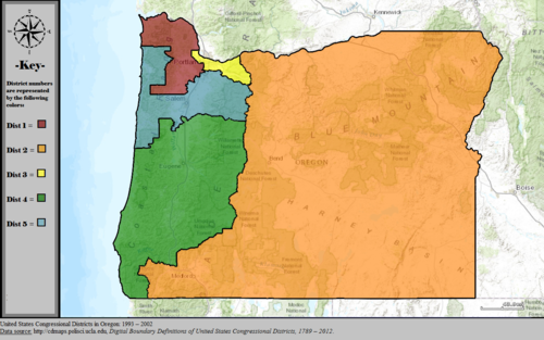 |
| 2003–2013 | 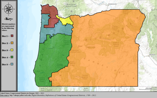 |
| 2013–2023 |  |
| 2023–2033 |  |
Obsolete districts
[edit]- Oregon Territory's at-large congressional district, obsolete since statehood
- Oregon's at-large congressional district (1859–1893)
See also
[edit]- List of United States congressional districts
- Lists of Oregon-related topics
- Oregon State Senate, with a map of state senate districts
References
[edit]- ^ VanderHart, Dirk (April 26, 2021). "Oregon to get 6th seat in Congress". Oregon Public Broadcasting. Retrieved April 26, 2021.
- ^ "Office of the Clerk, U.S. House of Representatives". clerk.house.gov. Retrieved January 9, 2022.
- ^ "2022 Cook PVI: District Map and List". The Cook Political Report. July 12, 2022. Retrieved January 5, 2023.
- ^ "Digital Boundary Definitions of United States Congressional Districts, 1789–2012". Retrieved October 18, 2014.


