東部州 (ザンビア)
 ウィキペディアから無料の百科事典
東部州 Eastern Province | |
|---|---|
 東部州の位置 | |
| 国 | |
| 州都 | チパタ |
| 面積 | |
| • 合計 | 51,476 km2 |
| 人口 (2016年) | |
| • 合計 | 1,861,500人 |
| • 密度 | 36人/km2 |
| 等時帯 | UTC+2 (CAT) |
| ISO 3166コード | ZM-03 |
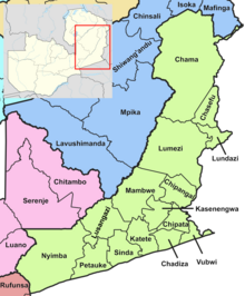
東部州(とうぶしゅう、英語:Eastern Province)は、ザンビア東部の州。 州都はチパタ。 2016年の人口は186万1500人、面積は5万1476km2、人口密度は36.2人/km2。 ザンビアの人口の11.7%、面積の6.8%を占める。 人口は南部州に次いで4番目に多いが、面積はルアプラ州に次いで4番目に小さい。 ルアングワ川が東のマラウィとの国境を成す。
隣接州
[編集]人口
[編集]- 1964年:48万人
- 1969年:51万人[2]
- 1980年8月25日:61万5543人
- 1990年8月20日:94万9521人
- 2000年10月20日:123万1283人
- 2010年10月16日:159万2661人
- 2016年7月1日:186万1500人[3]
2010年国勢調査
[編集]- 男性78万4680人⇔女性80万7981人(性比:97.1)
- 最大民族:チェワ族(39.7%)
- 言語話者率:ベンバ語(60%)[4]、チェワ語(34.6%)[5]
- 識字率:54.4%(全国では70.2%で、東部州は最低)
- 都市化率:12.58%
- 平均初婚年齢:20.1歳[6]
- 平均世帯人数:5.2人(男性家主:5.5人、女性家主:4.3人)[7]
- 有権者率:60.3%[8]
- 失業率:8.8%
- 貧困率:6.6%
- 完全出生率:6.3
- 普通出生率:38.0
- 一般受胎年齢女性1000人当たり出生率:168
- 総再生産率:2.6
- 純再生産率:1.8[9]
- 労働力人口率:58.7%
- 男性労働率:67.4%
- 女性労働率:50.7%
- 労働力人口増加率:1.8%/年[10]
- アルビノ人口:3225人(0.2%)[11]
- 平均寿命:46歳(全国:51歳)[12]
経済
[編集]| 職業[13] | % |
| 農林漁業 | 19.10 |
| 公務員 | 6.30 |
| 建設 | 7.10 |
| 電気・ガス・水道 | 4.10 |
| 金融 | 2.40 |
| ホテル・飲食店 | 3.10 |
| 工場 | 4.30 |
| 鉱業・採石 | 0.50 |
| 物流 | 4.10 |
| 小売り | 5.70 |
農業が盛んで、農地面積は38万7273haで全国の20.41%、農業生産高は79万9026tで全国の19.61%を占める。 特に向日葵は2万4053tを生産し、全国の70.2%を占める[14]。
空港
[編集]歴史
[編集]
チェワ人がカロンガ・ガワ・ウンディ王の元で、マラウィの中部州やモザンビークのテテ州に広がる帝国を築いた[17]。
1954年~1957年、帝国の10代目の王に当たるカロンガ・ガワ・ウンディ10世が、大英帝国の統治を補助した[18]。
1964年、ザンビアがイギリスから独立した。 州内のインフラや農業は整備されたが、銅の価格の下落によって成長は止まった[19]。
1968年、マラウィのヘイスティングズ・カムズ・バンダ初代大統領が、東部州の領有権を主張した。 これに対し、ザンビアのケネス・カウンダ初代大統領は、「領土を要求するならザンビアに対して戦争を仕掛ければ良い」と答えた。 また、領有権の主張を撤回するまでは、2国間の貿易を行わないと宣言した。 マラウィの領土拡張運動はこうして終わった。
気候
[編集]| 東部州の気候 | |||||||||||||
|---|---|---|---|---|---|---|---|---|---|---|---|---|---|
| 月 | 1月 | 2月 | 3月 | 4月 | 5月 | 6月 | 7月 | 8月 | 9月 | 10月 | 11月 | 12月 | 年 |
| 最高気温記録 °C (°F) | 27.8 (82) | 28 (82) | 28.3 (82.9) | 28.3 (82.9) | 27.6 (81.7) | 26.1 (79) | 26.1 (79) | 27.4 (81.3) | 30.7 (87.3) | 31.4 (88.5) | 30.9 (87.6) | 28.8 (83.8) | 31.4 (88.5) |
| 平均最低気温 °C (°F) | 18.2 (64.8) | 17.9 (64.2) | 17.4 (63.3) | 16 (61) | 13.6 (56.5) | 11 (52) | 10.6 (51.1) | 12.7 (54.9) | 17 (63) | 18.7 (65.7) | 19.1 (66.4) | 18.7 (65.7) | 10.6 (51.1) |
| 降水量 mm (inch) | 21 (0.83) | 16 (0.63) | 14 (0.55) | 6 (0.24) | 1 (0.04) | 0 (0) | 0 (0) | 0 (0) | 0 (0) | 2 (0.08) | 8 (0.31) | 18 (0.71) | 86 (3.39) |
| 出典:[20] | |||||||||||||
国立公園
[編集]
文化
[編集]- チパタ地区で2月にンゴニ人が行うンクワラ祭[18][22]
- カテテ地区で8月にチェワ人が行うクランバ祭:ザンビア、マラウィ、モザンビークのチェワ人が集まり、カロンガ・ガワ・ウンディ王を祀る。15世紀から続いている[23][24]。
- ルンダジ地区で8月にトゥンブカ人が行うクロンガ祭
- マンブウェ地区で10月にクンダ人が行うマライラ祭
- ルンダジ地区で10月にトゥンブカ人が行うゼンガニ祭
- ペタウケ地区で10月にンセンガ人が行うトゥウィンバ祭[25]
行政区画
[編集]
以下の15地区から成る。
2011年にチャマ地区が新設されたムチンガ州に割譲された[28]。
医療
[編集]| HIV感染者+AIDS死亡者[29] | ||
|---|---|---|
| 年 | HIV感染者 | AIDS死亡者 |
| 1985 | 779 | 107 |
| 1990 | 11,864 | 384 |
| 1995 | 49,750 | 2,688 |
| 2000 | 76,213 | 6,721 |
| 2005 | 81,680 | 9,614 |
| 2010 | 80,193 | 9,338 |
2005年には州内の1000人中447人がマラリアに感染した。 2010年には9338人がAIDSで亡くなった[30]。
主要都市
[編集]脚注
[編集]- ^ Simon, David J.; Pletcher, James R.; Siegel, Brian V., eds (2008). “Eastern Province”. Historical Dictionary of Zambia. African Historical Dictionaries. 106 (3rd ed.). Metuchen, New Jersey: Scarecrow Press. p. 104. ISBN 978-0-8108-5305-8
- ^ Census of population and housing, 1969 (PDF) (Report). Lusaka: Central Statistical Office, Republic of Zambia. 1970. pp. A6-7. 2015年10月26日時点のオリジナル (PDF)よりアーカイブ。
- ^ City Population[リンク切れ]閲覧日:2016年12月2日]
- ^ Census 2012, p. 99
- ^ Census 2012, p. 63
- ^ Census 2012, pp. 12–13
- ^ Census 2012, p. 19
- ^ Census 2012, p. 21
- ^ Census 2012, p. 44
- ^ Census 2012, p. 93
- ^ Census 2012, p. 78
- ^ Census 2012, p. 74
- ^ “Labour force survey”. Central Stastistical Office of Zambia (2008年). 17 October 2016閲覧。
- ^ “Agriculture statistics of Zambia 2014”. Central Stastistical Office of Zambia (2016年). 17 October 2016閲覧。
- ^ “Airports in Zamiba”. The Great Circle Mapper (2012年). 18 October 2016閲覧。
- ^ “Code for Trade and Transport Locations”. United Nations (2012年). 18 October 2016閲覧。
- ^ Kalusa, Mtonga, p. 7
- ^ a b Kalusa, Mtonga, p. 40
- ^ Kalusa, Mtonga, p. 79
- ^ “Weather statistics for Eastern (Zambia)”. Norway: Norwegian Meteorological Institute and Norwegian Broadcasting Corporation (2007年). 20 October 2016閲覧。
- ^ “Areas in Zambia”. Zambia Tourism Board (2011年). 19 October 2016閲覧。
- ^ Taylor, Scott D. (2006). Culture and Customs of Zambia. Greenwood Publishing Group. p. 115. ISBN 978-0-313-33246-3
- ^ Kalusa, Mtonga, p. 98
- ^ “Lungu expected to grace the Kulamba ceremony of the Chewa people of Zambia, Malawi and Mozambique”. Lusaka Times. (26 August 2016) 19 October 2016閲覧。
- ^ “Traditional Ceremonies”. Ministry of Tourism and Arts, Republic of Zambia (2011年). 20 October 2016閲覧。
- ^ Zambi Public administration Country profile (PDF) (Report). Division for Public Administration and Development Management (DPADM), Department of Economic and Social Affairs (DESA), United Nations. 2004. p. 7. 2016年10月16日閲覧。
- ^ The local government system in Zambia (PDF) (Report). Common Wealth Local Government Forum. pp. 218–220. 2016年10月16日閲覧。
- ^ Census 2012, p. 18
- ^ “AIDS and HIV statistics”. Central Stastistical Office of Zambia (2011年). 17 October 2016閲覧。
- ^ “Atlas Home”. Zambia data portal, Central statistical Office of Zambia (2011年). 16 October 2016閲覧。
- ^ City Population[リンク切れ]閲覧日:2016年12月5日
外部リンク
[編集]- Summary report for the 2010 Census of population (PDF) (Report). Lusaka: Central Statistical Office, Republic of Zambia. 2012. 2015年10月26日時点のオリジナル (PDF)よりアーカイブ。
- Mwakikagile, Godfrey (2010). Zambia: Life in an African Country. New Africa Press. ISBN 978-9987-16-011-2
- Kalusa, Walima Tuesday; Mtonga, Mapopa (2010). Kalonga Gawa Undi X: A Biography of an African Chief and Nationalist. African Books Collective. ISBN 978-9982-9972-5-6