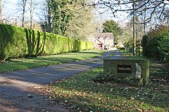
Andover Down

Andover Down is a hamlet in Hampshire, England 2 miles (3.2 km) east of Andover.[1][2]
History
[edit]On the 1888 OS map there are a very small number of houses: Down House, Down House farm, Harewood, Harewood Farm, and two further dwellings.[3]
It seems Andover Down underwent some expansion immediately after the Second World War, but remained a relatively isolated location until the rapid expansion of Andover (as an overspill town) and in particular with the building of the Walworth Industrial Estate to the east.
With the large housing development at Picket Twenty, and especially the post-2018 second phase development, houses now surround the south of Andover Down, and it is arguably now a suburb of Andover.
In 2020 planning permission was sought to build additional housing to the north of Andover Down, on agricultural land[4]
References
[edit]- ^ Ordnance Survey: Landranger map sheet 185 Winchester & Basingstoke (Andover & Romsey) (Map). Ordnance Survey. 2013. ISBN 9780319228845.
- ^ "Ordnance Survey: 1:50,000 Scale Gazetteer" (csv (download)). www.ordnancesurvey.co.uk. Ordnance Survey. 1 January 2016. Retrieved 30 January 2016.
- ^ "OSmap from 1888". OS maps.
- ^ "TVBC application". TVBC.
External links
[edit]![]() Media related to Andover Down at Wikimedia Commons
Media related to Andover Down at Wikimedia Commons


