Guanare Airport

Guanare Airport Aeropuerto Nacional Virgen de Coromoto | |||||||||||
|---|---|---|---|---|---|---|---|---|---|---|---|
| Summary | |||||||||||
| Airport type | Public | ||||||||||
| Operator | Government | ||||||||||
| Serves | Guanare, Venezuela | ||||||||||
| Elevation AMSL | 606 ft / 185 m | ||||||||||
| Coordinates | 9°01′40″N 69°45′15″W / 9.02778°N 69.75417°W | ||||||||||
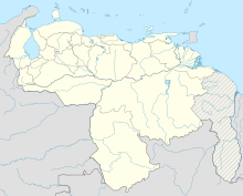
| Map | |||||||||||
 | |||||||||||
| Runways | |||||||||||
| |||||||||||
Guanare Airport (IATA: GUQ, ICAO: SVGU) is an airport serving Guanare, the capital of the Portuguesa state in Venezuela.
Runway length includes a 350 metres (1,150 ft) displaced threshold on Runway 23.
The Guanare non-directional beacon (Ident: GRE) is located on the field.[4]
See also
[edit]References
[edit]- ^ "Airport information for SVGU". World Aero Data. Archived from the original on 2019-03-05.
{{cite web}}: CS1 maint: unfit URL (link) Data current as of October 2006. - ^ Airport information for GUQ at Great Circle Mapper.
- ^ Google Maps - Guanare
- ^ GRE NDB
External links
[edit]
