Jatrabari Thana

This article needs additional citations for verification. (May 2016) |
Jatrabari Thana যাত্রাবাড়ী থানা | |
|---|---|
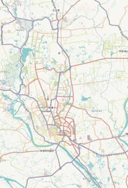
 Expandable map of vicinity of Jatrabari Thana | |
| Coordinates: 23°42′38″N 90°26′08″E / 23.7105°N 90.4355°E | |
| Country | |
| Division | Dhaka Division |
| District | Dhaka District |
| Established as Thana | 2007 |
| Area | |
| • Total | 13.19 km2 (5.09 sq mi) |
| Elevation | 23 m (75 ft) |
| Population | |
| • Total | 492,166 |
| • Density | 33,632/km2 (87,110/sq mi) |
| Time zone | UTC+6 (BST) |
| Postal code | 1236[3] |
| Area code | 02[4] |
Jatrabari Thana (Bengali: যাত্রাবাড়ী থানা) is a metropolitan thana within the megacity of Dhaka in central Bangladesh. It is known for its steel furniture industry.[5]
Administration
[edit]Jatrabari Thana consists of parts of Matuail and Ward 87 in addition to Ward 84, Ward 85 and Ward 86 of Dhaka South City Corporation. It contains 17 mouzas and mahallas.
Geography
[edit](Dhaka metropolitan; Postal code: 1204) area 13.19 square kilometres (5.09 sq mi), located in between 23°42' and 23°43' north latitudes and in between 90°20' and 90°22' east longitudes, at the starting point of Dhaka-Chittagong Highway. It is bounded by sabujbagh and Demra thanas on the north, Kadamtali and shyampur thanas on the south, Demra thana on the east, Gandaria and sutrapur thanas on the west.[6]
Demographics
[edit]According to the 2011 Census of Bangladesh, Jatrabari Thana had 96,453 households with an average household size of 4.29 and a population of 443,601. Males constituted 55.27% (245,176) of the population while females 44.73% (198,425). Jatrabari had a literacy rate (age 7 and over) of 72.0%, compared to the national average of 51.8%, and a sex ratio of 124.There were 965 floating people in this jurisdiction. [8]
The religious breakdown was Muslim 97.17% (431,037), Hindu 2.68% (11,891), Christian 0.14% (612), Buddhist 0.01% (37), and others 0.01% (24). The ethnic minority people living there were 102 persons in total.
Education
[edit]Jatrabari thana is famous for educational institutions such as Jatrabari Ideal High School, City Corporation Adarsha High School and College, Dania College, Dr. Mahbubur Rahman Mollah College. Other educational institutions include Tamirul Millat Kamil Madrasa, Matuail Multilateral High School, Matuail Girls High School, Matuail Adarsha High School, Matuail Latif Bhiuyh College, Bornomala High School, nobarun school and college and Abdullah Mollah High School. There is also the Jamia Muhammadia Arabia, which is in northern Jatrabari and is one of the largest Ahl-i Hadith madrasas in the country.[9]
Facilities
[edit]There are numerous mosques in Jatrabari Thana, most notably Babar Mosque, Dhalpur Zakarin Jame Mosque, Baytul Aman, Dhalpur Narikel Bagan Jame Mosque.
References
[edit]- ^ "Geographic coordinates of Dhaka, Bangladesh". DATEANDTIME.INFO. Retrieved 7 July 2016.
- ^ National Report (PDF). Population and Housing Census 2022. Vol. 1. Dhaka: Bangladesh Bureau of Statistics. November 2023. p. 386. ISBN 978-9844752016.
- ^ "Bangladesh Postal Code". Dhaka: Bangladesh Postal Department under the Department of Posts and Telecommunications of the Ministry of Posts, Telecommunications and Information Technology of the People's Republic of Bangladesh. 19 October 2024.
- ^ "Bangladesh Area Code". China: Chahaoba.com. 18 October 2024.
- ^ Faroqi, Gofran (2012). "Furniture". In Sirajul Islam; Miah, Sajahan; Khanam, Mahfuza; Ahmed, Sabbir (eds.). Banglapedia: the National Encyclopedia of Bangladesh (Online ed.). Dhaka, Bangladesh: Banglapedia Trust, Asiatic Society of Bangladesh. ISBN 984-32-0576-6. OCLC 52727562. OL 30677644M. Retrieved 27 October 2024.
- ^ Akhter, Shamima (2012). "Jatrabari Thana". In Sirajul Islam; Miah, Sajahan; Khanam, Mahfuza; Ahmed, Sabbir (eds.). Banglapedia: the National Encyclopedia of Bangladesh (Online ed.). Dhaka, Bangladesh: Banglapedia Trust, Asiatic Society of Bangladesh. ISBN 984-32-0576-6. OCLC 52727562. OL 30677644M. Retrieved 27 October 2024.
- ^ "Bangladesh Population and Housing Census 2011 Zila Report – Dhaka" (PDF). bbs.gov.bd. Bangladesh Bureau of Statistics.
- ^ "Community Tables: Dhaka district" (PDF). bbs.gov.bd. 2011.
- ^ Siddiqi, ABM Saiful Islam (2012). "Madrasah". In Sirajul Islam; Miah, Sajahan; Khanam, Mahfuza; Ahmed, Sabbir (eds.). Banglapedia: the National Encyclopedia of Bangladesh (Online ed.). Dhaka, Bangladesh: Banglapedia Trust, Asiatic Society of Bangladesh. ISBN 984-32-0576-6. OCLC 52727562. OL 30677644M. Retrieved 27 October 2024.


