Meyami

Meyami Mayāmey | |
|---|---|
City | |
| Coordinates: 36°24′37″N 55°39′12″E / 36.41028°N 55.65333°E[1] | |
| Country | Iran |
| Province | Semnan |
| County | Meyami |
| District | Meyami |
| Population (2016)[2] | |
| • Total | 4,566 |
| Time zone | UTC+3:30 (IRST) |
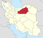
Meyami (Persian: میامی)[a] is a city in the Central District of Meyami County, Semnan province, Iran, serving as capital of both the county and the district.[4] It served as the administrative center for Meyami Rural District[5] until its capital was transferred to the village of Ebrahimabad-e Olya.[6]
Demographics
[edit]Population
[edit]At the time of the 2006 National Census, the city's population was 4,057 in 1,116 households, when it was in the former Meyami District of Shahrud County.[7] The following census in 2011 counted 4,562 people in 1,340 households.[8] The 2016 census measured the population of the city as 4,566 people in 1,431 households,[2] by which time the city and the rural district had been transferred to the Central District, with Meyami as the county's capital.[4]

Landmarks
[edit]Meyami Caravanserai is located in the center of Meyami and is one of the beautiful caravanserais of the Safavid era that is almost intact. This building is in the form of a central courtyard, with a base of 5250 square meters and is of the type of four porches made of bricks. The entrance is in the shape of a porch and has two floors, is located on the north side of the caravanserai. Carved stone inscriptions have been installed in the entrance door, the date of construction and its founder are written on it, and it is unique in this respect.
Miami Caravanserai is listed as a national monument of Iran in 1986 and is currently the location of the Anthropological Museum of Miami.
See also
[edit]Notes
[edit]References
[edit]- ^ OpenStreetMap contributors (25 April 2023). "Meyami, Meyami County" (Map). OpenStreetMap (in Persian). Retrieved 25 April 2023.
- ^ a b "Census of the Islamic Republic of Iran, 1395 (2016)". AMAR (in Persian). The Statistical Center of Iran. p. 20. Archived from the original (Excel) on 17 November 2020. Retrieved 19 December 2022.
- ^ Meyami can be found at GEOnet Names Server, at this link, by opening the Advanced Search box, entering "-3074377" in the "Unique Feature Id" form, and clicking on "Search Database".
- ^ a b Rahimi, Mohammadreza (2 June 2013). "Letter of approval regarding country divisions in Semnan province". Islamic Parliament Research Council (in Persian). Ministry of Interior, Board of Ministers. Archived from the original on 25 September 2011. Retrieved 22 November 2023.
- ^ Mousavi, Mirhossein (25 August 1391). "Creation and establishment of 11 rural districts including villages, farms and places in Shahrud County under Semnan province". Islamic Parliament Research Center (in Persian). Ministry of Interior, Board of Ministers. Archived from the original on 15 November 2012. Retrieved 20 December 2023.
- ^ Habibi, Hassan (17 December 1379). "Creating divisional changes and reforms in Rudbar Rural District center, Kalat-e Hay-ye Gharbi Rural District center, and Meyami Rural District center". Lamtakam (in Persian). Ministry of Interior, Council of Ministers. Archived from the original on 2 January 2024. Retrieved 2 January 2024.
- ^ "Census of the Islamic Republic of Iran, 1385 (2006)". AMAR (in Persian). The Statistical Center of Iran. p. 20. Archived from the original (Excel) on 20 September 2011. Retrieved 25 September 2022.
- ^ "Census of the Islamic Republic of Iran, 1390 (2011)". Syracuse University (in Persian). The Statistical Center of Iran. p. 20. Archived from the original (Excel) on 20 January 2023. Retrieved 19 December 2022.

