North Eleuthera Airport

This article needs additional citations for verification. (April 2021) |
North Eleuthera Airport | |||||||||||
|---|---|---|---|---|---|---|---|---|---|---|---|
 | |||||||||||
| Summary | |||||||||||
| Airport type | Public | ||||||||||
| Location | North Eleuthera | ||||||||||
| Elevation AMSL | 13 ft / 4 m | ||||||||||
| Coordinates | 25°28′30″N 076°41′01″W / 25.47500°N 76.68361°W | ||||||||||
| Map | |||||||||||
 | |||||||||||
| Runways | |||||||||||
| |||||||||||
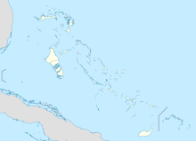
North Eleuthera Airport is an airport in North Eleuthera on Eleuthera in the Bahamas (IATA: ELH, ICAO: MYEH). It serves the outlying islands of Harbour Island and Spanish Wells as well as the northernmost third of Eleuthera Island.
Airlines and destinations
[edit]Passenger
[edit]References
[edit]- ^ "Airport information for MYEH". World Aero Data. Archived from the original on 5 March 2019.
{{cite web}}: CS1 maint: unfit URL (link) Data current as of October 2006. Source: DAFIF.
