Rhenoy

Rhenoy | |
|---|---|
Village | |
 Church of Rhenoy | |
 Rhenoy Location in the Netherlands  Rhenoy Rhenoy (Netherlands) | |
| Coordinates: 51°53′04″N 5°09′16″E / 51.88445°N 5.15442°E | |
| Country | Netherlands |
| Province | Gelderland |
| Municipality | West Betuwe |
| Area | |
| • Total | 6.14 km2 (2.37 sq mi) |
| Elevation | 4 m (13 ft) |
| Population (2021)[1] | |
| • Total | 910 |
| • Density | 150/km2 (380/sq mi) |
| Time zone | UTC+1 (CET) |
| • Summer (DST) | UTC+2 (CEST) |
| Postal code | 4152[1] |
| Dialing code | 0345 |
Rhenoy is a village in the Dutch province of Gelderland. It is a part of the municipality of West Betuwe, and is situated about 13 km east of Gorinchem, between Geldermalsen and Leerdam.
History[edit]
It was first mentioned in 1265 as tot Rynoey, and means "land neat a stream". It is not related to the Rhine, also because it is located on the Linge.[3] The Dutch Reformed church dates from 1836, but has 14th and 15th century elements. In 1840, it was home to 319 people.[4]
Gallery[edit]
-
 Street in Rhenoy
 -
 House in Rhenoy
 -
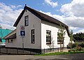 Cornerhouse
 -
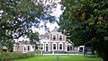 Villa in Rhenoy


References[edit]
- ^ a b c "Kerncijfers wijken en buurten 2021". Central Bureau of Statistics. Retrieved 24 March 2022.
two entries
- ^ "Postcodetool for 4152EA". Actueel Hoogtebestand Nederland (in Dutch). Het Waterschapshuis. Retrieved 24 March 2022.
- ^ "Rhenoy - (geografische naam)". Etymologiebank (in Dutch). Retrieved 24 March 2022.
- ^ "Rhenoy". Plaatsengids (in Dutch). Retrieved 24 March 2022.
This Gelderland location article is a stub. You can help Wikipedia by expanding it. |