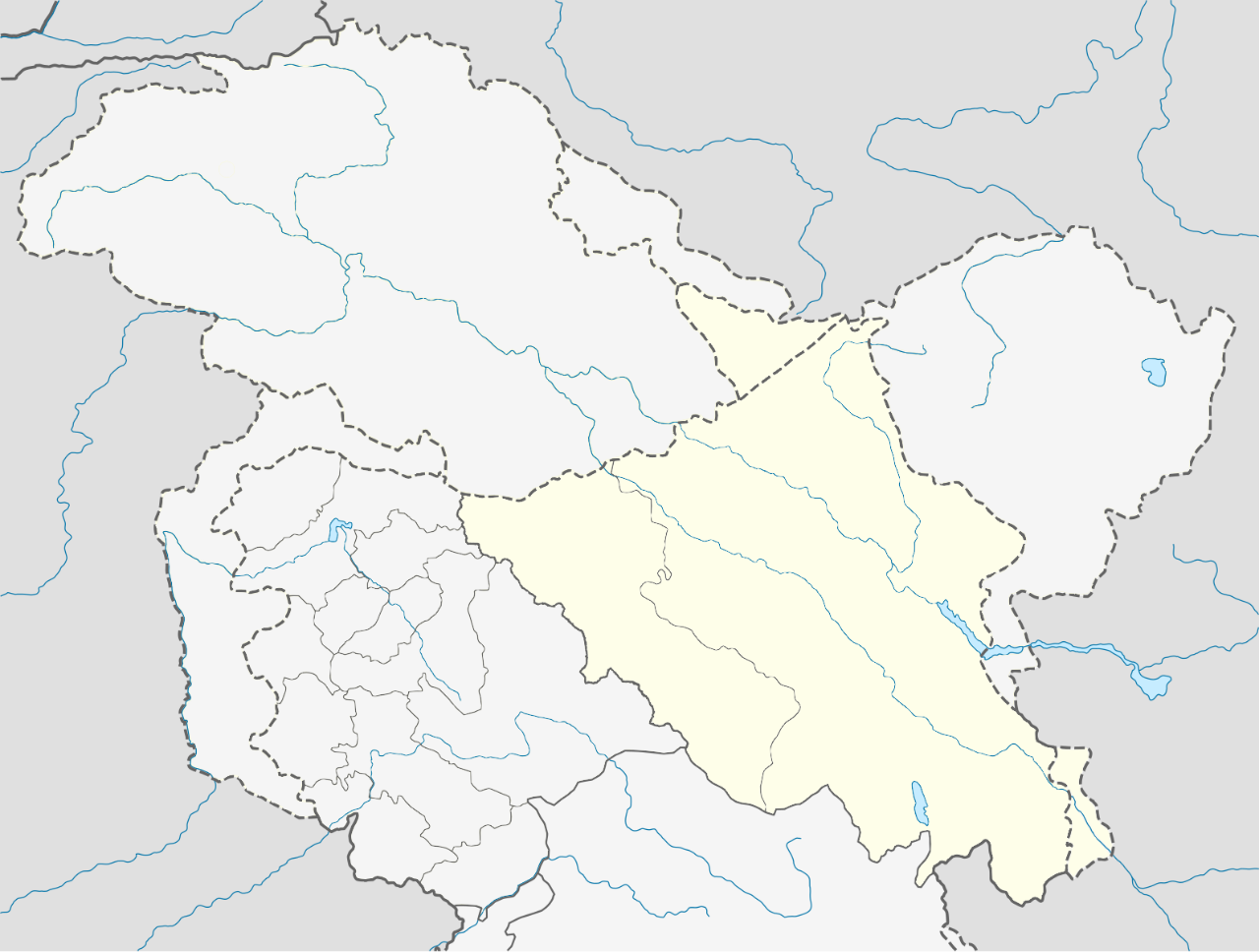
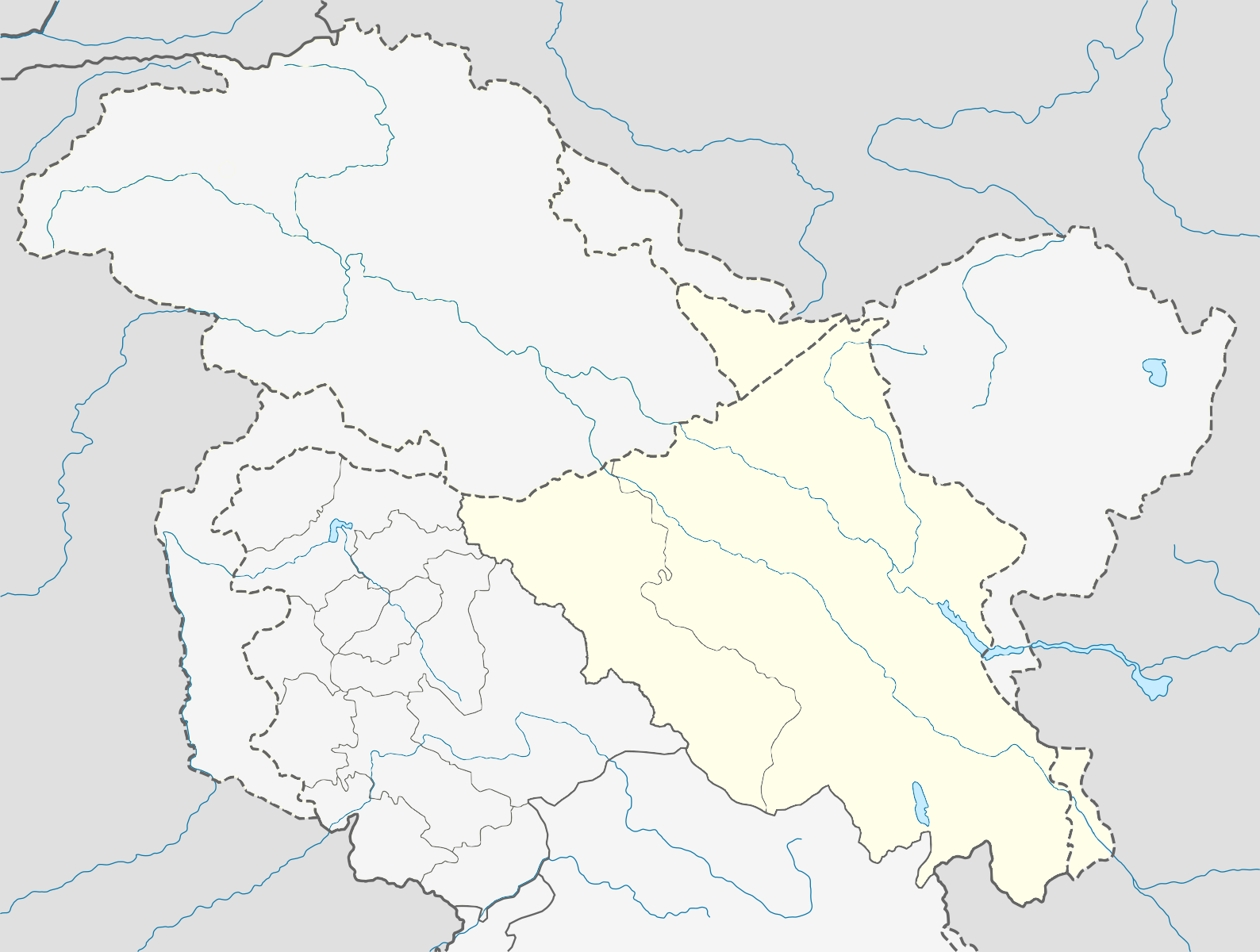
Файл:India Ladakh location map.svg
 Из Википедии, бесплатной энциклопедии

Размер этого PNG-превью для исходного SVG-файла: 794 × 600 пкс. Другие разрешения: 318 × 240 пкс | 635 × 480 пкс | 1016 × 768 пкс | 1280 × 967 пкс | 2560 × 1935 пкс | 1588 × 1200 пкс.
Исходный файл (SVG-файл, номинально 1588 × 1200 пкс, размер файла: 506 КБ)
Этот файл находится на Викискладе. Сведения о нём показаны ниже. Викисклад — централизованное хранилище для свободных файлов, используемых в проектах Викимедиа. |
Краткое описание
| Описание | Quadratische Plattkarte, N-S-Streckung 120 %. Geographische Begrenzung der Karte: * N: 37.2° N * S: 32.1° N * W: 72.4° O * O: 80.5° O Equirectangular projection, N/S stretching 120 %. Geographic limits of the map: * N: 37.2° N * S: 32.1° N * W: 72.4° E * E: 80.5° E |
| Дата | |
| Источник | |
| Автор |
|
| Это отретушированное изображение, что означает, что первоначальной версия изображения была изменена цифровым способом. Изменения: new political boundaries. Оригинал доступен по ссылке: India Jammu and Kashmir location map.svg:
|
Я, владелец авторских прав на это произведение, добровольно публикую его на условиях следующей лицензии:
Этот файл доступен по лицензии Creative Commons Attribution-Share Alike 3.0 Unported.
- Вы можете свободно:
- делиться произведением – копировать, распространять и передавать данное произведение
- создавать производные – переделывать данное произведение
- При соблюдении следующих условий:
- атрибуция – Вы должны указать авторство, предоставить ссылку на лицензию и указать, внёс ли автор какие-либо изменения. Это можно сделать любым разумным способом, но не создавая впечатление, что лицензиат поддерживает вас или использование вами данного произведения.
- распространение на тех же условиях – Если вы изменяете, преобразуете или создаёте иное произведение на основе данного, то обязаны использовать лицензию исходного произведения или лицензию, совместимую с исходной.
Исходный журнал загрузок
This image is a derivative work of the following images:
- File:India_Jammu_and_Kashmir_location_map.svg licensed with Cc-by-sa-3.0
- 2011-02-16T13:08:20Z NordNordWest 1722x1301 (196067 Bytes) Who cares discussions (discussion? only you: http://en.wikipedia.org/w/index.php?title=File_talk:India_Jammu_and_Kashmir_location_map.svg&action=history) at en:WP when this is a Commons file? Another revert by you -> COM:V.
- 2011-02-16T12:46:34Z Avoided blue 1722x1301 (259968 Bytes) Discussion was there on en:wiki for long time, the map otherwise is completely misleading
- 2011-02-15T12:10:59Z NordNordWest 1722x1301 (196067 Bytes) see [[:en:Kashmir conflict]], especially [[:en:Kashmir conflict#Indian view]], and [[:en:Instrument of Accession (Jammu and Kashmir)]], no changes of difficult maps without discussion
- 2011-02-15T06:47:01Z Avoided blue 1722x1301 (259968 Bytes) Fix colors of areas that are not militarily controlled by India.
- 2010-04-15T08:35:10Z NordNordWest 1722x1301 (196067 Bytes) =={{int:filedesc}}== {{Information |Description= {{de|Positionskarte von [[:de:Jammu und Kashmir|Jammu und Kashmir]], [[:de:Indien|Indien]]}} Quadratische Plattkarte, N-S-Streckung 120 %. Geographische Begrenzung der Karte: *
История файла
Нажмите на дату/время, чтобы посмотреть файл, который был загружен в тот момент.
| Дата/время | Миниатюра | Размеры | Участник | Примечание | |
|---|---|---|---|---|---|
| текущий | 01:45, 27 ноября 2019 | | 1588 × 1200 (506 КБ) | Fowler&fowler | Reverted to version as of 03:02, 26 November 2019 (UTC) Sorry I made a mistake. |
| 01:40, 27 ноября 2019 |  | 2000 × 1511 (591 КБ) | Fowler&fowler | Reverted to version as of 17:09, 25 November 2019 (UTC); We cannot show a POV map which colors the two regions of Pakistan administered Kashmir in different colors. See the discussion in #Uniform_format_for_infobox_of_Kashmir-related_first-order_division_articles and Talk:Jammu_and_Kashmir_(union_territory)#Three_map_proposal | |
| 03:02, 26 ноября 2019 |  | 1588 × 1200 (506 КБ) | Hindian1947 | Showing current situation after the bifurcation of Ladakh from Jammu and Kashmir. | |
| 17:09, 25 ноября 2019 |  | 2000 × 1511 (591 КБ) | Fowler&fowler | Restoring {{U|NordNordWest}} original map showing the de facto situation; removing the current map which shows the India government viewpoint per the discussion on WT:INDIA see [https://en.wikipedia.org/w/index.php?title=Wikipedia_talk:Noticeboard_for_India-related_topics&oldid=927910702#Uniform_format_for_infobox_of_Kashmir-related_first-order_division_articles here]. ~~~~ | |
| 20:17, 2 ноября 2019 |  | 1722 × 1301 (307 КБ) | RaviC | {{Information |Description={{de|Positionskarte von Ladakh, Indien. De-facto-Situation.}} Quadratische Plattkarte, N-S-Streckung 120 %. Geographische Begrenzung der Karte: * N: 37.2° N * S: 32.1° N * W: 72.4° O * O: 80.5° O {{en|Location map of Ladakh, India. De facto situation.}} Equirectangular projection, N/S stretching 120 %. Geographic limits of the map: * N: 37.2° N * S: 32.1° N * W: 72.4° E * E: 80.5° E |Source=*[[:File:India_Ja... |
Использование файла
Следующие 26 страниц используют этот файл:
Глобальное использование файла
Данный файл используется в следующих вики:
- Использование в en.wikipedia.org
- Использование в os.wikipedia.org
- Использование в uk.wikipedia.org