Файл:Map of Oregon NA.png
 Из Википедии, бесплатной энциклопедии

Размер этого предпросмотра: 800 × 541 пкс. Другие разрешения: 320 × 217 пкс | 640 × 433 пкс | 1024 × 693 пкс | 1280 × 866 пкс | 1967 × 1331 пкс.
Исходный файл (1967 × 1331 пкс, размер файла: 2,15 Мб, MIME-тип: image/png)
Этот файл находится на Викискладе. Сведения о нём показаны ниже. Викисклад — централизованное хранилище для свободных файлов, используемых в проектах Викимедиа. |
Краткое описание
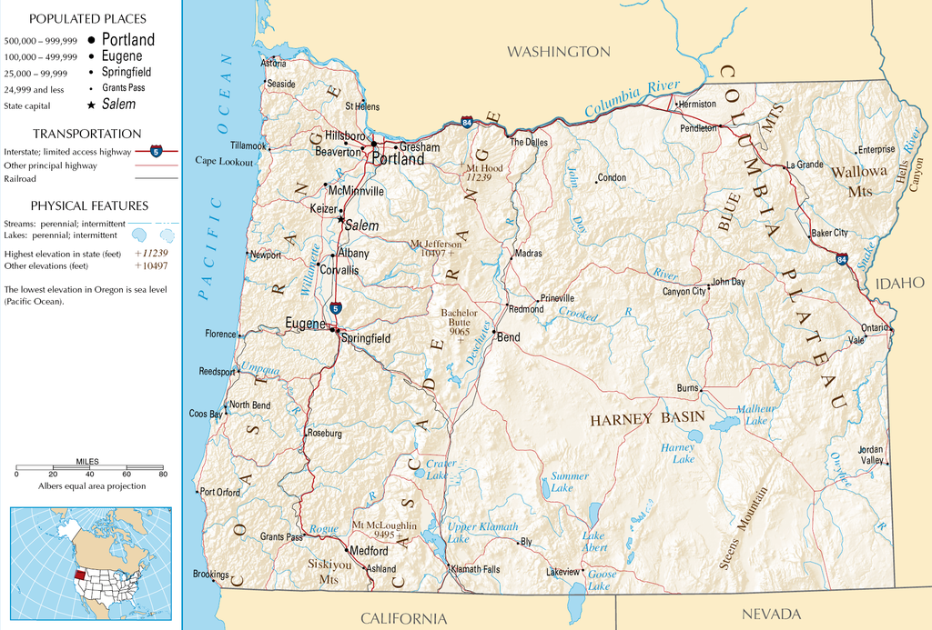
| Описание | English: Topographic map of the geography of Oregon — with major rivers shown.
|
| Источник | National Atlas |
| Автор | Неизвестен |
Лицензирование
This map was obtained from an edition of the National Atlas of the United States. Like almost all works of the U.S. federal government, works from the National Atlas are in the public domain in the United States. Online access: NationalAtlas.gov | 1970 print edition: Library of Congress, Perry-Castañeda Library
|
История файла
Нажмите на дату/время, чтобы посмотреть файл, который был загружен в тот момент.
| Дата/время | Миниатюра | Размеры | Участник | Примечание | |
|---|---|---|---|---|---|
| текущий | 05:46, 16 октября 2007 | | 1967 × 1331 (2,15 Мб) | Peteforsyth | removed extraneous text and logo from public domain image |
| 08:13, 15 августа 2006 |  | 2122 × 1640 (2,75 Мб) | Huebi~commonswiki | {{Information| |Description=Map of Oregon |Source=[http://www.nationalatlas.gov National Atlas] }} Category:Maps of the United States Category:Maps of Oregon {{PD-USGov-Atlas}} |
Использование файла
Следующая страница использует этот файл:
Глобальное использование файла
Данный файл используется в следующих вики:
- Использование в als.wikipedia.org
- Использование в ar.wikipedia.org
- Использование в de.wikipedia.org
- Использование в en.wikipedia.org
- Использование в eo.wikipedia.org
- Использование в fi.wikipedia.org
- Использование в fr.wikipedia.org
- Использование в hr.wiktionary.org
- Использование в hsb.wikipedia.org
- Использование в hu.wikipedia.org
- Использование в incubator.wikimedia.org
- Использование в is.wikipedia.org
- Использование в it.wikipedia.org
- Использование в ja.wikipedia.org
- Использование в kk.wikipedia.org
- Использование в lt.wikipedia.org
- Использование в mr.wikipedia.org
- Использование в nds-nl.wikipedia.org
- Использование в pa.wikipedia.org
- Использование в sw.wikipedia.org
- Использование в vi.wikipedia.org
- Использование в zea.wikipedia.org