Файл:Britain.4th.century.Roman.infrastructure.jpg

Повна роздільність (3158 × 3388 пікселів, розмір файлу: 961 КБ, MIME-тип: image/jpeg)
| Відомості про цей файл містяться на Вікісховищі — централізованому сховищі вільних файлів мультимедіа для використання у проектах Фонду Вікімедіа. |
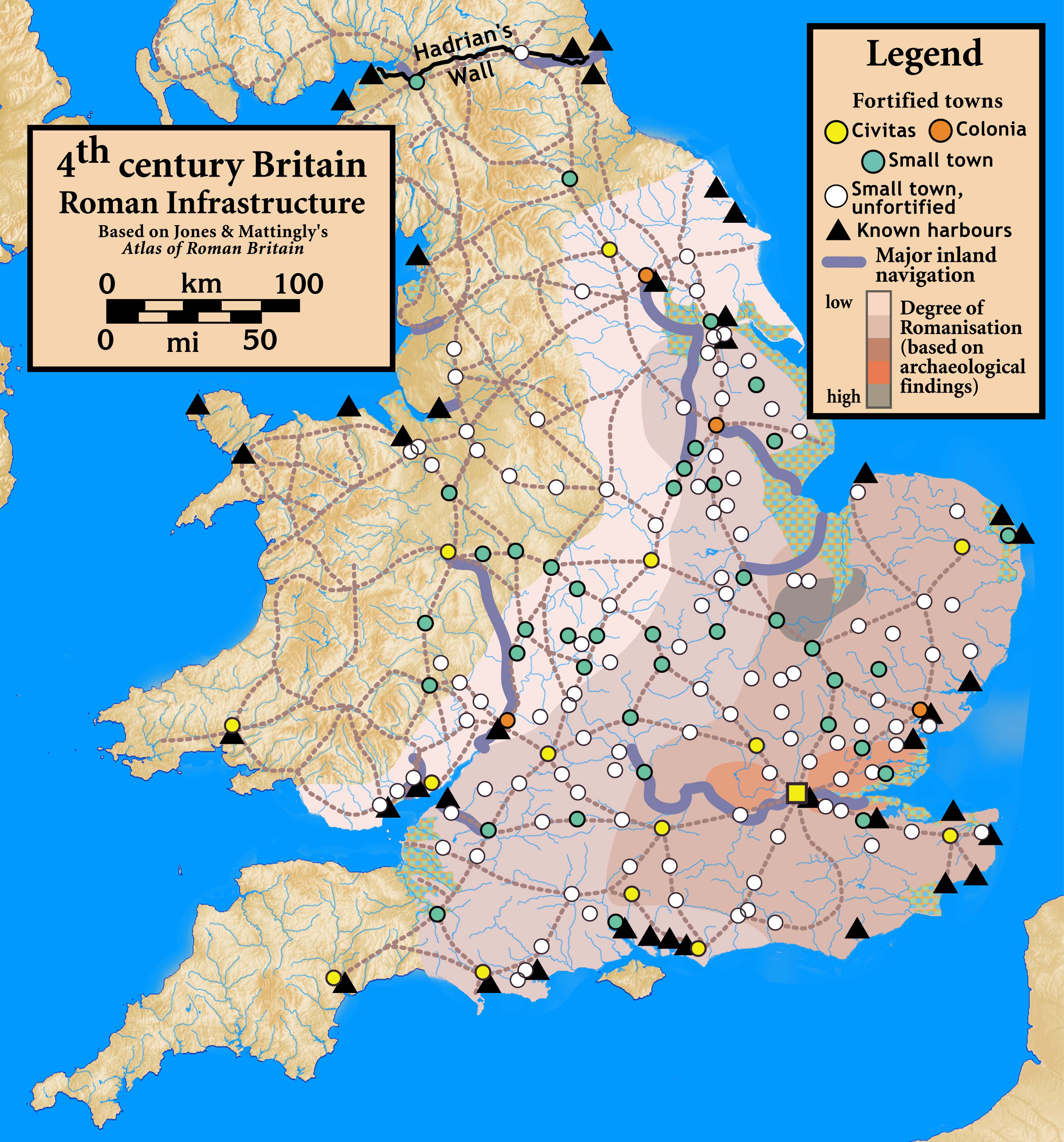
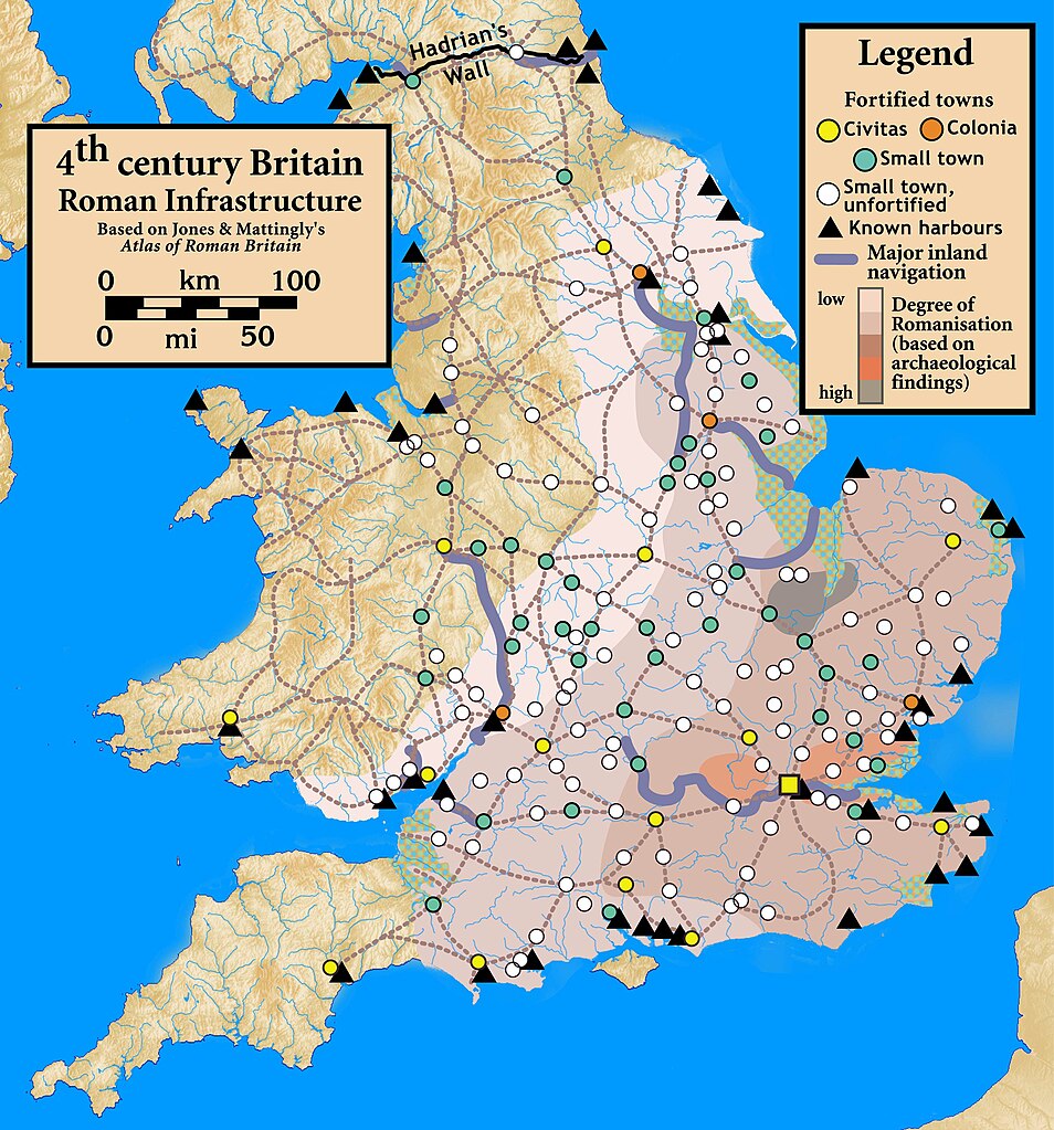
| Опис | Roman Infrastructure in 4th century Britain |
| Час створення | |
| Джерело | Based on Jones & Mattingly's Atlas of Roman Britain (ISBN 978-1-84217-06700, 1990, reprinted 2007) — the source is cited in the image legend — locations of towns (fortified and unfortified) are given on p. 156, with tribal civitates and coloniae specified on p. 154; major inland waterways are from p. 199; the degree of Romanisation ("boundaries of acculturation" with levels from "high density" to "low density" in the text) are given on page 151, with the authors citing it as a computer-generated map based on data contained in the standard Ordnance Survey map of Roman Britain; roads are from several sources, including the Antonine Itinerary. |
| Автор | my work |
- Ви можете вільно:
- ділитися – копіювати, поширювати і передавати твір
- модифікувати – переробляти твір
- При дотриманні таких умов:
- зазначення авторства – Ви повинні вказати авторство, надати посилання на ліцензію і вказати, чи якісь зміни було внесено до оригінального твору. Ви можете зробити це в будь-який розсудливий спосіб, але так, щоб він жодним чином не натякав на те, наче ліцензіар підтримує Вас чи Ваш спосіб використання твору.
- поширення на тих же умовах – Якщо ви змінюєте, перетворюєте або створюєте іншу похідну роботу на основі цього твору, ви можете поширювати отриманий у результаті твір тільки на умовах такої ж або сумісної ліцензії.
Історія файлу
Клацніть на дату/час, щоб переглянути, як тоді виглядав файл.
| Дата/час | Мініатюра | Розмір об'єкта | Користувач | Коментар | |
|---|---|---|---|---|---|
| поточний | 00:42, 30 вересня 2010 | | 3158 × 3388 (961 КБ) | Notuncurious | {{Information |Description=Roman Infrastructure in 4th century Britain |Source=Based on Jones & Mattingly's ''Atlas of Roman Britain'' (ISBN 978-1-84217-06700, 1990, reprinted 2007) — the source is cited in the image legend — locations of town |
Використання файлу
Така сторінка використовує цей файл:
Глобальне використання файлу
Цей файл використовують такі інші вікі:
- Використання в de.wikipedia.org
- Використання в el.wikipedia.org
- Використання в en.wikipedia.org
- Використання в fr.wikipedia.org
- Використання в it.wikipedia.org