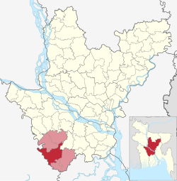
Gopalganj Sadar Upazila

Gopalganj Sadar গোপালগঞ্জ সদর | |
|---|---|
 | |
 | |
| Coordinates: 23°1′N 89°50′E / 23.017°N 89.833°E | |
| Country | |
| Division | Dhaka |
| District | Gopalganj |
| Headquarters | Gopalganj |
| Area | |
| • Total | 389.61 km2 (150.43 sq mi) |
| Population | |
| • Total | 401,160 |
| • Density | 1,000/km2 (2,700/sq mi) |
| Time zone | UTC+6 (BST) |
| Postal code | 8100[2] |
| Area code | 0668[3] |
| Website | Official Map of Gopalganj Sadar |
| dcgopalganj.gov.bd | |
Gopalganj Sadar (Bengali: গোপালগঞ্জ সদর) is an upazila of Gopalganj District in Dhaka Division, Bangladesh.[4]
History
[edit]Gopalganj sadar is the main town of Gopalganj District. 15 MPs are from there. It has 15 banks, including 3 commercial banks .It may take 2 or 3 hours to reach by road from Rajdhani after build the padma bridge (depending on traffic). After the Bangladesh Liberation War, Gopalgonj Sadar became 'Pourashava'. As a close fellow of Bangabandhu Sheikh Mujibur Rahman, Panna Biswas of Gimadanga was selected as first Chairman. Khan Saheb Sheikh Mosharrof Hossain, Molla Jalaluddin Ahmed, Hemaet Uddin, Wahiduzzaman, Fayekuzzaman are well known figures among the others born in Sadar upozila.
Geography
[edit]Gopalganj Sadar is located at 23°01′00″N 89°50′00″E / 23.0167°N 89.8333°E. It has 73,126 households and a total area of 391.35 km2.
Demographics
[edit]According to the 2011 Census of Bangladesh, Gopalganj Sadar Upazila had 73,126 households and a population of 344,008. 82,958 (24.12%) were under 10 years of age. Gopalganj Sadar had a literacy rate (age 7 and over) of 61.82%, compared to the national average of 51.8%, and a sex ratio of 989 females per 1000 males. 53,778 (15.63%) lived in urban areas.[6][7]
According to the 1991 Bangladesh census, Gopalganj Sadar had a population of 291,409. Males constituted 50.73% of the population, and females 49.27%. The population aged 18 or over was 141,978. Gopalganj Sadar had an average literacy rate of 44.7% (7+ years), against the national average of 32.4%.[8]
It has 57 schools, 13 colleges, and 2 university colleges.
Places of interest
[edit]- Ulpur has a former Zamindar palace which is known as "Ulpur Zamindar Bari". Now a part of that palace currently used as Tehsil Office.
- Arpara also has a former Zamindar Palace which is known as "Arpara Zamindar Bari". One of the oldest historical Mosque "Munshi Bari Jame Mosjid" is also situated in Arpara village under Verarhat. There also have a tourist attraction and picnic spot called "Arpara Park". This is one of the most beautiful botanical garden in the entire district.
Administration
[edit]Gopalganj Sadar Upazila is divided into Gopalganj Municipality and 21 union parishads: Borasi, Baultali, Chandra Dighalia, Durgapur, Gobra, Gopinathpur, Haridaspur, Jalalabad, Kajulia, Karpara, Kati, Latifpur, Majhigati, Nizra, Paikkandi, Raghunathpur, Sahapur, Satpar, Suktail, Ulpur, and Upafi. The union parishads are subdivided into 127 mauzas and 197 villages.[6]
Gopalganj Municipality is subdivided into 9 wards and 47 mahallas.[6]
Education
[edit]There are ten colleges in the upazila: Government Bangabandhu College, Gopalgonj, Dr. Dilawar Husain Memorial College, Government Nazrul Degree College Satpar, Haji Lalmia City College, Kazi Zahural Huq College, Krishnapur Shaptodas Palli College, M. H. Khan Degree College, N. Haque College of Business & Technology, Sabira - Rouf College, and Sheikh Fazilatunnesa Government Women's College.[9]
There also have some famous higher secondary school. They are: S. M. Model Government High School, Swarnakali High School, Arpara Islamia High School, Ulpur PC High School (1900), Boutali Sahapur Sammilani High School, founded in 1928, Karpara Union High School (1936), Satpar Dinnnath Goyali Chandra High School, Chandra Dighalia High School, Gopinathpur High School (1911) are notable secondary schools.[4]
See also
[edit]References
[edit]- ^ National Report (PDF). Population and Housing Census 2022. Vol. 1. Dhaka: Bangladesh Bureau of Statistics. November 2023. p. 398. ISBN 978-9844752016.
- ^ "Bangladesh Postal Code". Dhaka: Bangladesh Postal Department under the Department of Posts and Telecommunications of the Ministry of Posts, Telecommunications and Information Technology of the People's Republic of Bangladesh. 21 October 2024.
- ^ "Bangladesh Area Code". China: Chahaoba.com. 18 October 2024.
- ^ a b Gain, Swapan (2012). "Gopalganj Sadar Upazila". In Islam, Sirajul; Jamal, Ahmed A. (eds.). Banglapedia: National Encyclopedia of Bangladesh (Second ed.). Asiatic Society of Bangladesh.
- ^ Population and Housing Census 2022 - District Report: Gopalganj (PDF). District Series. Dhaka: Bangladesh Bureau of Statistics. June 2024. ISBN 978-984-475-225-2.
- ^ a b c "Bangladesh Population and Housing Census 2011 Zila Report – Gopalganj" (PDF). bbs.gov.bd. Bangladesh Bureau of Statistics.
- ^ "Community Tables: Gopalganj district" (PDF). bbs.gov.bd. Bangladesh Bureau of Statistics. 2011.
- ^ "Population Census Wing, BBS". Archived from the original on 2005-03-27. Retrieved November 10, 2006.
- ^ "List of Colleges". Department of Secondary and Higher Education. Retrieved 6 September 2020.
