Kōshū Kaidō


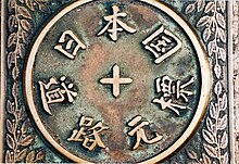
The Kōshū Kaidō (甲州街道) was one of the five routes of the Edo period. It was built to connect Edo (modern-day Tokyo) with Kai Province in modern-day Yamanashi Prefecture, Japan. The route continues from there to connect with the Nakasendō's Shimosuwa-shuku in Nagano Prefecture.[1] Many feudal lords from Shinano Province made use of the road during sankin-kōtai, including those from the Takatō, Suwa and Iida domains.
The Kōshū Kaidō's route is followed closely by the modern Route 20.
Stations of the Kōshū Kaidō[edit]
There are 44 post stations along the Kōshū Kaidō.[2][3] They are listed below with they corresponding modern-day municipality listed in parentheses.
Tokyo[edit]


- Starting Location: Nihonbashi (Chūō)
- 1. Naitō Shinjuku (内藤新宿) (Shinjuku)
- 2. Shimotakaido-shuku (下高井戸宿) (Suginami)
- 3. Kamitakaido-shuku (上高井戸宿) (Suginami)
- 4–8: Fuda-Goshuku(布田五宿): These small posts are collectively referred to as Fuda-Goshuku. 'Goshuku' means five post-stations in Japanese.
- 4. Kokuryō-shuku (国領宿) (Chōfu)
- 5. Shimofuda-shuku (下布田宿) (Chōfu)
- 6. Kamifuda-shuku (上布田宿) (Chōfu)
- 7. Shimoishihara-shuku (下石原宿) (Chōfu)
- 8. Kamiishihara-shuku (上石原宿) (Chōfu)
- 9. Fuchū-shuku (府中宿) (Fuchū)
- 10. Hino-shuku (日野宿) (Hino)
- 11. Hachiōji-shuku (八王子宿) (Hachiōji)
- 12. Komagino-shuku (駒木野宿) (Hachiōji)
- 13. Kobotoke-shuku (小仏宿) (Hachiōji)
Kanagawa Prefecture[edit]
- 14. Ohara-shuku (小原宿) (Sagamihara)
- 15. Yose-shuku (与瀬宿) (Sagamihara)
- 16. Yoshino-shuku (吉野宿) (Sagamihara)
- 17. Sekino-shuku (関野宿) (Sagamihara)
Yamanashi Prefecture[edit]

- 18. Uenohara-shuku (上野原宿) (Uenohara)
- 19. Tsurukawa-shuku (鶴川宿) (Uenohara)
- 20. Notajiri-shuku (野田尻宿) (Uenohara)
- 21. Inume-shuku (犬目宿) (Uenohara)
- 22. Shimotorisawa-shuku (下鳥沢宿) (Ōtsuki)
- 23. Kamitorisawa-shuku (上鳥沢宿) (Ōtsuki)
- 24. Saruhashi-shuku (猿橋宿) (Ōtsuki)
- 25. Komahashi-shuku (駒橋宿) (Ōtsuki)
- 26. Ōtsuki-shuku (大月宿) (Ōtsuki)
- 27. Shimohanasaki-shuku (下花咲宿) (Ōtsuki)
- 28. Kamihanasaki-shuku (上花咲宿) (Ōtsuki)
- 29. Shimohatsukari-shuku (下初狩宿) (Ōtsuki)
- 30. Nakahatsukari-shuku (中初狩宿) (Ōtsuki)
- 31. Shirano-shuku (白野宿) (Ōtsuki)
- 32. Kuronoda-shuku (黒野田宿) (Ōtsuki)
- 33. Komakai-shuku (駒飼宿) (Kōshū)
- 34. Tsuruse-shuku (鶴瀬宿) (Kōshū)
- 35. Katsunuma-shuku (勝沼宿) (Kōshū)
- 36. Kuribara-shuku (栗原宿) (Yamanashi)
- 37. Isawa-shuku (石和宿) (Fuefuki)
- 38. Kōfu-shuku (甲府宿) (Kōfu)
- 39. Nirasaki-shuku (韮崎宿) (Nirasaki)
- 40. Daigahara-shuku (台ヶ原宿) (Hokuto)
- 41. Kyōraiishi-shuku (教来石宿) (Hokuto)
Nagano Prefecture[edit]

- 42. Tsutaki-shuku (蔦木宿) (Fujimi, Suwa District)
- 43. Kanazawa-shuku (金沢宿) (Chino)
- 44. Kamisuwa-shuku (上諏訪宿) (Suwa)
- Ending Location: Shimosuwa-shuku (Shimosuwa, Suwa District) (also part of the Nakasendō)
See also[edit]
References[edit]
- ^ Information on Everyday Living for Foreign Residents of Shinjuku City Archived 2007-12-09 at the Wayback Machine. Shinjuku City Office. Accessed November 28, 2007.
- ^ Kōshū Kaidō Map Archived 2009-04-02 at the Wayback Machine. Yumekaidō. Accessed September 4, 2007.
- ^ Kōshū Kaidō 44 Information Archived 2007-08-22 at the Wayback Machine. NEC Corporation. Accessed August 4, 2007.