Karancsberény

This article needs additional citations for verification. (March 2015) |
Karancsberény | |
|---|---|
Village (község) | |
 Church of Karancsberény | |
| Coordinates: 48°11′16″N 19°44′39″E / 48.18778°N 19.74417°E | |
| Country | Hungary |
| Region | Northern Hungary |
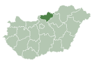
| County | Nógrád |
| Subregion | Salgótarján |
| Government | |
| • Mayor | Erzsébet Csabainé Freistág |
| Area | |
| • Total | 23.14 km2 (8.93 sq mi) |
| Elevation | 236 m (774 ft) |
| Population (1 January 2016)[2] | |
| • Total | 846 |
| • Density | 37/km2 (95/sq mi) |
| Time zone | UTC+1 (CET) |
| • Summer (DST) | UTC+2 (CEST) |
| Postal code | 3137 |
| Area code | +36 32 |
| Website | https://karancsbereny.hu/ |
Karancsberény is a village in Nógrád County, Northern Hungary region, Hungary.
References[edit]
- ^ Karancsberény at the Hungarian Central Statistical Office (Hungarian).
- ^ "Gazetteer of Hungary, 1st January 2016" (in English and Hungarian). Hungarian Central Statistical Office. 22 September 2016. Retrieved 14 August 2017.


