Lepsény

Lepsény | |
|---|---|
Large village | |
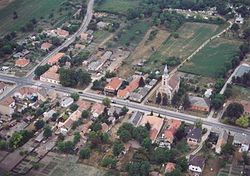
 Aerial photograph of Lepsény | |
| Coordinates: 46°59′35″N 18°14′44″E / 46.99310°N 18.2456°E | |
| Country | |
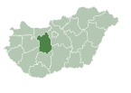
| County | Fejér |
| District | Enying |
| Government | |
| • Mayor | Salamon Béla (Ind.) |
| Area | |
| • Total | 39.08 km2 (15.09 sq mi) |
| Population (2022)[3] | |
| • Total | 3,082 |
| • Density | 79/km2 (200/sq mi) |
| Time zone | UTC+1 (CET) |
| • Summer (DST) | UTC+2 (CEST) |
| Postal code | 8132 |
| Area code | (+36) 22 |
| Motorways | M7 |
| Distance from Budapest | 87.1 km (54.1 mi) Northeast |
Lepsény is a village in Fejér county, Hungary.
References
[edit]- ^ "Település adatlap". Nemzeti Választási Iroda (in Hungarian). Retrieved 26 July 2024.
- ^ "Detailed Gazetteer of Hungary". www.ksh.hu. Retrieved 26 July 2024.
- ^ "Census 2022". Census 2022. Retrieved 26 July 2024.
External links
[edit]![]() Media related to Lepsény at Wikimedia Commons
Media related to Lepsény at Wikimedia Commons
- Official website in Hungarian
- Street map (in Hungarian)


