List of places of worship in Brussels

This article needs additional citations for verification. (March 2024) |
In Brussels, there are numerous church buildings, most of which are attached to the Roman Catholic Church. The Brussels-Capital Region is home to 107 Catholic parishes. Other religious buildings in the region are also mentioned.
By municipality[edit]
Anderlecht[edit]
Audergem/Oudergem[edit]
| name | district | coordinates | denomination | photo |
|---|---|---|---|---|
| Our Lady Of Caucasian Dell Church | Auderghem/Oudergem | 50°48′23.38″N 4°26′15.27″E / 50.8064944°N 4.4375750°E | Roman Catholic | |
| St. Anne's Church, Auderghem | Auderghem/Oudergem | 50°48′57.25″N 4°26′1.41″E / 50.8159028°N 4.4337250°E | Roman Catholic |  |
| St. Julien Church | Auderghem/Oudergem | 50°49′16.3″N 4°24′34.77″E / 50.821194°N 4.4096583°E | Roman Catholic |
Berchem-Sainte-Agathe/Sint-Agatha-Berchem[edit]
| name | district | coordinates | denomination | photo |
|---|---|---|---|---|
| Old St. Agatha Church, Sint-Agatha-Berchem | Berchem-Sainte-Agathe/Sint-Agatha-Berchem | 50°51′48.92″N 4°17′42.97″E / 50.8635889°N 4.2952694°E | Roman Catholic |  |
City of Brussels[edit]
Etterbeek[edit]
| name | district | coordinates | denomination | photo |
|---|---|---|---|---|
| Church of Our Lady of the Sacred Heart, Etterbeek | Etterbeek | 50°49′53.52″N 4°24′1.08″E / 50.8315333°N 4.4003000°E | Roman Catholic | |
| Church of St. John Berchmans[9] | Etterbeek | 50°50′5″N 4°24′26″E / 50.83472°N 4.40722°E | Roman Catholic |  |
| Our Lady Immaculate Church, Etterbeek | Etterbeek | 50°50′3.3″N 4°22′51.77″E / 50.834250°N 4.3810472°E | Roman Catholic | |
| St. Anthony of Padua Church, Brussels | Etterbeek | 50°50′36.41″N 4°20′34.31″E / 50.8434472°N 4.3428639°E | Roman Catholic |  |
| St. Gertrude Church, Etterbeek | Etterbeek | 50°50′11.45″N 4°23′24.45″E / 50.8365139°N 4.3901250°E | Roman Catholic |
Evere[edit]
| name | district | coordinates | denomination | photo |
|---|---|---|---|---|
| Church of Our Lady Immaculate Received, Evere | Evere | 50°52′15.43″N 4°24′2.33″E / 50.8709528°N 4.4006472°E | Roman Catholic |  |
| Saint Joseph Church, Evere | Evere | 50°51′31.58″N 4°24′53.43″E / 50.8587722°N 4.4148417°E | Roman Catholic |  |
| St. Vincent Church | Evere | 50°52′52.78″N 4°24′11.28″E / 50.8813278°N 4.4031333°E | Roman Catholic |  |
Forest/Vorst[edit]
| name | district | coordinates | denomination | photo |
|---|---|---|---|---|
| Holy Mary Mother of God Church | Forest/Vorst | 50°49′12.66″N 4°19′44.65″E / 50.8201833°N 4.3290694°E | Roman Catholic | |
| Holy Father Van Ars Church | Forest/Vorst | 50°48′21.37″N 4°19′14.41″E / 50.8059361°N 4.3206694°E | Roman Catholic | |
| Saint Pius X Church | Forest/Vorst | 50°48′29.82″N 4°19′57.77″E / 50.8082833°N 4.3327139°E | Roman Catholic | |
| St. Anthony of Padua Church | Forest/Vorst | 50°49′40.29″N 4°19′54.13″E / 50.8278583°N 4.3317028°E | Roman Catholic | |
| Church of St. Augustine[10] | Altitude Cent/Hoogte Honderd, Forest/Vorst | 50°48′59.96″N 4°20′12.33″E / 50.8166556°N 4.3367583°E | Roman Catholic |  |
| Barnabites Church | Forest/Vorst | 50°49′7.18″N 4°21′2.76″E / 50.8186611°N 4.3507667°E | Roman Catholic |  |
| Saint-Denis Church, Vorst | Forest/Vorst | 50°48′40.11″N 4°19′3.84″E / 50.8111417°N 4.3177333°E | Roman Catholic |  |
Ganshoren[edit]
| name | district | coordinates | denomination | photo |
|---|---|---|---|---|
| St. Cecilia's Church | Ganshoren | 50°52′28.43″N 4°18′12.45″E / 50.8745639°N 4.3034583°E | Roman Catholic | |
| Saint Martin's Church | Ganshoren | 50°52′19.83″N 4°18′52.81″E / 50.8721750°N 4.3146694°E | Roman Catholic |
Haren[edit]
| name | district | coordinates | denomination | photo |
|---|---|---|---|---|
| Saint Elisabeth Church, Haren | Haren | 50°53′34.1″N 4°25′2.87″E / 50.892806°N 4.4174639°E | Roman Catholic |  |
Ixelles/Elsene[edit]
Jette[edit]
| name | district | coordinates | denomination | photo |
|---|---|---|---|---|
| St. Clara Church, Jette | Jette | 50°53′32.19″N 4°19′21.38″E / 50.8922750°N 4.3226056°E | Roman Catholic | |
| Saint Joseph Church, Jette | Dielegem, Jette | 50°53′11.58″N 4°19′9.35″E / 50.8865500°N 4.3192639°E | Roman Catholic | |
| Our Lady of Lourdes Church, Jette | Jette | 50°52′23.8″N 4°20′7.26″E / 50.873278°N 4.3353500°E | Roman Catholic | |
| St. Peters Church, Jette | Jette | 50°52′49.37″N 4°19′49.92″E / 50.8803806°N 4.3305333°E | Roman Catholic |  |
Koekelberg[edit]
| name | district | coordinates | denomination | photo |
|---|---|---|---|---|
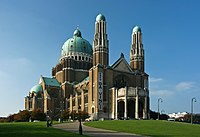
| Basilica of the Sacred Heart[11] | Koekelberg | 50°52′1″N 4°19′1″E / 50.86694°N 4.31694°E | Roman Catholic |  |
| St. Anna Church, Koekelberg | Koekelberg | 50°51′37.36″N 4°19′55.25″E / 50.8603778°N 4.3320139°E | Roman Catholic |
Laeken/Laken[edit]
| name | district | coordinates | denomination | photo |
|---|---|---|---|---|
| Christ the King Church, Laken | Mutsaard, Laeken/Laken | 50°53′56.54″N 4°21′48.61″E / 50.8990389°N 4.3635028°E | Roman Catholic | |
| Saint Lambert Church, Laken | Heizel, Laeken/Laken | 50°53′26.6″N 4°20′38.13″E / 50.890722°N 4.3439250°E | Roman Catholic | |
| Holy Angels Church | Laeken/Laken | 50°52′55.04″N 4°20′26.59″E / 50.8819556°N 4.3407194°E | Roman Catholic | |
| Church of Our Lady of Laeken[12] | Laeken/Laken | 50°52′43″N 4°21′21″E / 50.87861°N 4.35583°E | Roman Catholic |  |
| Divine Child Jesus Church, Laken | Verregat, Laeken/Laken | 50°53′50.62″N 4°19′42″E / 50.8973944°N 4.32833°E | Roman Catholic |
Molenbeek-Saint-Jean/Sint-Jans-Molenbeek[edit]
| name | district | coordinates | denomination | photo |
|---|---|---|---|---|
| St. Barbara Church, Sint-Jans-Molenbeek | Molenbeek-Saint-Jean/Sint-Jans-Molenbeek | 50°50′59.08″N 4°19′41.5″E / 50.8497444°N 4.328194°E | Roman Catholic | |
| Church of St. John the Baptist[13] | Molenbeek-Saint-Jean/Sint-Jans-Molenbeek | 50°51′25.84″N 4°20′25.66″E / 50.8571778°N 4.3404611°E | Roman Catholic |  |
| St Remigius Church, Sint-Jans-Molenbeek | Molenbeek-Saint-Jean/Sint-Jans-Molenbeek | 50°51′46.07″N 4°20′18.45″E / 50.8627972°N 4.3384583°E | Roman Catholic | |
| Our Lady Mediatrix Church | Molenbeek-Saint-Jean/Sint-Jans-Molenbeek | 50°51′18.6″N 4°20′39.27″E / 50.855167°N 4.3442417°E | Roman Catholic | |
| St. Charles Borromeo and Good Herder Church | Karreveld-Mettewie, Molenbeek-Saint-Jean/Sint-Jans-Molenbeek | 50°51′31.19″N 4°19′9.18″E / 50.8586639°N 4.3192167°E | Roman Catholic | |
| Resurrection Church, Sint-Jans-Molenbeek | Molenbeek-Saint-Jean/Sint-Jans-Molenbeek | 50°50′52.11″N 4°17′21.62″E / 50.8478083°N 4.2893389°E | Roman Catholic |
Neder-Over-Heembeek[edit]
| name | district | coordinates | denomination | photo |
|---|---|---|---|---|
| New St. Peter and Paul Church | Neder-Over-Heembeek | 50°53′45.97″N 4°23′16.85″E / 50.8961028°N 4.3880139°E | Roman Catholic |
Saint Gilles/Saint-Gillis[edit]
| name | district | coordinates | denomination | photo |
|---|---|---|---|---|
| Jesus Worker Church | Saint Gilles/Sint-Gillis | 50°49′35.15″N 4°20′16.4″E / 50.8264306°N 4.337889°E | Roman Catholic | |
| St. Alena Church | Saint Gilles/Sint-Gillis | 50°49′28.39″N 4°20′27.08″E / 50.8245528°N 4.3408556°E | Roman Catholic |  |
| St. Bernard Church, Saint-Gillis | Saint Gilles/Sint-Gillis | 50°49′50.18″N 4°21′14.27″E / 50.8306056°N 4.3539639°E | Roman Catholic | |
| St Giles' Church, Saint-Gillis | Saint Gilles/Sint-Gillis | 50°49′50.19″N 4°20′37.47″E / 50.8306083°N 4.3437417°E | Roman Catholic |
Saint-Josse-ten-Node/Sint-Joost-ten-Node[edit]
| name | district | coordinates | denomination | photo |
|---|---|---|---|---|
| Saint-Josse Church | Saint-Josse-ten-Node/Sint-Joost-ten-Node | 50°51′0.58″N 4°22′28.26″E / 50.8501611°N 4.3745167°E | Roman Catholic |  |
Schaerbeek/Schaarbeek[edit]
Uccle/Ukkel[edit]
Watermael-Boitsfort/Watermaal-Bosvoorde[edit]
| name | district | coordinates | denomination | photo |
|---|---|---|---|---|
| Our Lady of Perpetual Help Church | Watermael-Boitsfort/Watermaal-Bosvoorde | 50°48′30.97″N 4°25′3.97″E / 50.8086028°N 4.4177694°E | Roman Catholic | |
| Church of St. Clement | Watermael-Boitsfort/Watermaal-Bosvoorde | 50°48′35.93″N 4°24′20.96″E / 50.8099806°N 4.4058222°E | Roman Catholic |  |
| Holy Cross Church, Watermael-Boitsfort | Watermael-Boitsfort/Watermaal-Bosvoorde | 50°48′1.03″N 4°23′57.62″E / 50.8002861°N 4.3993389°E | Roman Catholic | |
| Queen of Heaven Church | Watermael-Boitsfort/Watermaal-Bosvoorde | 50°47′24.02″N 4°25′18.71″E / 50.7900056°N 4.4218639°E | Roman Catholic | |
| St. Hubert Church, Watermael | Watermael-Boitsfort/Watermaal-Bosvoorde | 50°47′46.8″N 4°24′50.44″E / 50.796333°N 4.4140111°E | Roman Catholic |  |
Woluwe-Saint-Lambert/Sint-Lambrechts-Woluwe[edit]
| name | district | coordinates | denomination | photo |
|---|---|---|---|---|
| Our Lady Assumption Church, Woluwe-Saint-Lambert | Kapelleveld, Woluwe-Saint-Lambert/Sint-Lambrechts-Woluwe | 50°50′52.91″N 4°27′4.08″E / 50.8480306°N 4.4511333°E | Roman Catholic | |
| Chapel of Lenneke | Woluwe-Saint-Lambert/Sint-Lambrechts-Woluwe | 50°50′46″N 4°26′31.99″E / 50.84611°N 4.4422194°E | Roman Catholic |  |
| Holy-Family Church, Woluwe-Saint-Lambert | Woluwe-Saint-Lambert/Sint-Lambrechts-Woluwe | 50°51′0.51″N 4°25′38.58″E / 50.8501417°N 4.4273833°E | Roman Catholic | |
| St. Henricus Church | Woluwe-Saint-Lambert/Sint-Lambrechts-Woluwe | 50°50′31.37″N 4°24′35.7″E / 50.8420472°N 4.409917°E | Roman Catholic | |
| Saint Lambert Church | Woluwe-Saint-Lambert/Sint-Lambrechts-Woluwe | 50°50′29.04″N 4°25′59.13″E / 50.8414000°N 4.4330917°E | Roman Catholic |  |
Woluwe-Saint-Pierre/Sint-Pieters-Woluwe[edit]
| name | district | coordinates | denomination | photo |
|---|---|---|---|---|
| St. Paul's Church, Woluwe-Saint-Pierre | Woluwe-Saint-Pierre/Sint-Pieters-Woluwe | 50°49′47.76″N 4°26′51.08″E / 50.8299333°N 4.4475222°E | Roman Catholic | |
| St. Peters Church, Woluwe-Saint-Pierre | Woluwe-Saint-Pierre/Sint-Pieters-Woluwe | 50°50′17.78″N 4°25′54.26″E / 50.8382722°N 4.4317389°E | Roman Catholic | |
| Church of Our Lady, Stokkel | Woluwe-Saint-Pierre/Sint-Pieters-Woluwe | 50°50′28.61″N 4°27′46″E / 50.8412806°N 4.46278°E | Roman Catholic | |
| St. Aleydis Church, Woluwe-Saint-Pierre | Woluwe-Saint-Pierre/Sint-Pieters-Woluwe | 50°49′41.38″N 4°27′44.32″E / 50.8281611°N 4.4623111°E | Roman Catholic | |
| Our Lady of Grace Church | Woluwe-Saint-Pierre/Sint-Pieters-Woluwe | 50°49′37.38″N 4°25′7.43″E / 50.8270500°N 4.4187306°E | Roman Catholic |
References[edit]
- ^ "Collégiale Saints-Pierre-et-Guidon – Inventaire du patrimoine architectural". monument.heritage.brussels (in French). Retrieved 2024-03-21.
- ^ "Eglise Notre-Dame des Victoires au Sablon – Inventaire du patrimoine architectural". monument.heritage.brussels (in French). Retrieved 2024-03-21.
- ^ "Eglise paroissale Notre-Dame de la Chapelle – Inventaire du patrimoine architectural". monument.heritage.brussels (in French). Retrieved 2024-03-21.
- ^ "église paroissiale Sainte-Catherine – Inventaire du patrimoine architectural". monument.heritage.brussels (in French). Retrieved 2024-03-21.
- ^ "Eglise Saint-Jean-Baptiste au Béguinage – Inventaire du patrimoine architectural". monument.heritage.brussels (in French). Retrieved 2024-03-21.
- ^ "Eglise Saint-Jacques-sur-Coudenberg – Inventaire du patrimoine architectural". monument.heritage.brussels (in French). Retrieved 2024-03-21.
- ^ "Cathédrale Saints-Michel-et-Gudule – Inventaire du patrimoine architectural". monument.heritage.brussels (in French). Retrieved 2024-03-21.
- ^ "Grande Mosquée et Centre islamique et culturel de Belgique – ancien Pavillon du Panorama du Caire – Inventaire du patrimoine architectural". monument.heritage.brussels (in French). Retrieved 2024-03-21.
- ^ "Collège Saint-Michel – Inventaire du patrimoine architectural". monument.heritage.brussels (in French). Retrieved 2024-03-21.
- ^ "Eglise Saint-Augustin – Inventaire du patrimoine architectural". monument.heritage.brussels (in French). Retrieved 2024-03-21.
- ^ "Basilique Nationale du Sacré-Cœur – Inventaire du patrimoine architectural". monument.heritage.brussels (in French). Retrieved 2024-03-21.
- ^ "Église Notre-Dame de Laeken – Inventaire du patrimoine architectural". monument.heritage.brussels (in French). Retrieved 2024-03-21.
- ^ "église Saint-Jean-Baptiste – Inventaire du patrimoine architectural". monument.heritage.brussels (in French). Retrieved 2024-03-21.
- ^ "Église Sainte-Marie – Inventaire du patrimoine architectural". monument.heritage.brussels (in French). Retrieved 2024-03-21.


