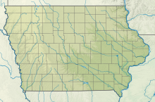
Newton Municipal Airport (Iowa)

Newton Municipal Airport | |||||||||||
|---|---|---|---|---|---|---|---|---|---|---|---|
| Summary | |||||||||||
| Airport type | Public | ||||||||||
| Owner | City of Newton | ||||||||||
| Serves | Newton, Iowa | ||||||||||
| Elevation AMSL | 953 ft / 290 m | ||||||||||
| Coordinates | 41°40′28″N 093°01′18″W / 41.67444°N 93.02167°W | ||||||||||
| Map | |||||||||||
 | |||||||||||
| Runways | |||||||||||
| |||||||||||
| Statistics (2007) | |||||||||||
| |||||||||||
Newton Municipal Airport (IATA: TNU, ICAO: KTNU, FAA LID: TNU) is a city-owned public-use airport located two miles (3 km) southeast of the central business district of Newton, a city in Jasper County, Iowa, United States.[1] The airport is adjacent to Iowa Speedway.
Facilities and aircraft
[edit]Newton Municipal Airport covers an area of 304 acres (123 ha) which contains one runway designated 14/32 with a 5,599 x 100 ft (1,707 x 30 m) asphalt surface. For the 12-month period ending September 12, 2007, the airport had 9,000 aircraft operations, an average of 24 per day: 93% general aviation and 7% air taxi. At that time there were 21 aircraft based at this airport: 90% single-engine and 10% multi-engine.[1]
Fly Iowa 2011
[edit]On September 17, 2011, Newton was scheduled to be the host of the annual Fly Iowa Airshow. Fly Iowa travels to different towns in Iowa and hosts airshows for the public.
See also
[edit]References
[edit]- ^ a b c FAA Airport Form 5010 for TNU PDF, effective 2008-04-10
External links
[edit]- FAA Terminal Procedures for TNU, effective October 3, 2024
- Resources for this airport:
- FAA airport information for TNU
- AirNav airport information for KTNU
- ASN accident history for TNU
- FlightAware airport information and live flight tracker
- NOAA/NWS weather observations: current, past three days
- SkyVector aeronautical chart, Terminal Procedures

