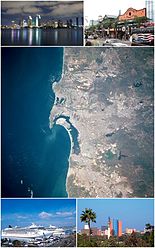
Playas de Rosarito Municipality

Playas de Rosarito Municipality | |
|---|---|
| Municipio de Playas de Rosarito | |
| Motto(s): Un horizonte de posiblidades (A Horizon of Possibilities) | |
 Location of Playas de Rosarito Municipality in Baja California. | |
| Coordinates: 32°20′32″N 117°03′22″W / 32.34222°N 117.05611°W | |
| Country | Mexico |
| State | |
| Municipal seat | Rosarito |
| Largest city | Rosarito |
| Municipality established | June 29, 1995 |
| Government | |
| • Mayor | Rocio Adame Muñoz[1] |
| Area | |
| • Total | 513.32 km2 (198.19 sq mi) |
| Population (2020) | |
| • Total | 126,890 |
| • Density | 250/km2 (640/sq mi) |
| Data source:[2] | |
| Time zone | UTC−8 (PST) |
| • Summer (DST) | UTC−7 (PDT) |
| INEGI code | 005 |
| Website | (in Spanish) Ayuntamiento de Playas de Rosarito |
| Source: Enciclopedia de los Municipios de México | |
Playas de Rosarito Municipality (Spanish: Municipio de Playas de Rosarito) is located in the northwestern part of the Mexican state of Baja California comprising part of the Tijuana metropolitan area. It lies just south of the city of Tijuana. Its municipal seat is the city of Rosarito. According to the 2020 census, the municipality had a population of 126,890 inhabitants.[2] Its area is 513.32 km2 (198.19 sq mi).
History
[edit]At the end of the 18th century, Spanish Dominican missionaries and friars gave the name of El Rosario to an indigenous settlement in the area. The town was part of the mission of San Miguel Arcangel de la Frontera, located a few miles to the south. The mission was founded on March 28, 1787 by the Dominican friar Luis Sales on the banks of the San Juan Bautista stream.
Over time, the name of El Rosario became Rosarito. After the Mexican–American War and the Treaty of Guadalupe Hidalgo, the new Mexican border lay no more than 30 km (18.5 miles) from Rosarito. This brought the development of the Rancho de la Tia Juana, which eventually grew into the city of Tijuana, the region's development hub.
Playas de Rosarito means "beaches of Rosarito".
Boroughs
[edit]Demographics
[edit]| Year | Pop. | ±% |
|---|---|---|
| 2010 | 90,668 | — |
| 2015 | 96,734 | +6.7% |
| 2020 | 126,890 | +31.2% |
| [3][4][5][6] | ||
As of 2020, the municipality had a total population of 126,890.[2]
As of 2010, the city of Playas de Rosarito had a population of 65,278.[7] Other than the city of Playas de Rosarito, the municipality had 358 localities, the largest of which (with 2010 populations in parentheses) were: Ampliación Ejido Plan Libertador (5,906), Primo Tapia (4,921), classified as urban, and Ciudad Morelos (2,040), Colinas del Sol (1,361), and Santa Anita (1,284), classified as rural.[7]
- El Descanso (pop. 567)
- Puerto Nuevo (pop. 135)
- Santa Anita (pop. 1,284)
References
[edit]- (in Spanish) Link to tables of population data from the 2005 Census, INEGI: Instituto Nacional de Estadística, Geografía e Informática.
- (in Spanish) Playas de Rosarito, Enciclopedia de los Municipios de México, Instituto Nacional Para el Federalismo y el Desarrollo Municipal, SEGOB. Accessed on line November 15, 2007.
- ^ "Alejandra Padilla Orozco meets with Mayor-elect Rocio Adame Muñoz". Playas de Rosarito Municipality (in Spanish). Retrieved September 28, 2024.
...on October 1; we will hand over
- ^ a b c "México en cifras". January 2016.
- ^ "Localidades y su población por municipio según tamaño de localidad" (PDF) (in Spanish). INEGI. Archived from the original (PDF) on August 31, 2018. Retrieved July 15, 2017.
- ^ "Número de habitantes". INEGI (National Institute of Statistics and Geography). Archived from the original on July 2, 2017. Retrieved July 15, 2017.
- ^ "Tabulados de la Encuesta Intercensal 2015" (xls) (in Spanish). INEGI. Archived from the original on December 31, 2017. Retrieved July 15, 2017.
- ^ "INEGI. Censo de Población y Vivienda 2020. Tabulados del Cuestionario Básico – Aguascalientes" [INEGI. 2020 Population and Housing Census. Basic Questionnaire Tabulations – Aguascalientes] (Excel) (in Spanish). INEGI. 2020. pp. 1–4. Archived from the original on January 28, 2021. Retrieved January 27, 2021.
- ^ a b c "Playas de Rosarito". Catálogo de Localidades. Secretaría de Desarrollo Social (SEDESOL). Retrieved April 23, 2014.
External links
[edit]- (in Spanish) Ayuntamiento de Playas de Rosarito Official government website.
- (in English) Official government tourism office website


