The Portal
 Van Wikipedia, de gratis encyclopedie
| The Portal | |||
|---|---|---|---|
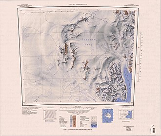
 Topographische Karte mit The Portal (oberer Kartenrand) | |||
| Himmelsrichtung | Polarplateau (Westen) | Skelton-Firnfeld (Osten) | |
| Viktorialand, Ostantarktika | |||
| Gebirge | Transantarktisches Gebirge | ||
| Karte | |||
| | |||
| Koordinaten | 78° 2′ 0″ S, 159° 45′ 0″ O | ||
The Portal (englisch für Der Haupteingang) ist ein Durchlass zwischen dem Portal Mountain und den Lashly Mountains im ostantarktischen Viktorialand. Er stellt die Verbindung des Skelton-Gletschers vom Polarplateau zum Skelton-Firnfeld dar.
Den deskriptiven Namen verliehen Teilnehmer der neuseeländischen Mannschaft der Commonwealth Trans-Antarctic Expedition (1956–1958).
Weblinks[Bearbeiten | Quelltext bearbeiten]
- The Portal. In: Geographic Names Information System. United States Geological Survey, United States Department of the Interior, archiviert vom (englisch).
- The Portal auf geographic.org (englisch)
