Tumen, Jilin
 From Wikipedia the free encyclopedia
Tumen 图们市 · 도문시 | |
|---|---|
 Tumen and the Tumen River | |
| Coordinates: 42°58′N 129°51′E / 42.967°N 129.850°E | |
| Country | People's Republic of China |
| Province | Jilin |
| Prefecture | Yanbian |
| Seat | Xiangshang Subdistrict |
| Area | |
| • County-level city | 1,142.7 km2 (441.2 sq mi) |
| • Urban | 15.00 km2 (5.79 sq mi) |
| Elevation | 97 m (318 ft) |
| Population (2017)[1] | |
| • County-level city | 121,000 |
| • Density | 110/km2 (270/sq mi) |
| • Urban | 84,700 |
| Time zone | UTC+8 (China Standard) |
| Area code | 133100 |
| Website | [2] |
| Tumen, Jilin | |||||||
|---|---|---|---|---|---|---|---|
| Simplified Chinese | 图们市 | ||||||
| Traditional Chinese | 圖們市 | ||||||
| |||||||
| Chinese Korean name | |||||||
| Chosŏn'gŭl | 도문시 | ||||||
| |||||||
| South Korean name | |||||||
| Hangul | 투먼 시 | ||||||
| |||||||
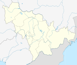
Tumen (simplified Chinese: 图们; traditional Chinese: 圖們; pinyin: Túmén; Chosŏn'gŭl: 도문; Hangul: 투먼) is a county-level city in Yanbian Korean Autonomous Prefecture, eastern Jilin province, Northeast China. Of its 136,000 inhabitants, approximately 78,000 (or 57%) are of Korean descent.[citation needed] The two official languages are Chinese and Korean. Tumen is separated from Namyang of North Hamgyong province of North Korea by the Tumen River. Due to this proximity, many North Koreans escaping North Korea pass through Tumen. Tumen is also the location of a large detention center for captured North Koreans awaiting deportation. Tumen has two major food markets, the South Market and the North Market, where most of the residents purchase their food. Packaged foods and meats are usually sold inside the building, and vegetables are sold outside. There are six elementary schools, with three Korean schools, and three Chinese schools.
A riverfront promenade in the city has restaurants where patrons can gaze across the river into North Korea.[2]
Administrative divisions
[edit]
Tumen has three subdistricts and four towns.[3]
Subdistricts:
- Xiangshang Subdistrict (向上街道 / 향상가도)
- Xinhua Subdistrict (新华街道 / 신화가도)
- Yuegong Subdistrict (月宫街道 / 월궁가도)
Towns:
Climate
[edit]| Climate data for Tumen (1991–2020 normals, extremes 1981–2010) | |||||||||||||
|---|---|---|---|---|---|---|---|---|---|---|---|---|---|
| Month | Jan | Feb | Mar | Apr | May | Jun | Jul | Aug | Sep | Oct | Nov | Dec | Year |
| Record high °C (°F) | 8.7 (47.7) | 11.3 (52.3) | 20.8 (69.4) | 33.3 (91.9) | 33.7 (92.7) | 37.4 (99.3) | 37.7 (99.9) | 36.5 (97.7) | 32.2 (90.0) | 27.4 (81.3) | 19.3 (66.7) | 10.1 (50.2) | 37.7 (99.9) |
| Mean daily maximum °C (°F) | −5.9 (21.4) | −1.2 (29.8) | 5.8 (42.4) | 14.7 (58.5) | 20.4 (68.7) | 23.6 (74.5) | 26.2 (79.2) | 26.6 (79.9) | 22.6 (72.7) | 15.1 (59.2) | 4.1 (39.4) | −4.2 (24.4) | 12.3 (54.2) |
| Daily mean °C (°F) | −11.7 (10.9) | −7.4 (18.7) | −0.2 (31.6) | 7.9 (46.2) | 13.5 (56.3) | 17.7 (63.9) | 21.2 (70.2) | 21.5 (70.7) | 15.9 (60.6) | 8.3 (46.9) | −1.5 (29.3) | −9.5 (14.9) | 6.3 (43.4) |
| Mean daily minimum °C (°F) | −16.6 (2.1) | −13.0 (8.6) | −5.8 (21.6) | 1.5 (34.7) | 7.7 (45.9) | 13.2 (55.8) | 17.5 (63.5) | 17.7 (63.9) | 10.8 (51.4) | 2.5 (36.5) | −6.2 (20.8) | −14 (7) | 1.3 (34.3) |
| Record low °C (°F) | −29.2 (−20.6) | −26.7 (−16.1) | −20.3 (−4.5) | −9.1 (15.6) | −1.3 (29.7) | 5.7 (42.3) | 10.0 (50.0) | 7.1 (44.8) | −1.1 (30.0) | −11.5 (11.3) | −20.2 (−4.4) | −26.2 (−15.2) | −29.2 (−20.6) |
| Average precipitation mm (inches) | 6.5 (0.26) | 6.6 (0.26) | 12.9 (0.51) | 31.0 (1.22) | 68.1 (2.68) | 81.0 (3.19) | 128.7 (5.07) | 111.6 (4.39) | 65.0 (2.56) | 32.6 (1.28) | 20.1 (0.79) | 7.6 (0.30) | 571.7 (22.51) |
| Average precipitation days (≥ 0.1 mm) | 2.8 | 3.3 | 5.6 | 8.5 | 13.9 | 14.2 | 14.4 | 14.1 | 9.4 | 6.5 | 6.1 | 4.4 | 103.2 |
| Average snowy days | 4.2 | 4.9 | 6.4 | 2.6 | 0.1 | 0 | 0 | 0 | 0 | 1.1 | 5.7 | 5.8 | 30.8 |
| Average relative humidity (%) | 56 | 53 | 52 | 53 | 66 | 78 | 83 | 82 | 76 | 63 | 59 | 58 | 65 |
| Mean monthly sunshine hours | 193.3 | 200.0 | 228.6 | 213.9 | 212.0 | 186.9 | 163.4 | 172.7 | 202.4 | 202.0 | 166.1 | 171.3 | 2,312.6 |
| Percent possible sunshine | 66 | 67 | 62 | 53 | 47 | 41 | 35 | 40 | 55 | 60 | 57 | 61 | 54 |
| Source: China Meteorological Administration[4][5] | |||||||||||||
See also
[edit]References
[edit]- ^ a b Ministry of Housing and Urban-Rural Development, ed. (2019). China Urban Construction Statistical Yearbook 2017. Beijing: China Statistics Press. p. 50. Retrieved 11 January 2020.
- ^ [1] Onishi, Norimitsu, "Tension, Desperation: The China-North Korean Border", October 22, 2006. Information here comes from a one-paragraph caption ("The View from Prosperity") in the article's extensive illustration.
- ^ "延边朝鲜族自治州-行政区划网 www.xzqh.org" (in Chinese). xzqh.org. Retrieved 2011-04-28.
- ^ 中国气象数据网 – WeatherBk Data (in Simplified Chinese). China Meteorological Administration. Retrieved 7 July 2023.
- ^ 中国气象数据网 (in Simplified Chinese). China Meteorological Administration. Retrieved 7 July 2023.
External links
[edit]- Official site (in Chinese)

