Aghmeed
 From Wikipedia the free encyclopedia
This article needs additional citations for verification. (March 2016) |
Aghmeed أغميد | |
|---|---|
 | |
 | |
| Country | |
| Governorate | Mount Lebanon Governorate |
| District | Aley District |
| Elevation | 3,900 ft (1,200 m) |
| Time zone | UTC+2 (EET) |
| • Summer (DST) | +3 |
| Website | www.aghmeed.com |
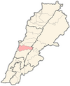
Aghmeed, also spelled Aghmide (Arabic: أغميد), is a village[citation needed] located about 37 km from Beirut, in the governorate of Mount Lebanon, in the Aley District.[1] One can reach Aghmeed through Mdairej Road, Ain Dara and Al Azzounieh. Aghmeed is at an altitude of 1,200 m, close to Mount Barouk, which is famous for its cedar forest.
Other villages surrounding Aghmeed are : Al Azzounieh, Ain Dara, Sharoun, Bmahray, Alramlieh, Al Mreijat, Nabaa Al Safa and Ain Zhalta.
References
[edit]33°47′00″N 35°32′00″E / 33.7833°N 35.5333°E
