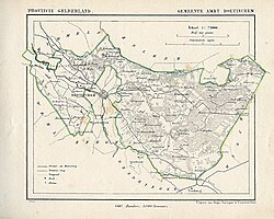
Ambt Doetinchem
 From Wikipedia the free encyclopedia
Ambt Doetinchem | |
|---|---|
 Map of Ambt Doetinchem (1867) | |
| Coordinates: 51°57′57″N 6°18′07″E / 51.96583°N 6.30194°E | |
| Country | Netherlands |
| Province | Gelderland |
| Population (1890) | |
| • Total | 3,996 |
| Demonym | (Ambt) Doetinchemmer |
| Time zone | UTC+1 (CET) |
| • Summer (DST) | UTC+2 (CEST) |
| This municipality has merged with Doetinchem on January 1st, 1920. | |
Ambt Doetinchem is a former municipality in the Dutch province of Gelderland. It consisted of the countryside surrounding the city of Doetinchem, which belonged to the separate municipality of Stad Doetinchem.
Ambt Doetinchem was a separate municipality between 1818 and 1920, when it merged with Stad Doetinchem.[1]
References
[edit]- ^ Ad van der Meer and Onno Boonstra, "Repertorium van Nederlandse gemeenten", KNAW, 2006. "Archived copy" (PDF). Archived from the original on 2017-08-21. Retrieved 2009-12-03.
{{cite web}}: CS1 maint: archived copy as title (link)
