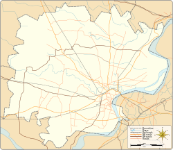
Anantpur
 From Wikipedia the free encyclopedia
Anantpur | |
|---|---|
Village | |
| Coordinates: 25°19′56″N 82°53′25″E / 25.332263°N 82.890306°E | |
| Country | |
| State | Uttar Pradesh |
| Elevation | 85 m (279 ft) |
| Population (2011) | |
| • Total | 1,140 |
| Languages | |
| • Official | Hindi |
| Time zone | UTC+5:30 (IST) |
| PIN | 221107 |
| STD | 0542 |
| Vehicle registration | UP65 XXXX |
| Village code | 209469 |
| Website | up |
Anantpur () is a village in Varanasi district in the Indian state of Uttar Pradesh. It is about 267 kilometers from the state capital Lucknow.[1][2][3]
Demography
[edit]Anantpur has a total population of 1,140 people amongst 191 families. Sex ratio of Anantpur is 894 and child sex ratio is 1,165. Uttar Pradesh state average for both ratios is 912 and 902 respectively.[2]
| Details | Male | Female | Total | Comments |
|---|---|---|---|---|
| Number of houses | - | - | 191 | (census 2011) [2] |
| Adult | 505 | 425 | 930 | |
| Children (0–6 years) | 97 | 113 | 210 | |
| Total population | 620 | 538 | 1,140 | |
| Literacy | 76.44% | 59.76% | 68.82% |
See also
[edit]References
[edit]- ^ "Village coordinates". latlong.net. Archived from the original on 7 August 2017. Retrieved 25 June 2018. [specify]
- ^ a b c "Population & General info". Census 2011. Retrieved 25 June 2018.
- ^ "Anantpur". Indian Village Directory. Retrieved 25 June 2018.


