Güssing District
 From Wikipedia the free encyclopedia
Güssing District Bezirk Güssing | |
|---|---|
 | |
| Country | Austria |
| State | Burgenland |
| Number of municipalities | 28 |
| Area | |
| • Total | 486.71 km2 (187.92 sq mi) |
| Population (2022) | |
| • Total | 25,668 |
| • Density | 53/km2 (140/sq mi) |
| Time zone | UTC+01:00 (CET) |
| • Summer (DST) | UTC+02:00 (CEST) |
| NUTS code | AT113 |
The Bezirk Güssing (Croatian: Kotar Novi Grad; Hungarian: Németújvár Járás) is an administrative district (Bezirk) in the federal state of Burgenland, Austria, bordering on Vas County of Hungary, of which it had been a part prior to 1921.
The area of the district is 486.71km², with a population of 25,668 (2022),[1] and the population density is 53 persons per km2. The administrative center and the largest settlement in the district is Güssing. Other main settlements include Stegersbach, Kukmirn and Olbendorf.
Administrative divisions
[edit]The district consists of the below municipalities and towns:
| Municipality | Location | Area (km2) | Population (2022) | Population Density (per km2) | Image |
|---|---|---|---|---|---|
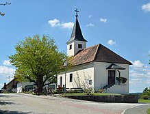
| Bildein |  | 15.91 | 341 | 21 |  |
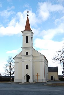
| Bocksdorf |  | 9.99 | 804 | 80 |  |
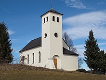
| Burgauberg-Neudauberg |  | 10.91 | 1,327 | 122 |  |
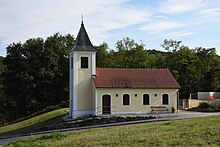
| Eberau |  | 30.74 | 921 | 30 |  |
| Gerersdorf-Sulz |  | 21.63 | 1,024 | 47 |  |
| Großmürbisch |  | 7.92 | 233 | 29 |  |
| Güssing |  | 49.31 | 3,578 | 73 |  |
| Güttenbach |  | 15.90 | 871 | 55 |  |
| Hackerberg |  | 3.87 | 363 | 94 |  |
| Heiligenbrunn |  | 33.51 | 743 | 22 |  |
| Heugraben |  | 6.47 | 224 | 35 |  |
| Inzenhof |  | 5.97 | 330 | 55 |  |
| Kleinmürbisch |  | 4.29 | 231 | 54 |  |
| Kukmirn |  | 40.50 | 2,012 | 50 |  |
| Moschendorf |  | 13.18 | 387 | 29 |  |
| Neuberg im Burgenland |  | 17.61 | 957 | 54 |  |
| Neustift bei Güssing |  | 11.44 | 447 | 39 |  |
| Olbendorf |  | 17.38 | 1,458 | 84 |  |
| Ollersdorf im Burgenland |  | 8.86 | 921 | 104 |  |
| Rauchwart |  | 17.51 | 454 | 26 |  |
| Rohr im Burgenland |  | 8.38 | 367 | 44 |  |
| Sankt Michael im Burgenland |  | 18.38 | 986 | 54 |  |
| Stegersbach |  | 17.77 | 2,701 | 152 |  |
| Stinatz |  | 9.50 | 1,205 | 127 |  |
| Strem |  | 23.78 | 886 | 37 |  |
| Tobaj |  | 58.14 | 1,351 | 23 |  |
| Tschanigraben |  | 1.71 | 65 | 38 |  |
| Wörterberg |  | 4.76 | 481 | 101 |  |
References
[edit]- ^ "Bevölkerung des Burgenlandes seit 1869 nach politischen Bezirken" (PDF). Statistik Burgenland. Retrieved 1 February 2023.
