Kleiwegkwartier
 From Wikipedia the free encyclopedia
Kleiwegkwartier | |
|---|---|
Neighborhood of Rotterdam | |
 Rotterdam's Kleiweg in 1931 | |
 Location of the Kleiwegkwartier in Rotterdam | |
| Coordinates: 51°56′44″N 4°28′57″E / 51.94556°N 4.48250°E | |
| Country | |
| Province | South Holland |
| COROP | Rotterdam |
| Borough | Hillegersberg-Schiebroek |
| Area | |
| • Total | 127 ha (314 acres) |
| Time zone | UTC+1 (CET) |
| Postcode | 3045, 3051 |
| Area code | 010 |
| Website | http://www.bokrotterdam.nl/ |
Kleiwegkwartier is a neighbourhood quarter in Rotterdam, Netherlands. It is in the southern part of Hillegersberg with origins dating from the early 1600s.
Background[edit]

T51°56′44″N 4°28′58″E / 51.94556°N 4.48278°Ehe Kleiwegkwartier is located just north of the A20 autoroute and is part of Rotterdam's Hillegersberg-Schiebroek district. The district originally belonged to the municipalities of Hillegersberg and Schiebroek until they were annexed by Rotterdam in 1941. The area now makes part of Rotterdam's Hillegersberg-Zuid district.[1][2]
The area owes its name to the Kleiweg, the main road that runs centrally through its neighbourhood. The Kleiweg originally served as the main connection between Rotterdam and Overschie where it crossed old creek bridges over the Rivers Schie and Rotte.[3] The road's early existence is documented on an area map dated 1611.[4]
Over time the road became increasingly lined by farms, houses and businesses—especially with major residential development occurring in the Kleiwegkwartier during the 1930s.[2] The area's railway station (1908) and Bergse Achterplas (lake) had been established by that time.[3]
Character[edit]

The Kleiwegkwartier a mixed-use neighbourhood which lies close to the centre of Rotterdam. It "mostly escaped wartime bombing, leaving its residential streets intact."[5] Many of its streets are now tree lined.
The houses north of the Kleiweg, also close to the Bergse Plassen, tend to be larger and more luxurious than the houses on its southern side.[6][7] Light industry, warehouses and tram depots are located in the southern part of the neighbourhood. Its most western section, near the Overschiese Kleiweg, still retains characteristics of the area's rural origins.
The Sint Franciscus Gasthuis (hospital) is located on the south-western edge of Kleiwegkwartier.[8]
The neighbourhood benefits from good communication links with Rotterdam International airport, two railways stations, a tram and bus line and the A20 Autoroute all lying in close proximity.[9]
The shops on the Kleiweg make part of one of the Hillegersberg area's three shopping centres.
Gallery[edit]
-
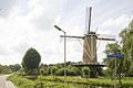 Image of the Overschiese Kleiweg (2007)
 -
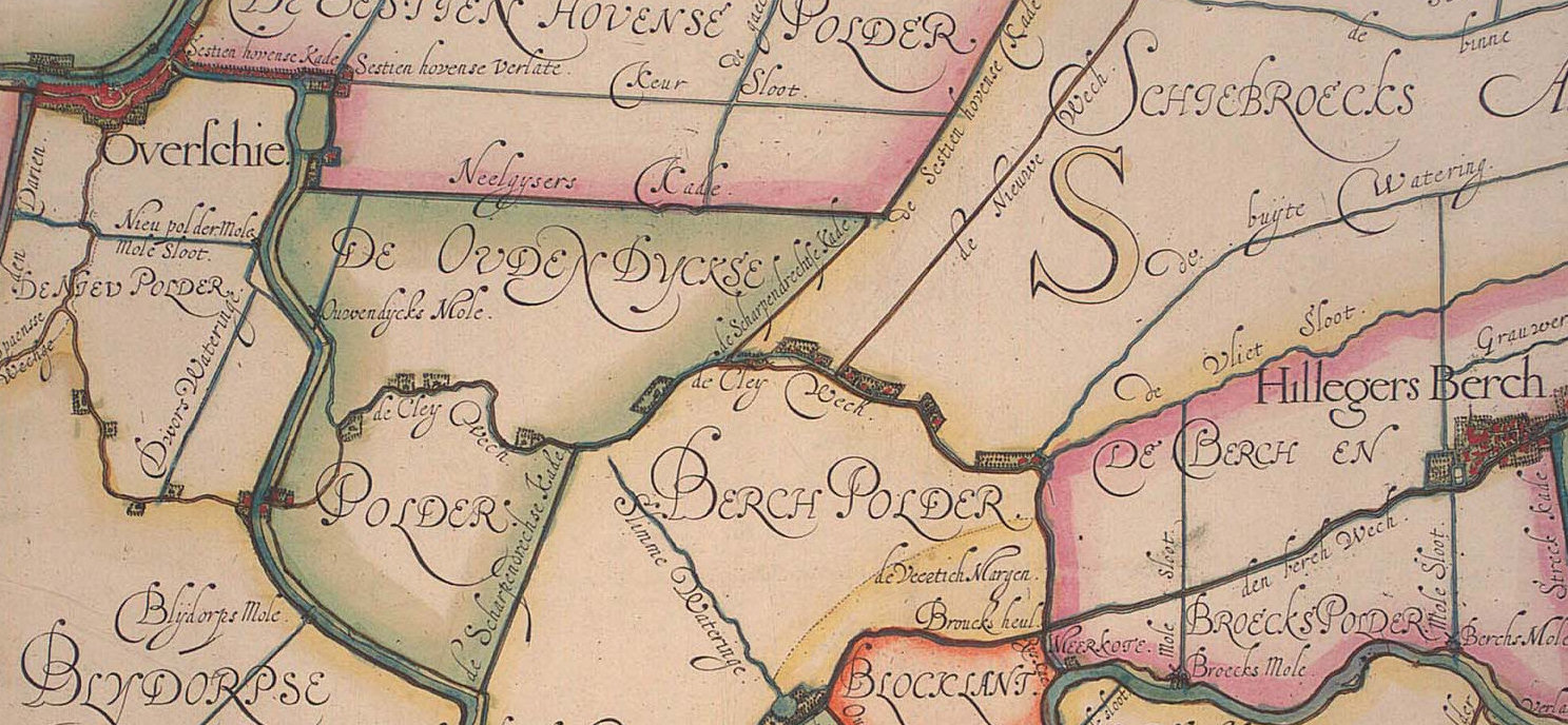
 Map of Hillegersberg in 1867 prior to the development of the Kleiwegkwartier's development
 -
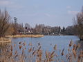 View on the Bergse Achterplas from the Klweiwegkwartier (2006)
 -
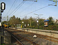 The Kleiweg Station in 2005 (now closed)


References[edit]
- ^ "Bewonersorganisatie Kleiwegkwartier". www.bokrotterdam.nl. Retrieved 2018-06-20.
- ^ a b Rotterdam, Gemeente. "Hillegersberg-Zuid | Rotterdam.nl". Gemeente Rotterdam (in Dutch). Retrieved 2018-06-20.
- ^ a b Laar, Paul Th van de; Jaarsveld, Mies van (2007). Historical Atlas of Rotterdam: The City's Growth Illustrated. SUN. ISBN 9789085061984.
- ^ Originally Kleiweg was written de Cley Wech in 1611 (see image of map)
- ^ Information, Rotterdam Tourist. "Hilligersberg-Schiebroek | Rotterdam Tourist Information". Rotterdam Tourist Information. Retrieved 2018-06-22.
- ^ "Bergse Plassen | Stadsarchief Rotterdam". www.stadsarchief.rotterdam.nl (in Dutch). Retrieved 2018-06-20.
- ^ Netherlands, Statistics. "Society". www.cbs.nl. Retrieved 2018-06-20.
- ^ "Franciscus Gasthuis&Vlietland, zorg van generaties - Franciscus Gasthuis & Vlietland". www.franciscus.nl (in Dutch). Retrieved 2018-06-20.
- ^ "RET Home Rotterdam". www.ret.nl. Archived from the original on 2017-08-03. Retrieved 2018-06-20.