Makanza Territory
 From Wikipedia the free encyclopedia
Makanza | |
|---|---|
Territory | |
| Country | |
| Province | Équateur |
| Seat | Makanza |
| Area | |
| • Total | 7,570 km2 (2,920 sq mi) |
| Population | |
| • Total | 250,549 |
| • Density | 33/km2 (86/sq mi) |
| Time zone | UTC+1 (West Africa Time) |
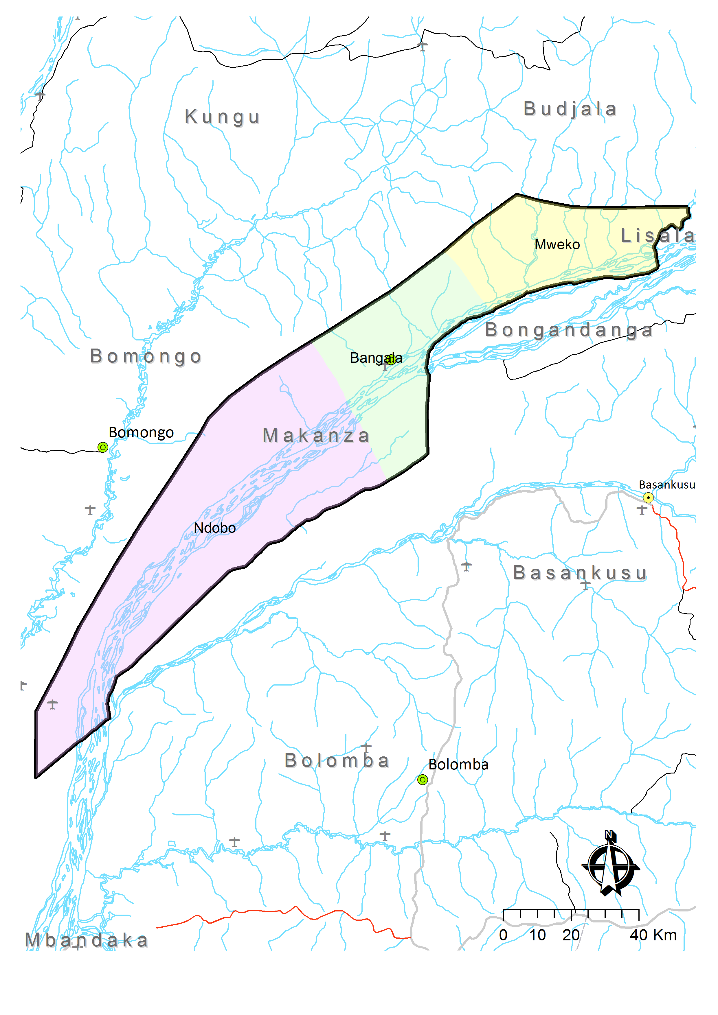
Makanza or Mankanza Territory is an administrative area in Équateur Province in the Democratic Republic of the Congo.[2] It lies along the main channel of the Congo River.[3] Headquarters for the territory is the town of Makanza.[4] The territory was created by presidential order on 6 October 1976.[5]
In the early 21st century, bandits operated in the area.[6]
Climate[edit]
The average temperature is between 23° and 25°C. The average annual rainfall is between 1700 mm and 1900 mm.[7]
Administrative divisions[edit]
In addition to the town of Makanza, officially a commune, the territory is divided into three sectors:[3]
- Bangala, with four groupings (groupements) of 34 villages;
- Mweko, with two groupings (groupements) of 21 villages;
- Ndobo, with four groupings (groupements) of 17 villages.
Towns[edit]
The main towns are:
- Bolombo
- Mabanga
- Makanza, HQ
- Malele
- Malundja
- Mobeka
- Lusenge
Notes and references[edit]
- ^ a b "Cellule d'Analyses des Indicateurs de Développement". caid.cd (in French). Archived from the original on 4 June 2021. Retrieved 25 March 2023.
- ^ Kyalangilwa, Joseph M. (22 January 2007). "Nouvelles entités provinciales" (PDF). Archived from the original (PDF) on 23 July 2011. Retrieved 21 May 2018.
- ^ a b Territoire de Makanza: Carte administrative (Map). Cellule d'Analyses des Indicateurs de Développement (CAID). Archived from the original on 21 May 2018.
- ^ "Administrative Zones of the Democratic Republic of Congo (Congo Kinshasa)". Statoids.
- ^ Portant création de la zone de Makanza dans la sous-région de l'Équateur, région de l'Équateur, Ordonnance Présidentielle n°76-295 (PDF), 6 October 1976
- ^ "Makanza: des bandits armés attaquent trois bateaux". Radio Okapi (in French). 21 April 2010. Archived from the original on 24 April 2010.
- ^ "Territoire de Makanza: Données géographiques". Cellule d'Analyses des Indicateurs de Développement (CAID). Archived from the original on 21 May 2018.