Puerto Rico Highway 133
 From Wikipedia the free encyclopedia
Highway 133 | ||||
|---|---|---|---|---|
| Ruta 133 | ||||
.svg) | ||||
| Route information | ||||
| Maintained by Puerto Rico DTPW | ||||
| Length | 2.0 km[1] (1.2 mi) | |||
| Major junctions | ||||
| West end | ||||
| East end | ||||
| Location | ||||
| Country | United States | |||
| Territory | Puerto Rico | |||
| Municipalities | Ponce | |||
| Highway system | ||||
| ||||

Puerto Rico Highway 133 (PR-133)[a] is a major access road in Ponce, Puerto Rico.[6] The road is 1.2 miles long and consists of three segments called (moving eastward) "Calle Comercio" (a.k.a. "Calle Francisco Parra Duperón"[7]), "Avenida Cuatro Calles", and "Avenida Ednita Nazario". The road has both of its endpoints, as well as its entire length, within the Ponce city limits. It runs west to east. The road is a main access road from downtown Ponce to PR-1, providing access to Guayama and all other points in the eastern portion of the Puerto Rico, and to PR-52, which provides expressway access to San Juan.
Route description[edit]
Highway 133 is 1.2 miles long, making it one of Puerto Rico's shortest primary roads.
Calle Comercio[edit]
The road starts at its intersection with Calle Marina (PR-123) at Plaza Las Delicias in downtown Ponce ("Ponce Centro"). From this point the road runs east for three blocks as a one-lane, one-way street and is called Francisco Parra Duperón but it is popularly known as Calle Comercio.[7] At the end of the third block, the road intersects Cruz Street and becomes a two-lane, two-way street. The road runs as a two-way street until its intersection with Río Portugués. Parque de la Ceiba is on the north side of the road at this point.
-
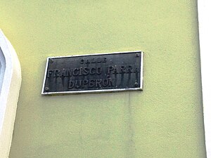 A road sign on PR-133 with the name Francisco Parra Duperón
 -
 PR-133 west of Río Portugués in Barrio San Antón

,_Barrio_San_Ant%C3%B3n,_Ponce,_Puerto_Rico,_mirando_al_este-sureste_(DSC03365).jpg)
Avenida Cuatro Calles[edit]
After crossing Rio Portugués the road is called Avenida Cuatro Calles. The road crosses PR-12 via an underpass (no access to PR-12 at this point) and continues to run in a westerly direction, intersecting with PR-163/Avenida Las Américas at Café Rico, near Centro del Sur Mall.
-
 A road sign on the southbound side of PR-12 announcing the PR-133/Comercio Street exit towards Downtown Ponce (Ponce Centro)
,_en_Barrio_San_Ant%C3%B3n,_Ponce,_PR,_mostrando_antiguo_letrero_de_la_PR-14.jpg)
Avenida Ednita Nazario[edit]
After crossing Avenida Las Americas the road becomes a 4-lane roadway known as Avenida Ednita Nazario. The former headquarters of Rovira Biscuits Corporation are located on the north side of the road in this section. A public art display consisting of the bust of Ednita Nazario is located at easternmost end of this section of PR-133, on the north side of the road. PR-133 ends at its intersection with the PR-2/PR-1/Miguel Pou Boulevard complex. (Continuing straight east the roadway is six lanes wide and it is a section of Eastbound PR-1 known as "Avenida La Ceiba".[8])
Landmarks[edit]
Landmarks along this road include Ceiba Tree Park, located next to Río Portugués, Cafe Rico, and Rovira Biscuits Corporation. A monument to Ednita Nazario is located at the northwest corner of PR-133 and PR-2.
Major intersections[edit]
The entire route is located in Ponce.
| Location | km[1] | mi | Destinations | Notes | |
|---|---|---|---|---|---|
| Cuarto–Tercero– Segundo–Primero quadripoint | 2.0 | 1.2 | Western terminus of PR-133; one-way streets | ||
| Cuarto–Tercero line | 1.8 | 1.1 | One-way street | ||
| San Antón | 1.0– 0.9 | 0.62– 0.56 | Diamond interchange | ||
| 0.6 | 0.37 | ||||
| 0.0 | 0.0 | Eastern terminus of PR-133 | |||
| 1.000 mi = 1.609 km; 1.000 km = 0.621 mi | |||||
See also[edit]
Notes[edit]
- ^ Sections of this road are also commonly known as Comercio Street,[2] Cuatro Calles Avenue,[3] and La Ceiba Street.[4] It has also been erroneously documented as Federico Parra Duperan street.[5] Per the Archivo Histórico de Ponce, a dependency of the Autonomous Municipality of Ponce, the official name of the Calle Comercio segment of this road is Francisco Parra Duperón. This name (Francisco Parra Duperón) is also documented in some sources such as Luis Fortuño Janeiro's Album Histórico de Ponce.
References[edit]
- ^ a b Google (2 March 2020). "PR-133" (Map). Google Maps. Google. Retrieved 2 March 2020.
- ^ Comercio Street. Retrieved March 11, 2010.
- ^ Cuatro Calles Avenue. Retrieved March 11, 2009.
- ^ La Ceiba Street. Archived 2010-08-12 at the Wayback Machine Retrieved March 11, 2010.
- ^ Federico Parra Duperan Street. Archived 2009-09-08 at the Wayback Machine Retrieved March 11, 2010.
- ^ "Tránsito Promedio Diario (AADT)". Transit Data (Datos de Transito) (in Spanish). DTOP PR. p. 176. Archived from the original on 1 April 2019.
- ^ a b Fortuño Janeiro, Luis (1963). Álbum Histórico de Ponce (in Spanish). Ponce: Imprenta Fortuño.
- ^ ¿Una avenida o zona de combate? Primera Hora. 19 June 2014. Retrieved 18 July 2014.
External links[edit]
- Historia de las Carreteras de Puerto Rico. Retrieved March 11, 2010. (in Spanish)
- Roads in Porto Rico. By Manuel Victor Domenech (Former Commissioner of the Interior), in The Overland Monthly. Vol 73, No, 4; April, 1919. Page 321. Retrieved March 11, 2010.
- Guía de Carreteras Principales, Expresos y Autopistas (in Spanish)