Sakhrai district
 From Wikipedia the free encyclopedia
Sakhrai สระใคร | |
|---|---|
 District location in Nong Khai province | |
| Coordinates: 17°40′30″N 102°45′2″E / 17.67500°N 102.75056°E | |
| Country | Thailand |
| Province | Nong Khai |
| Seat | Sakhrai |
| Area | |
| • Total | 210.90 km2 (81.43 sq mi) |
| Population (2005) | |
| • Total | 25,247 |
| • Density | 119.7/km2 (310/sq mi) |
| Time zone | UTC+7 (ICT) |
| Postal code | 43150 |
| Geocode | 4314 |
Sakhrai (Thai: สระใคร, pronounced [sàʔ.kʰrāj]) is a district (amphoe) of Nong Khai province, northeastern Thailand.
History[edit]
The minor district (king amphoe) was split off from Mueang Nong Khai district on 30 April 1994.[1]
On 15 May 2007, all 81 minor districts were upgraded to full districts.[2] Publication in the Royal Gazette on 24 August the upgrade became official.[3]
Geography[edit]
Neighboring districts are (from the north clockwise): Tha Bo and Mueang Nong Khai of Nong Khai Province, and Phen and Ban Phue of Udon Thani province.
Administration[edit]
The district is divided into three sub-districts (tambons), which are further subdivided into 39 villages (mubans). There are no municipal (thesaban) areas. There are three tambon administrative organizations (TAO).
| No. | Name | Thai name | Villages | Pop. | |
|---|---|---|---|---|---|
| 1. | Sakhrai | สระใคร | 15 | 10,053 | |
| 2. | Khok Chang | คอกช้าง | 12 | 6,161 | |
| 3. | Ban Fang | บ้านฝาง | 12 | 8,994 |
Gallery[edit]
-
 Wat Salawan Nimit, Sakhrai
 -
 Wat Salawan Nimit, Sakhrai
 -
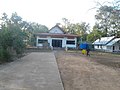
 Sakhrai
 -
 Road in Sakhrai
.jpg)
.jpg)
.jpg)
.jpg)
References[edit]
- ^ ประกาศกระทรวงมหาดไทย เรื่อง แบ่งเขตท้องที่อำเภอเมืองหนองคาย จังหวัดหนองคาย ตั้งเป็นกิ่งอำเภอสระใคร (PDF). Royal Gazette (in Thai). 111 (42 ง): 23. May 26, 1994. Archived from the original (PDF) on February 24, 2012.
- ^ แถลงผลการประชุม ครม. ประจำวันที่ 15 พ.ค. 2550 (in Thai). Manager Online.
- ^ พระราชกฤษฎีกาตั้งอำเภอฆ้องชัย...และอำเภอเหล่าเสือโก้ก พ.ศ. ๒๕๕๐ (PDF). Royal Gazette (in Thai). 124 (46 ก): 14–21. August 24, 2007. Archived from the original (PDF) on September 30, 2007.
External links[edit]
This Nong Khai Province location article is a stub. You can help Wikipedia by expanding it. |