Supsa
 From Wikipedia the free encyclopedia
This article needs additional citations for verification. (November 2020) |
Supsa სუფსა | |
|---|---|
Village | |
 Georgian coast guard facility in Supsa | |
| Coordinates: 42°02′29″N 41°48′42″E / 42.04139°N 41.81167°E | |
| Country | |
| Region | Guria |
| District | Lanchkhuti |
| Elevation | 7 m (23 ft) |
| Population (2014)[1] | |
| • Total | 273 |
| Time zone | UTC+4 (Georgian Time) |
| Port of Supsa | |
|---|---|
 Click on the map for a fullscreen view | |
| Location | |
| Country | Georgia |
| Location | Supsa |
| UN/LOCODE | GESPS[2] |
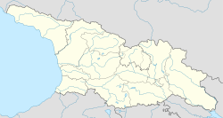
Supsa (Georgian: სუფსა) is a Black Sea village in western Georgia with the population of 273 (2014). It is located in the Lanchkhuti Municipality, on the river Supsa.
It is the terminus of the Western Early Oil pipeline from Azerbaijan and the Caspian Sea oil fields. In 2011 a cement plant was put into operation. There is a railway station (Samtredia–Batumi railway) in the village. European route E692 passes Supsa which has a junction with European route E70 near the village.
See also
[edit]References
[edit]- ^ "Population Census 2014". www.geostat.ge. National Statistics Office of Georgia. November 2014. Retrieved 28 June 2021.
- ^ "UNLOCODE (GE) - GEORGIA". service.unece.org. Retrieved 2 March 2022.
External links
[edit] Media related to Supsa community at Wikimedia Commons

