Tököl
 From Wikipedia the free encyclopedia
Tököl | |
|---|---|
 The Chapel of St Anna | |
 | |
| Coordinates: 47°19′13″N 18°58′02″E / 47.32030°N 18.96711°E | |
| Country | |
| County | Pest |
| Area | |
| • Total | 38.49 km2 (14.86 sq mi) |
| Population (2004) | |
| • Total | 9,337 |
| • Density | 242.58/km2 (628.3/sq mi) |
| Time zone | UTC+1 (CET) |
| • Summer (DST) | UTC+2 (CEST) |
| Postal code | 2316 |
| Area code | 24 |
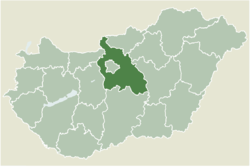
Tököl (Croatian: Tukulja) is a town in Pest County, Hungary.

Demography
[edit]The majority of residents are Hungarians, with a Croatian minority of Bunjevci or Raci.
Hungarian Uprising
[edit]An Budapest-Tököl airfield (47 20 35 N / 18 59 20 E) was built during World War II, which was to become a Soviet military base. During the Hungarian Uprising, Pál Maléter, as Defence Minister for the Imre Nagy government, went to negotiate with the Soviet military presence and was arrested during the negotiations.
In 1952, the 24th and 25th fighter regiments of the Hungarian Air Force settled at the Tököl airport. In 1953, on October 1, the Tököl air base of the Hungarian People's Army was established. That same year, the aircraft repair company operating at the airport was separated from Csepel Autógyár National Vállalat and the Pestvidéki Machine Factory specializing in the repair of military aircraft was established. The overhauled aircraft were flown in at the Tököl airport. The factory continued to repair helicopters after the dissolution of the Warsaw Pact and the removal of Soviet forces from Hungary.[1]
Notable residents
[edit]- Pál Hoffman, politician
- István Szilágyi, handball player
Twin towns – sister cities
[edit] Klein Rönnau, Germany
References
[edit]- ^ Lindsey Peacock and Bob Archer, "Tokol Helicopter Plant," Air Forces Monthly, March 1992, 36-39.
- ^ "Geschichte" (in German). Amt Trave-Land. Retrieved 2024-06-04.
External links
[edit]- Street map (in Hungarian)


