Wheeling metropolitan area
 From Wikipedia the free encyclopedia
Greater Wheeling | |
|---|---|
| Wheeling, WV–OH Metropolitan Statistical Area | |
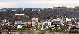
 Downtown Wheeling | |
 | |
| Country | |
| State | |
| Largest city | Wheeling |
| Population | |
| • Total | 141,254 |
| • Rank | 290th in the U.S. |
| Time zone | UTC−5 (EST) |
| • Summer (DST) | UTC−4 (EDT) |
The Wheeling, WV–OH Metropolitan Statistical Area, as defined by the United States Census Bureau, is an area consisting of two counties in the Northern Panhandle of West Virginia and one in eastern Ohio, anchored by the city of Wheeling. As of the 2010 census, the MSA had a population of 147,950. This represents a decline of 3.4% from the 2000 census population of 153,172.[2]
Greater Wheeling is generally considered part of the Pittsburgh Tri-State area, as the area is heavily influenced by Pittsburgh media and transportation (notably Pittsburgh International Airport), as well as some Ohio media and sports influence.
Counties
[edit]Communities
[edit]- Places with more than 25,000 inhabitants
- Wheeling, West Virginia (Principal city)
- Places with 5,000 to 10,000 inhabitants
|
- Places with 500 to 1,000 inhabitants
- Places with less than 500 inhabitants
- Townships (Belmont County, Ohio)
Demographics
[edit]| Census | Pop. | Note | %± |
|---|---|---|---|
| 1970 | 182,712 | — | |
| 1980 | 185,566 | 1.6% | |
| 1990 | 159,301 | −14.2% | |
| 2000 | 153,172 | −3.8% | |
| 2010 | 147,950 | −3.4% | |
| 2020 | 139,513 | −5.7% | |
| U.S. Decennial Census[3][4][5] | |||
As of the census[7] of 2000, there were 153,172 people, 62,249 households, and 41,506 families residing within the MSA. The racial makeup of the MSA was 95.62% White, 2.87% African American, 0.12% Native American, 0.44% Asian, 0.02% Pacific Islander, 0.14% from other races, and 0.79% from two or more races. Hispanic or Latino of any race were 0.48% of the population.
The median income for a household in the MSA was $30,513, and the median income for a family was $39,284. Males had a median income of $31,388 versus $20,307 for females. The per capita income for the MSA was $16,942.
See also
[edit]References
[edit]- ^ United States Census
- ^ "CPH-T-5. Population Change for Metropolitan and Micropolitan Statistical Areas in the United States and Puerto Rico (February 2013 Delineations): 2000 to 2010" (PDF). 2010 Census Population and Housing Tables. United States Census Bureau, Population Division. March 2013. Archived (PDF) from the original on October 2, 2013. Retrieved February 12, 2014.
- ^ United States Census Bureau. "Census of Population and Housing". Retrieved June 7, 2016.
- ^ "U.S. Census Bureau QuickFacts: Marshall County, West Virginia; Ohio County, West Virginia; Belmont County, Ohio". Census Bureau QuickFacts. Retrieved 26 April 2018.
- ^ "Archived copy" (PDF). Archived (PDF) from the original on 2017-02-13. Retrieved 2017-03-21.
{{cite web}}: CS1 maint: archived copy as title (link) - ^ "US Census QuickFacts". Retrieved June 7, 2016.
- ^ "U.S. Census website". United States Census Bureau. Retrieved 2008-01-31.
