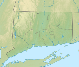
Becket Hill State Park Reserve
 From Wikipedia the free encyclopedia
| Becket Hill State Park Reserve | |
|---|---|
 Becket Hill, as seen across Uncas Pond from Nehantic State Forest | |
| Location | Lyme, Connecticut, United States |
| Coordinates | 41°22′20″N 72°17′59″W / 41.37222°N 72.29972°W[1] |
| Area | 260 acres (110 ha)[2] |
| Elevation | 262 ft (80 m)[1] |
| Established | 1961 |
| Administered by | Connecticut Department of Energy and Environmental Protection |
| Designation | Connecticut state park |
| Website | Other State Parks and Forests |
Becket Hill State Park Reserve is a public recreation area lying adjacent to Nehantic State Forest in the town of Lyme, Connecticut. The state park is as an undeveloped, walk-in park totaling 260 acres (110 ha) with no officially listed activities. It is managed by the Connecticut Department of Energy and Environmental Protection.[3]
History
[edit]Becket Hill State Park Reserve is named for an early settler of the area named Beckwith; the land was part of the Nehantic tribe's territory.[4] In 1961, the land for the reserve was given to the state by the George Dudley Seymour Trust, to become the 76th designated Connecticut state park.[5][6] Beckett Hill was listed on the Connecticut Register and Manual for 1962 as having 260 acres of undeveloped land.[7]
Activities
[edit]The reserve is an undeveloped, walk-in park with access through the Lyme section of Nehantic State Forest, which is entered from Connecticut Route 156.[3][8] Bushwhacking is required as no roads or trails cross from the forest to the state park reserve.[9] The reserve's boundary with the state forest is created by 69-acre (28 ha) Uncas Lake[10] and Falls Brook, a stream that connects Uncas Lake with 30-acre (12 ha) Norwich Pond.[11] Boat launches for non-motorized craft are located on each.[12] The waters are stocked with brook, brown and rainbow trout; other fish include largemouth bass, yellow perch and sunfish.[4]
References
[edit]- ^ a b "Becket Hill". Geographic Names Information System. United States Geological Survey, United States Department of the Interior.
- ^ "Appendix A: List of State Parks and Forests" (PDF). State Parks and Forests: Funding. Staff Findings and Recommendations. Connecticut General Assembly. January 23, 2014. p. A-1. Retrieved March 8, 2016.
- ^ a b "Other State Parks and Forests". Connecticut Department of Energy and Environmental Protection. Retrieved July 23, 2024.
- ^ a b Leary, Joseph (2004). A Shared Landscape: A Guide & History of Connecticut's State Parks & Forests. Hartford, Conn.: Friends of the Connecticut State Parks, Inc. pp. 130–131. ISBN 0974662909.
- ^ The Seymour Trust contributed to the creation of numerous public recreation areas including Beaver Brook, Becket Hill, Bigelow Hollow, Hurd, Millers Pond, Platt Hill, George Dudley Seymour, and Stoddard Hill state parks and Nathan Hale State Forest. "George Dudley Seymour State Park". State Parks and Forests. Connecticut Department of Energy and Environmental Protection. Archived from the original on March 30, 2018. Retrieved March 8, 2016.
- ^ "The Day 25 Years Ago: Week of July 28, 1961". The Day. Good Ole Days. July 31, 1986. Retrieved May 20, 2014.
- ^ "State Parks". State Register and Manual 1962. State of Connecticut. 1962. p. 150. Retrieved March 8, 2016.
- ^ "Nehantic State Forest Map" (PDF). Connecticut Department of Energy and Environmental Protection. January 30, 2009. Retrieved July 23, 2024.
- ^ The park's isolation has perplexed many commentators. The commercial Oh Ranger website, which says that picnicking is "encouraged" and suggests calling ahead for information, provides directions that lead to private property. "Beckett Hill State Park Reserve". Oh Ranger. Retrieved May 20, 2014. A blogger writes that no trails to the park can be found leading from the state forest and that "there doesn’t seem to be a way in." "Beckett Hill State Park". The A to Z of CT State Parks. March 11, 2012. Retrieved May 20, 2014. A reporter for The Day suggests that hiking is "suitable" without mentioning Nehantic State Forest or the lack of trails leading from it. Cotter, Betty (August 15, 2013). "Centennial SoJourn spotlights state parks in an 11-day trek". The Day. New London, Conn. Retrieved May 20, 2014. Joseph Leary has also noted the park's accessibility problems.Leary, Joseph (2004). A Shared Landscape: A Guide & History of Connecticut's State Parks & Forests. Hartford, Conn.: Friends of the Connecticut State Parks, Inc. pp. 130–131. ISBN 0974662909.
- ^ "Uncas Lake". Geographic Names Information System. United States Geological Survey, United States Department of the Interior.
- ^ "Norwich Pond". Geographic Names Information System. United States Geological Survey, United States Department of the Interior.
- ^ "2024 Fishing Guide" (PDF). Connecticut Department of Energy and Environmental Protection. April 24, 2024. p. 24, 28. Retrieved July 23, 2024.
External links
[edit]- Other State Parks and Forests Connecticut Department of Energy and Environmental Protection
- Nehantic State Forest Map Connecticut Department of Energy and Environmental Protection
