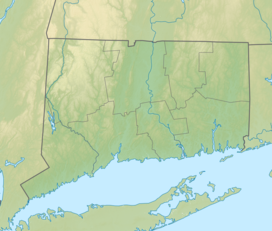
George Waldo State Park
 From Wikipedia the free encyclopedia
| George Waldo State Park | |
|---|---|
| Location | Southbury, Connecticut, United States |
| Coordinates | 41°27′45″N 73°17′28″W / 41.46250°N 73.29111°W |
| Area | 150 acres (61 ha)[1] |
| Elevation | 315 ft (96 m) |
| Established | 1957 |
| Administered by | Connecticut Department of Energy and Environmental Protection |
| Designation | Connecticut state park |
| Website | Official website |
George Waldo State Park is an undeveloped public recreation area on the eastern shore of Lake Lillinonah in the town of Southbury, Connecticut. Park activities include hiking, mountain biking, horseback riding, fishing, and hunting.[1] The park's 2.1-mile (3.4 km) loop trail is described as a moderately challenging route.[2] The state park is managed by the Connecticut Department of Energy and Environmental Protection.
History
[edit]George Curtis Waldo was chairman of the Connecticut Park and Forest Commission in the 1940s and the owner of the Bridgeport Post. [3] He died in 1956 at the age of 68.[4] George C. Waldo State Park was first listed in the State of Connecticut Register and Manual in 1957.[5]
References
[edit]- ^ a b "Other State Parks and Forests". Connecticut Department of Energy and Environmental Protection. Retrieved July 24, 2024.
- ^ "George Waldo State Park Loop". AllTrails, LLC. Retrieved July 24, 2024.
- ^ Hawes, Austin (April 2014). "History of Forestry in Connecticut" (PDF). Connecticut Agricultural Experiment Station. p. 176. Retrieved July 24, 2024.
- ^ "George C. Waldo, Editor, Publisher; Head of Bridgeport concern that issues Telegram and Post is dead at 68". New York Times. October 1, 1956. p. 27. Retrieved July 24, 2024.
- ^ "State Parks". State Register and Manual 1957. State of Connecticut. 1957. p. 404. Retrieved July 24, 2024.
External links
[edit]- Other State Parks and Forests Connecticut Department of Energy and Environmental Protection
- George Waldo State Park Map Connecticut Department of Energy and Environmental Protection

