Hailles
 From Wikipedia the free encyclopedia
Hailles | |
|---|---|
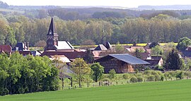
 A general view of Hailles | |
| Coordinates: 49°48′22″N 2°26′23″E / 49.8061°N 2.4397°E | |
| Country | France |
| Region | Hauts-de-France |
| Department | Somme |
| Arrondissement | Montdidier |
| Canton | Moreuil |
| Intercommunality | CC Avre Luce Noye |
| Government | |
| • Mayor (2020–2026) | Fabrice Veront[1] |
| Area 1 | 5.07 km2 (1.96 sq mi) |
| Population (2021)[2] | 413 |
| • Density | 81/km2 (210/sq mi) |
| Time zone | UTC+01:00 (CET) |
| • Summer (DST) | UTC+02:00 (CEST) |
| INSEE/Postal code | 80405 /80440 |
| Elevation | 32–110 m (105–361 ft) (avg. 35 m or 115 ft) |
| 1 French Land Register data, which excludes lakes, ponds, glaciers > 1 km2 (0.386 sq mi or 247 acres) and river estuaries. | |
Hailles (French pronunciation: [aj]) is a commune in the Somme department in Hauts-de-France in northern France.
Geography
[edit]Hailles is situated on the banks of the river Avre and by the D90e road, some 10 miles (16 km) southeast of Amiens.
History
[edit]The name probably comes from ‘haie’ (eng: hedge), and has been variously written as Haies or Heilles. During the Franco-Prussian War of 1870, some francs-tireurs, hidden behind the town fired 60 times on a Prussian officer. All missed, he wasn't even scratched. The German troops threatened to burn down the town.
Population
[edit]
|
| ||||||||||||||||||||||||||||||||||||||||||||||||||||||||||||||||||||||||||||||||||||||||||||||||||||||||||||||||||
| Source: EHESS[3] and INSEE (1968-2017)[4] | |||||||||||||||||||||||||||||||||||||||||||||||||||||||||||||||||||||||||||||||||||||||||||||||||||||||||||||||||||
See also
[edit]References
[edit]- ^ "Répertoire national des élus: les maires". data.gouv.fr, Plateforme ouverte des données publiques françaises (in French). 2 December 2020.
- ^ "Populations légales 2021" (in French). The National Institute of Statistics and Economic Studies. 28 December 2023.
- ^ Des villages de Cassini aux communes d'aujourd'hui: Commune data sheet Hailles, EHESS (in French).
- ^ Population en historique depuis 1968, INSEE
External links
[edit]- Hailles on the Quid website (in French)


